Death Valley, revisited with LRCSD

p m

Administrator
Staff member
Apr 19, 2004
15,630
863
58
La Jolla, CA
www.3rj.org
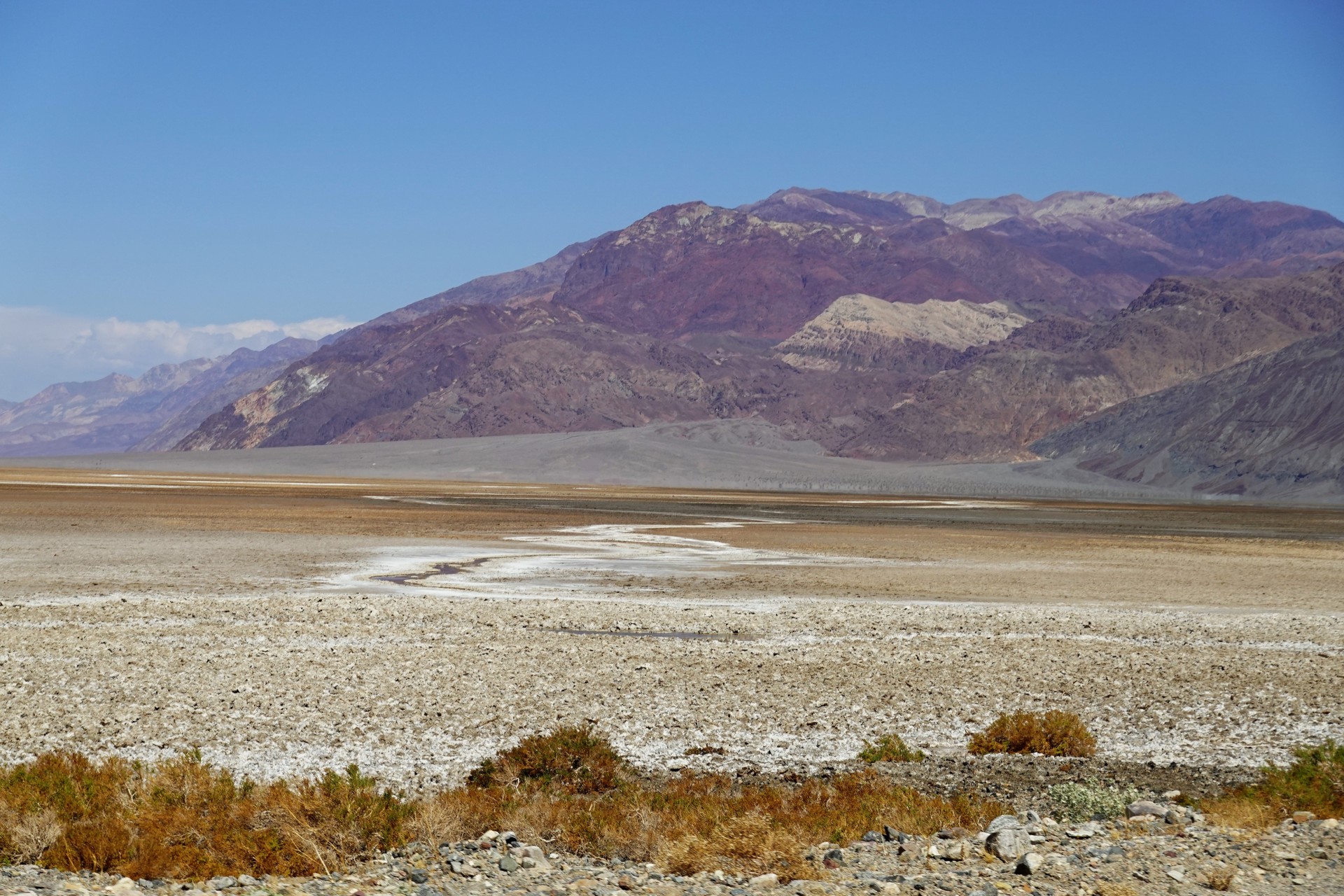
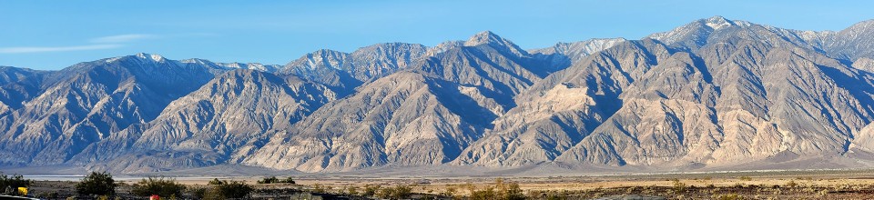
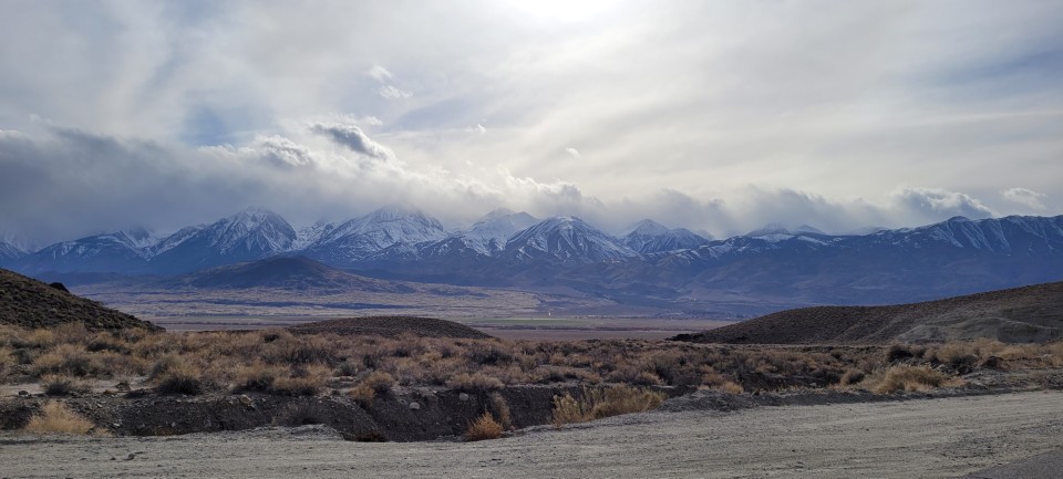
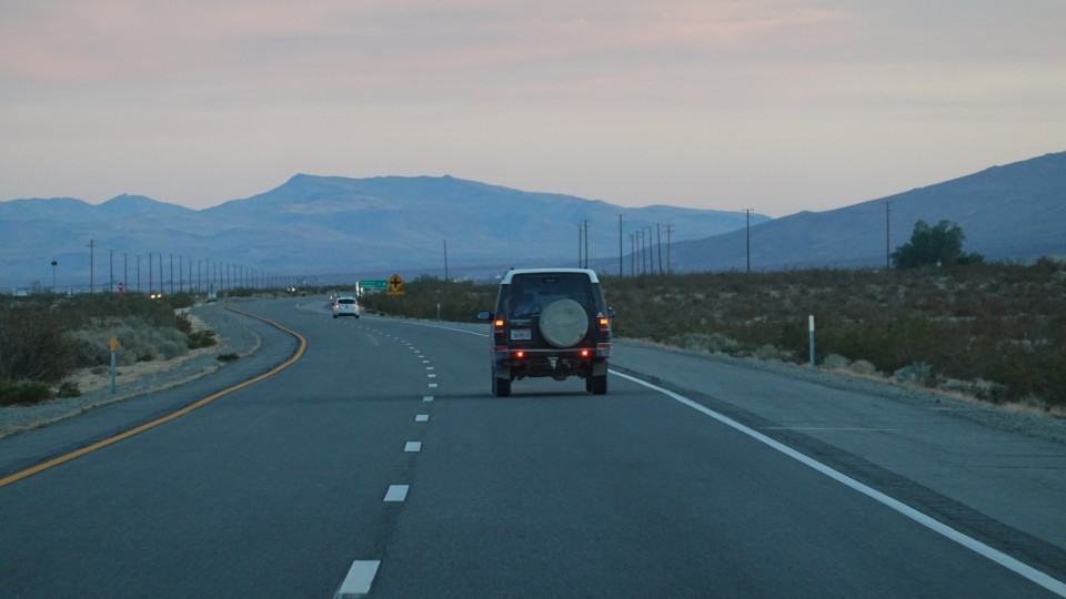
The spring of 2021 has finally arrived to California; it means the prime time to visit the desert is here.
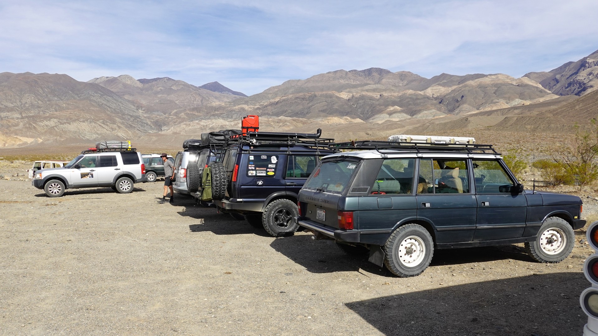
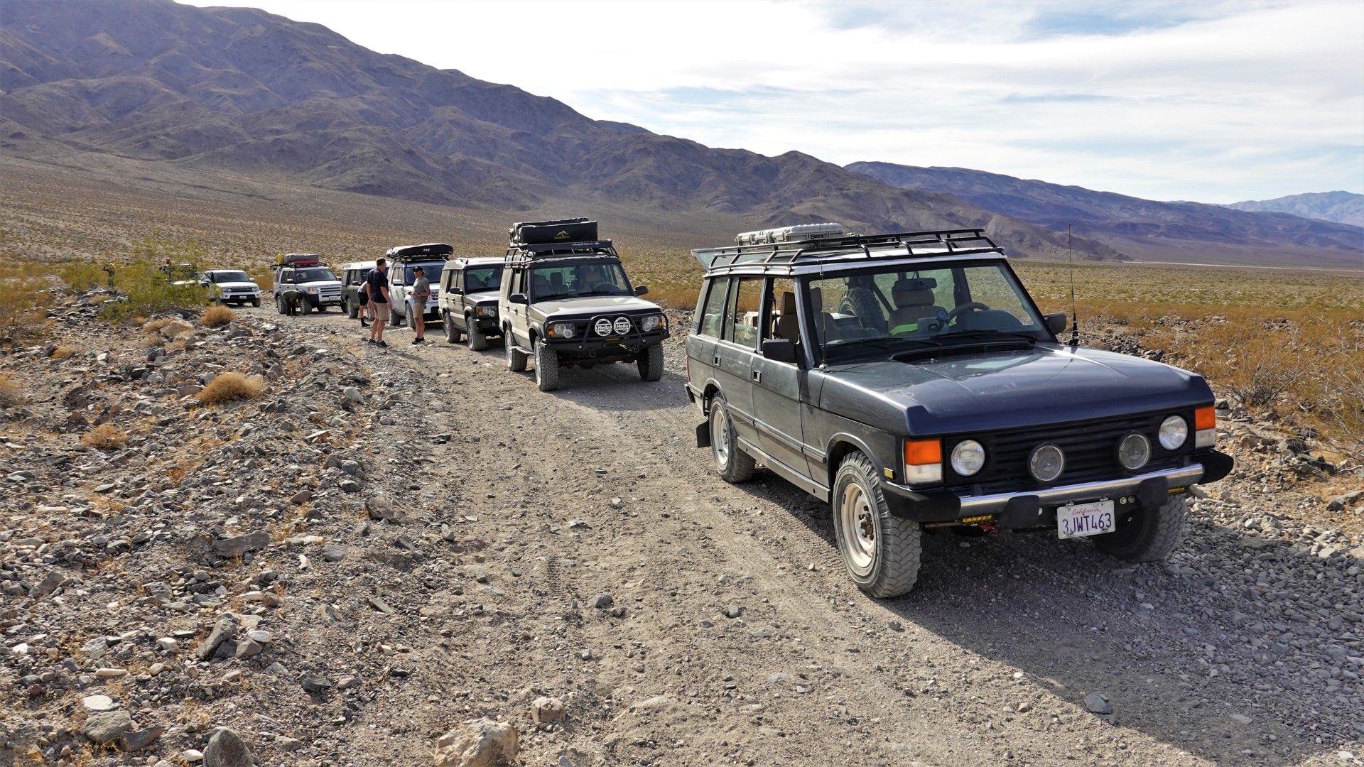
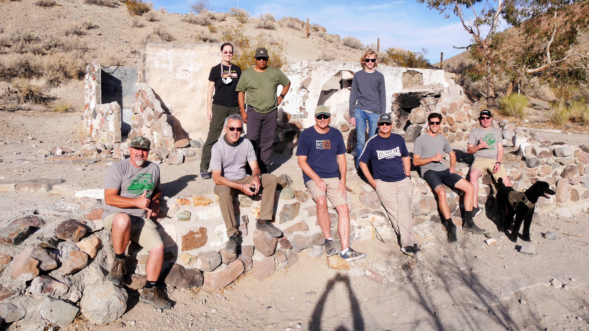
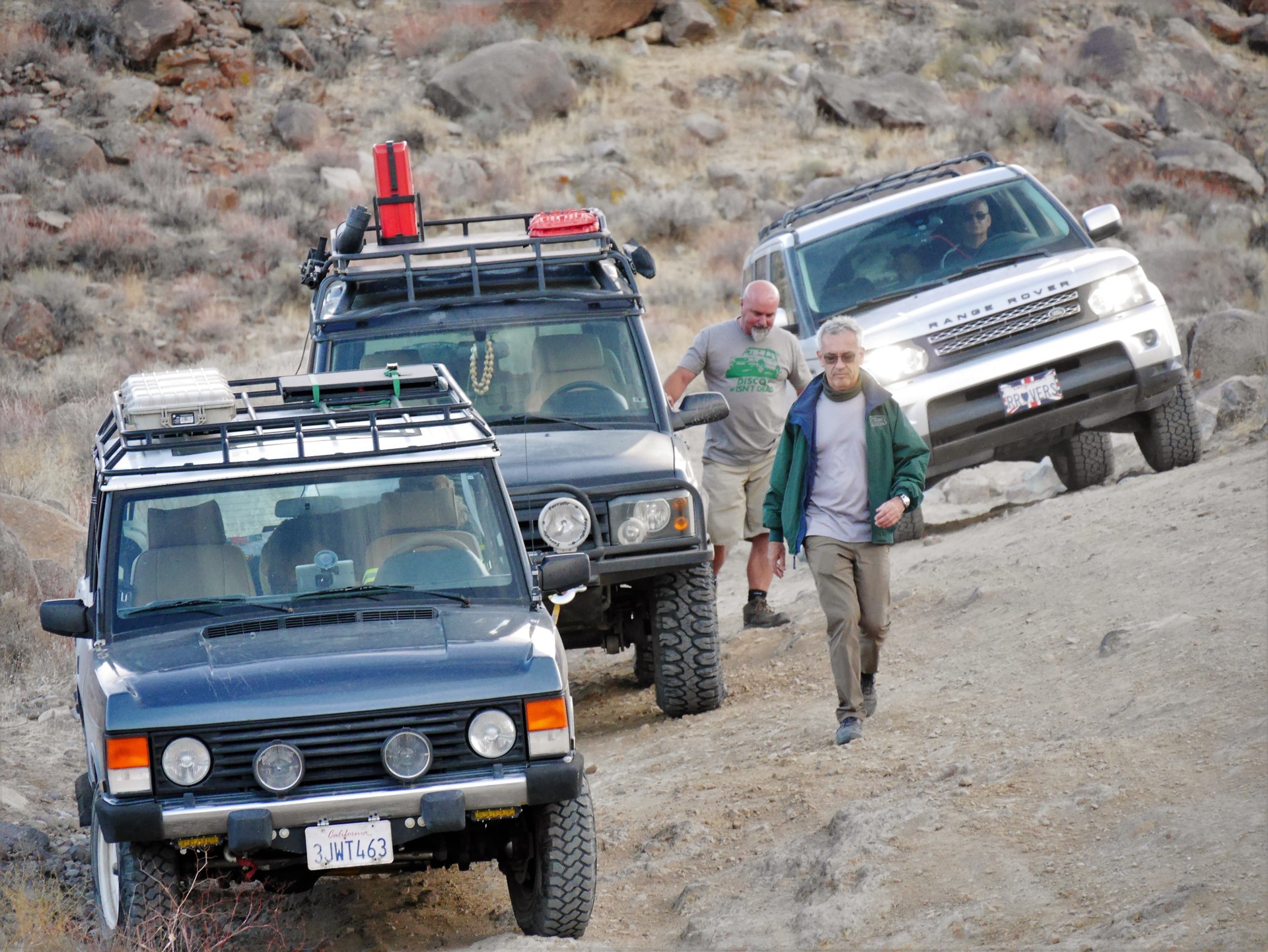
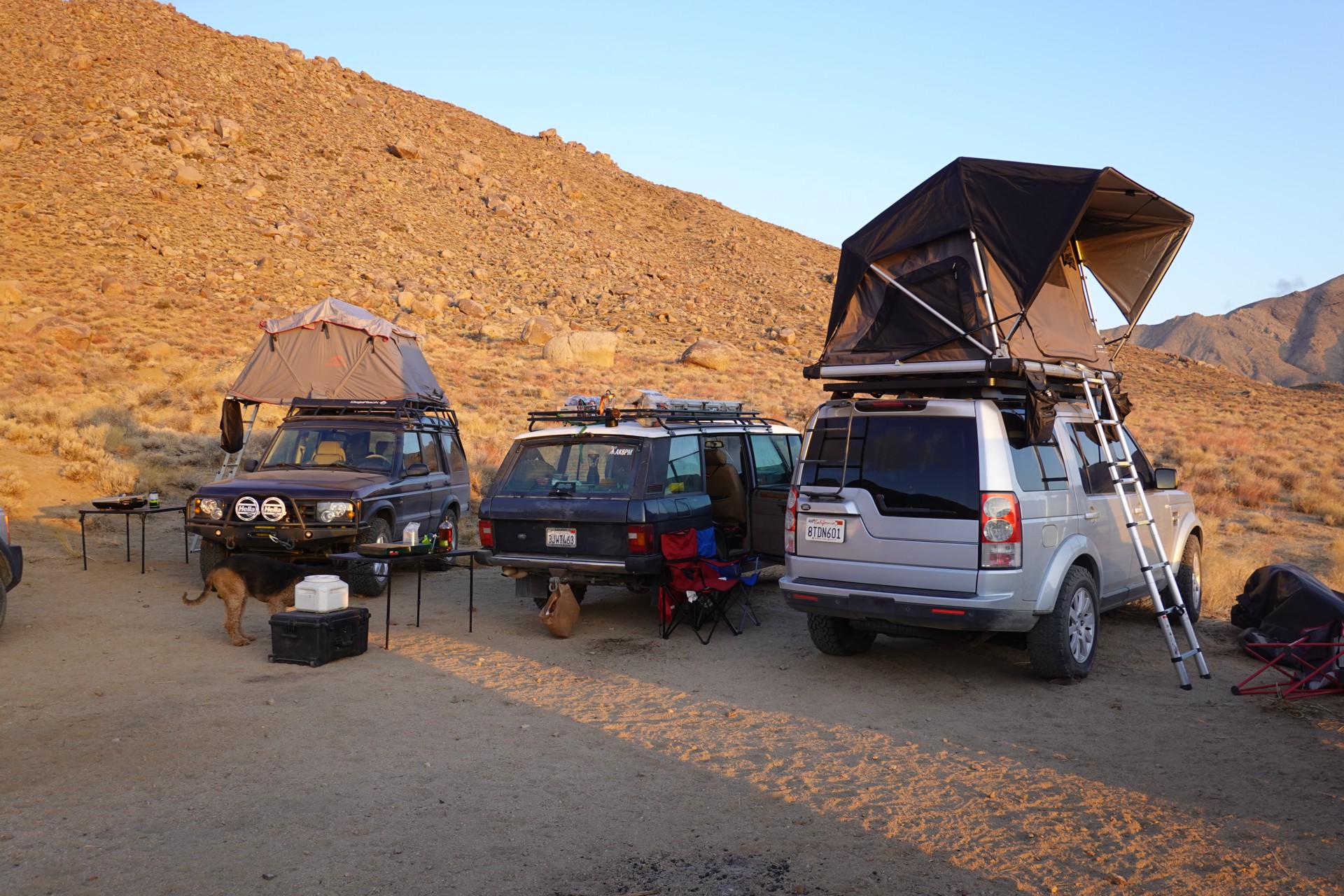
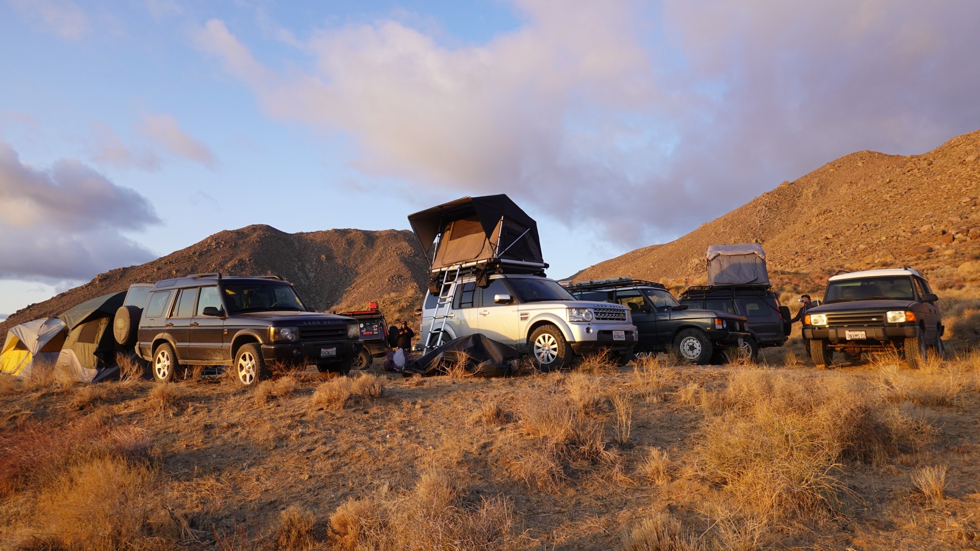
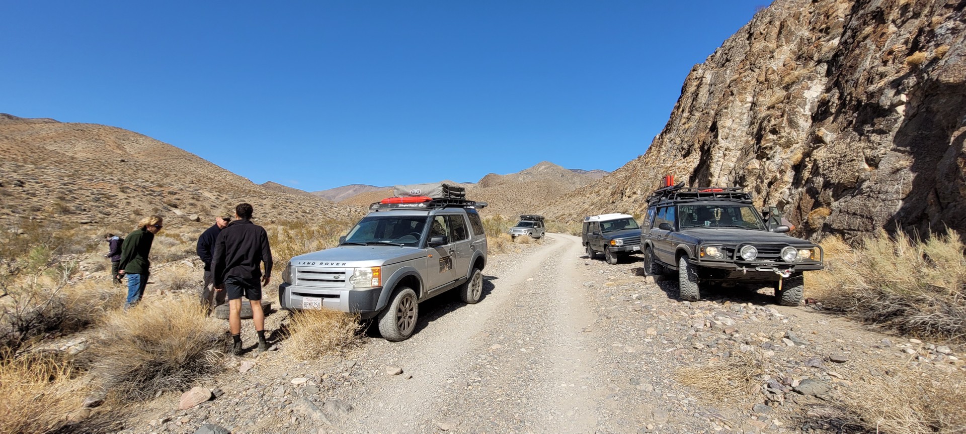
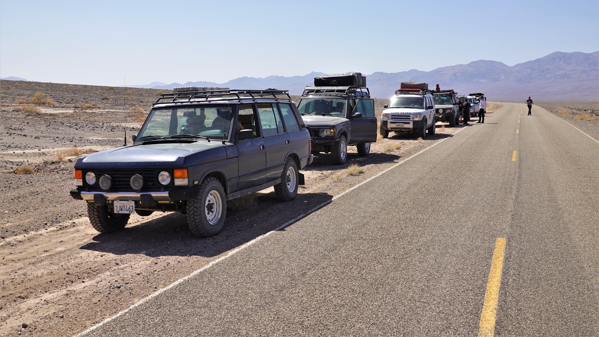
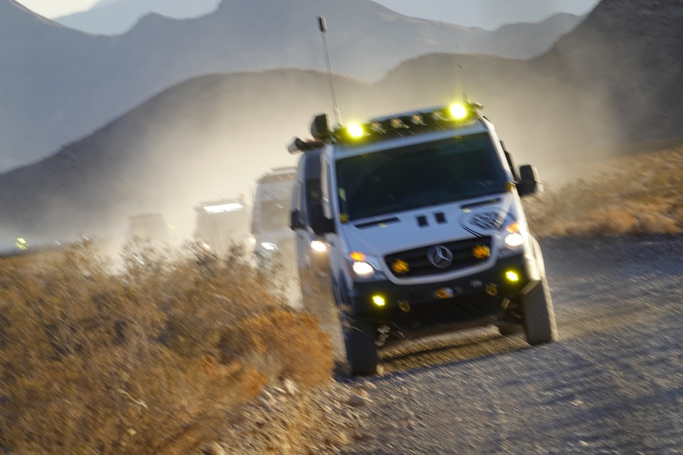
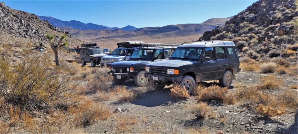
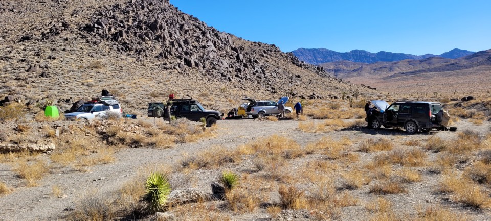
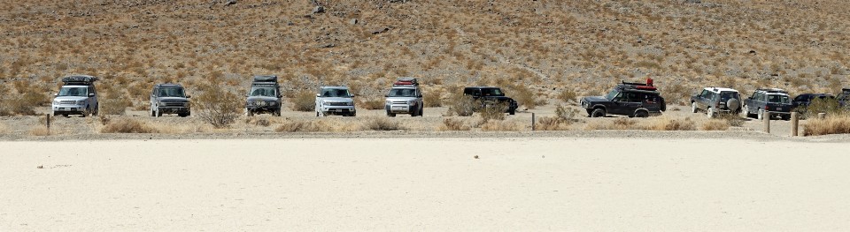
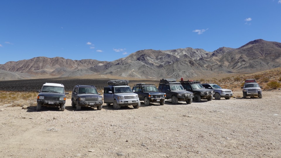
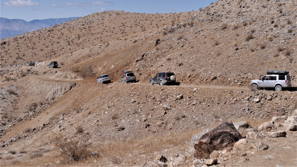
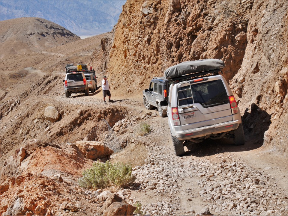
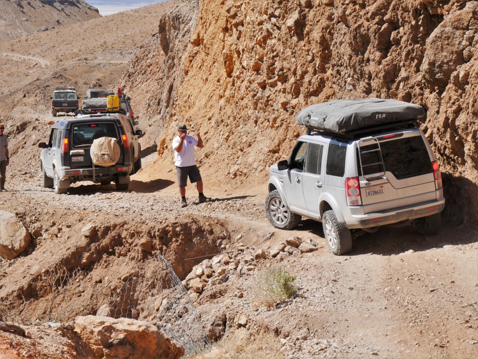
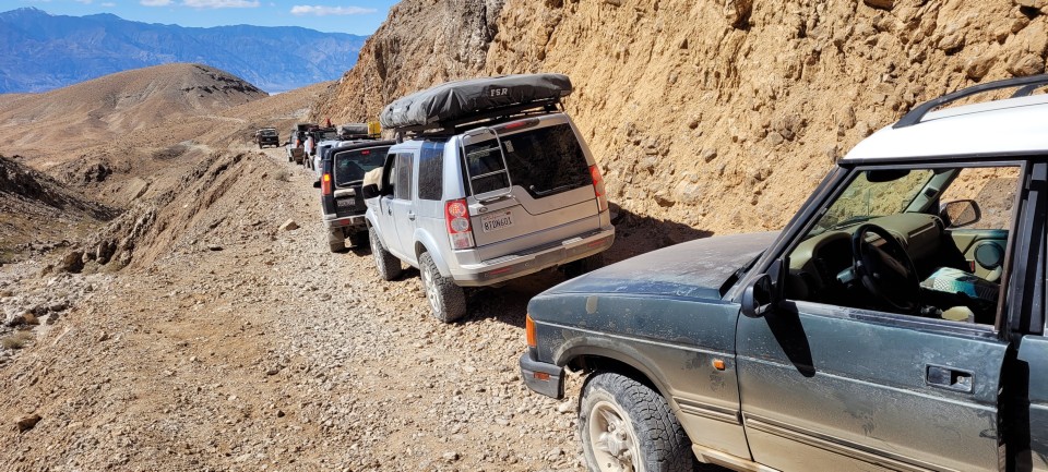
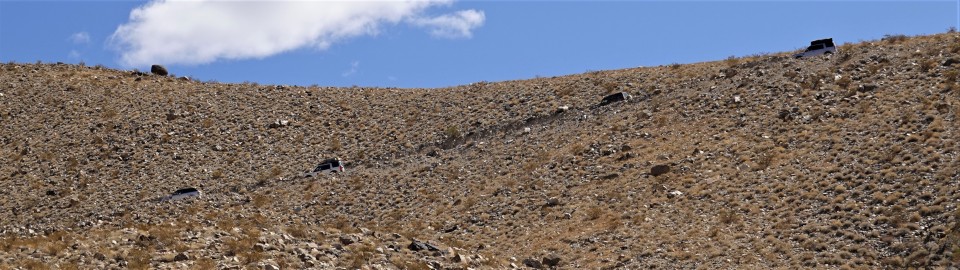
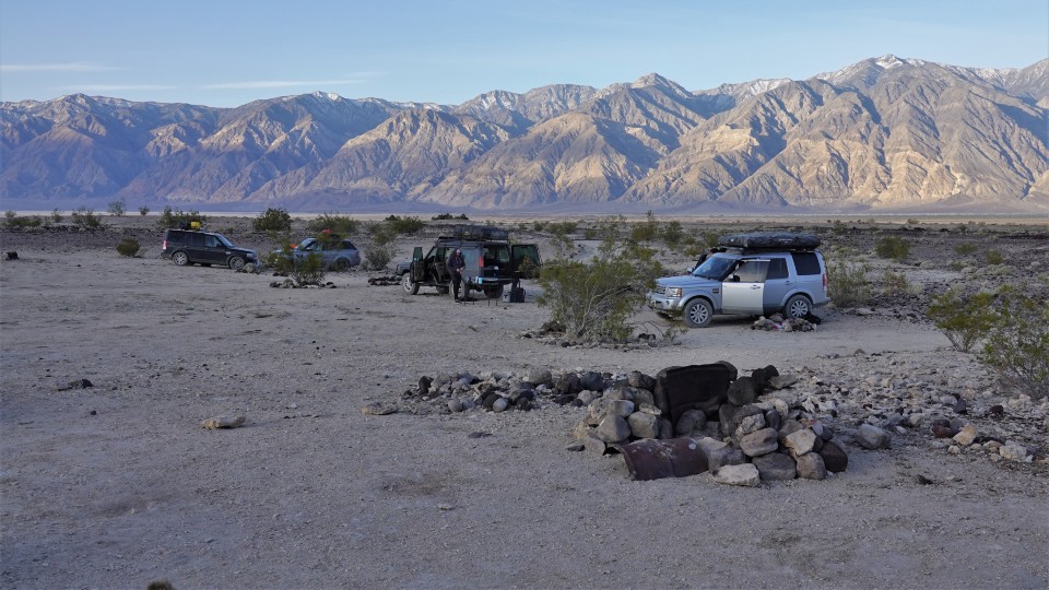
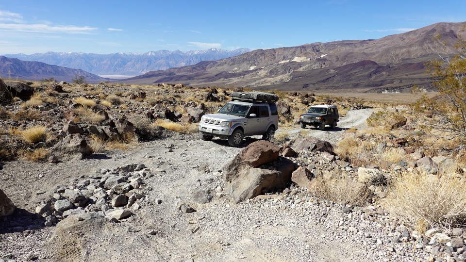
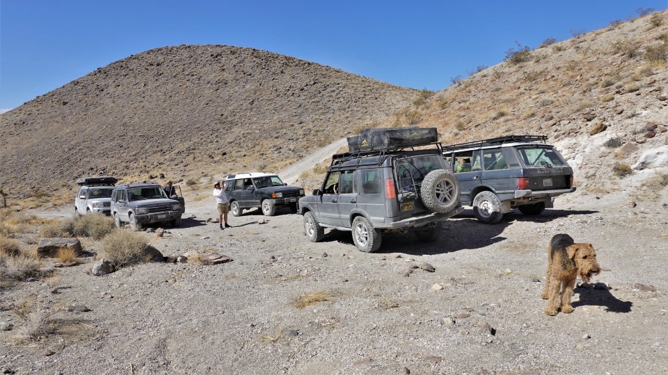
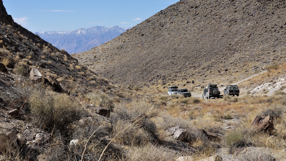
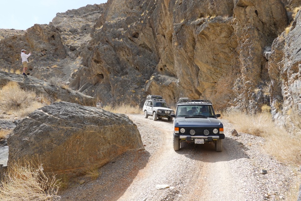
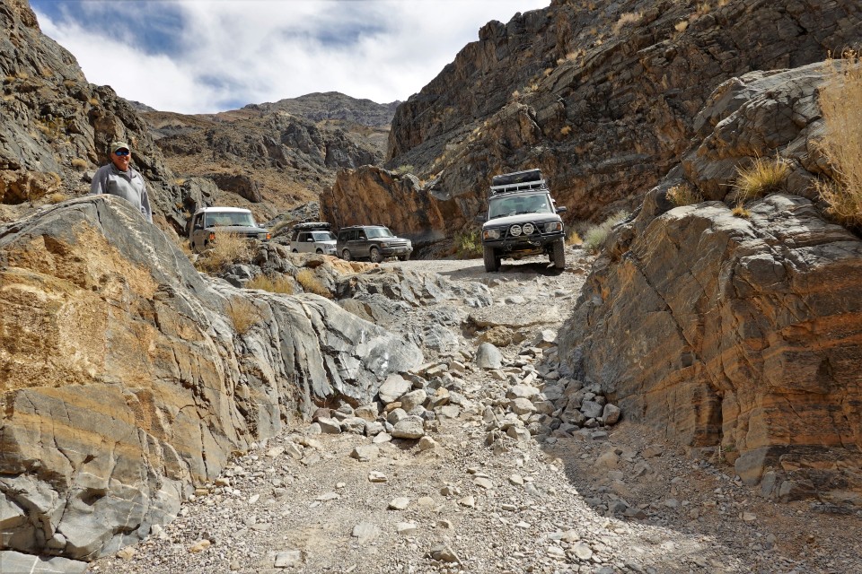
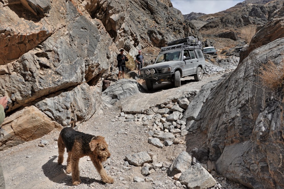
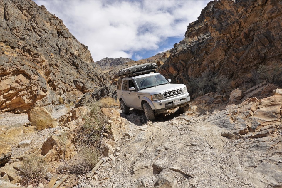
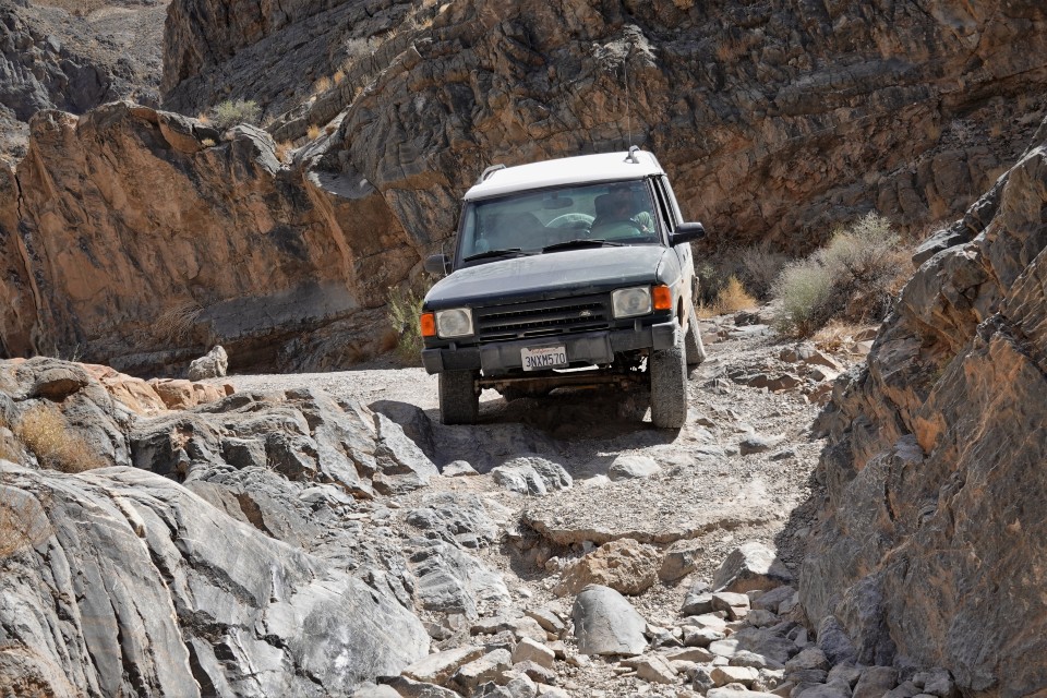
The Land Rover Club of San Diego assembled a team of 8 vehicles and sent it sailing North on Interstate 15 - towards Death Valley.
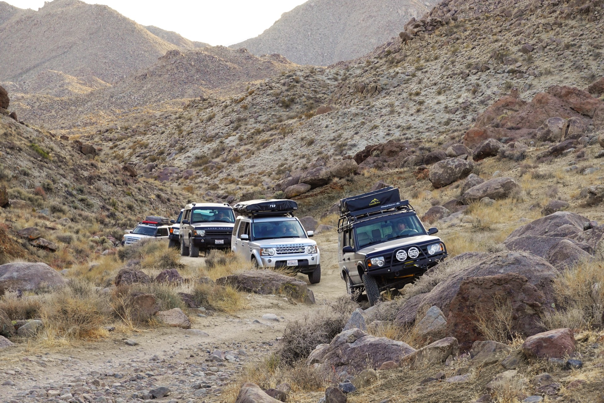
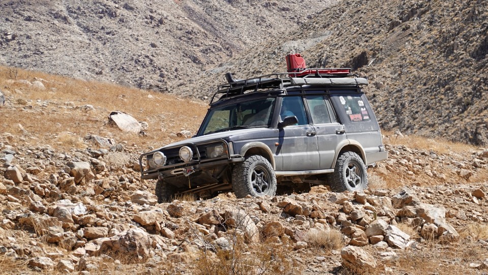
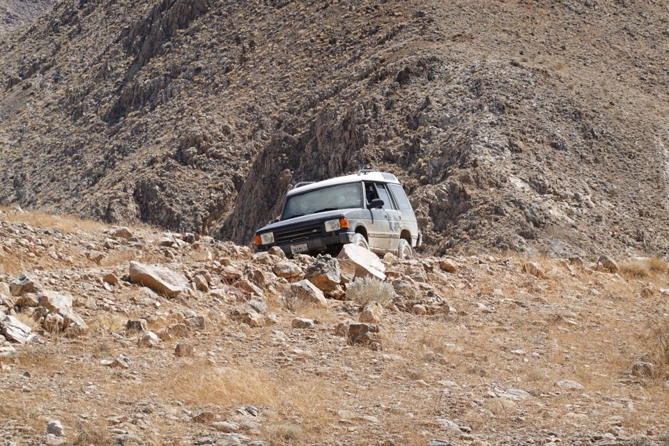
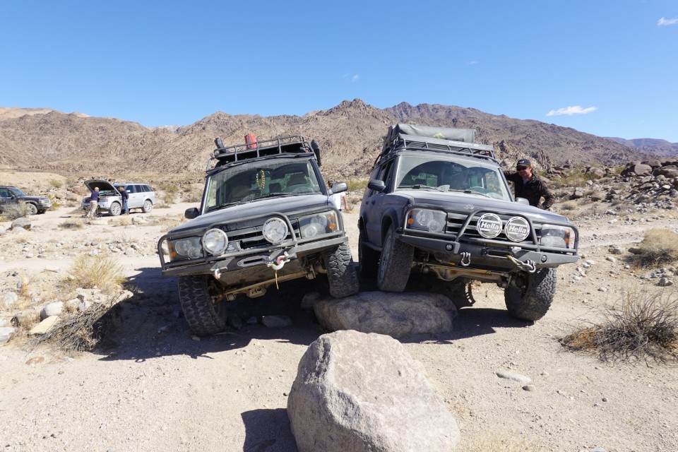
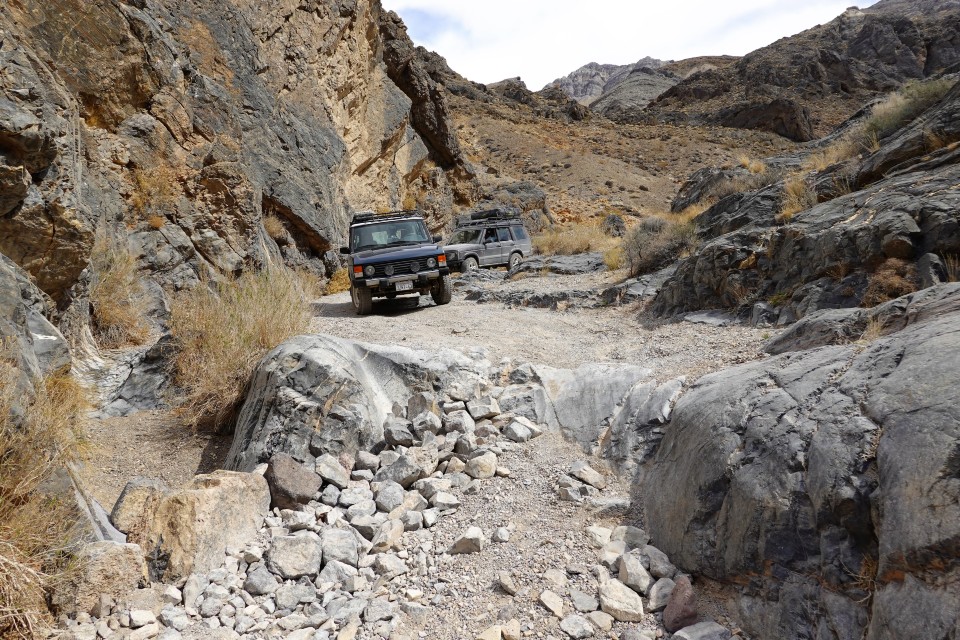
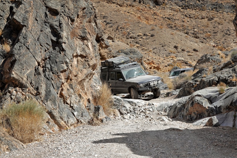
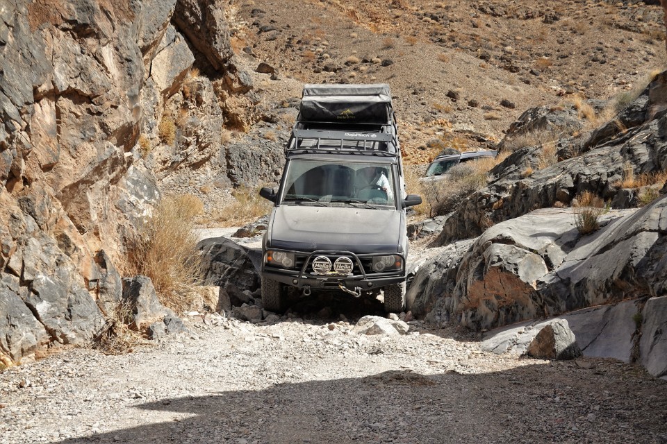
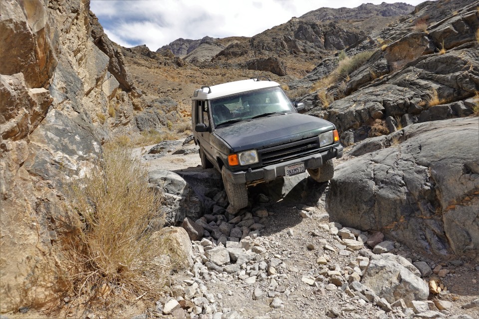
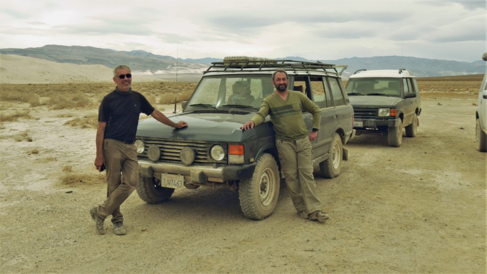
We witness a rare turnout of the first four generations of Discovery, and two Range Rovers two and a half generations apart - a Classic and a Sport.
This is also an incredibly rare trip where Discovery models make up an overwhelming majority - so the trip report goes here.

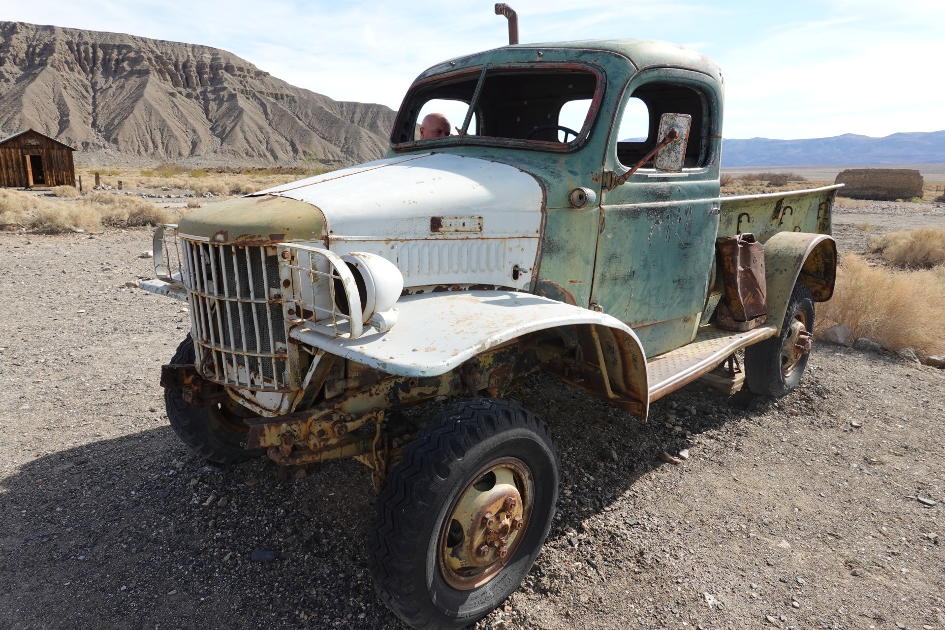
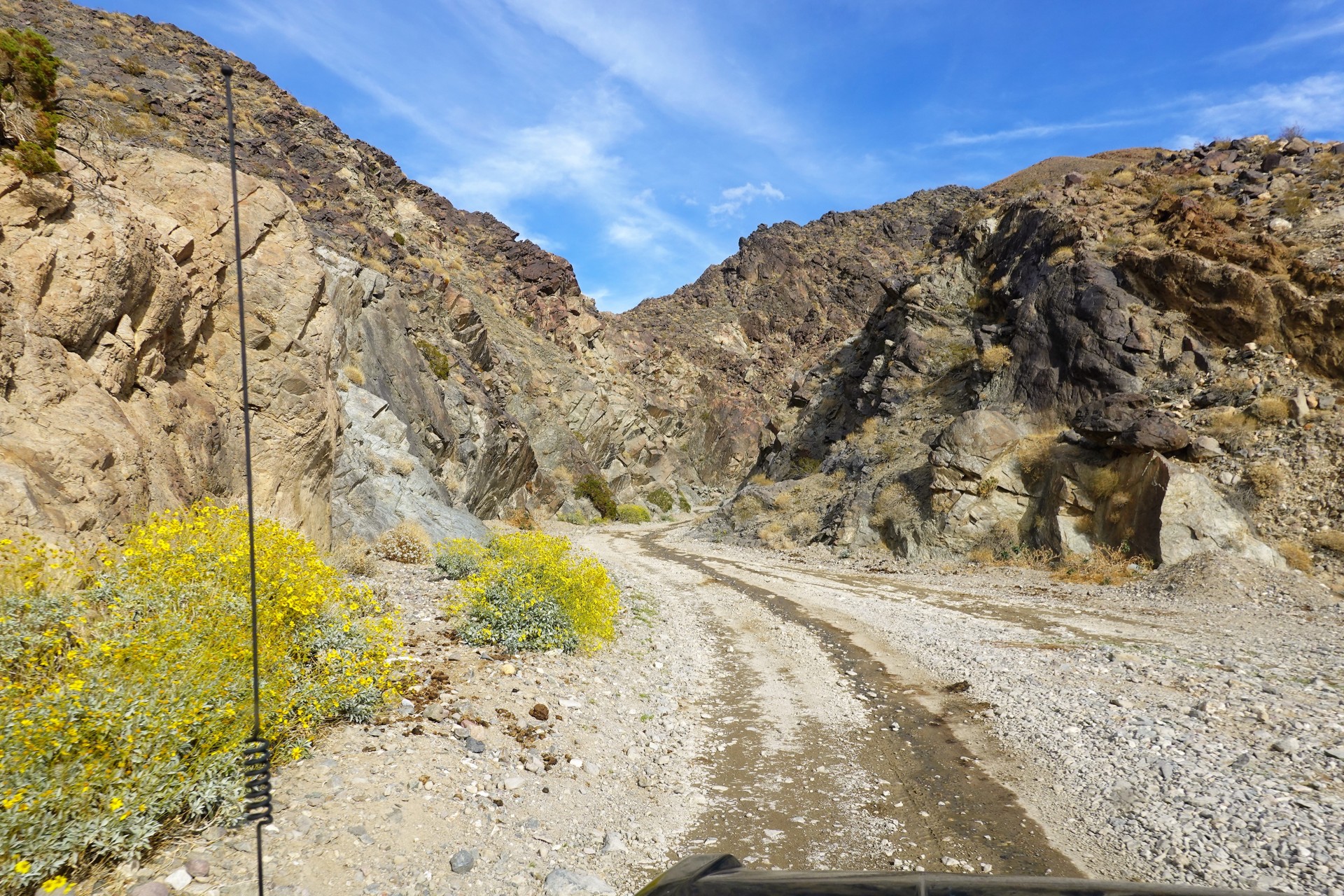
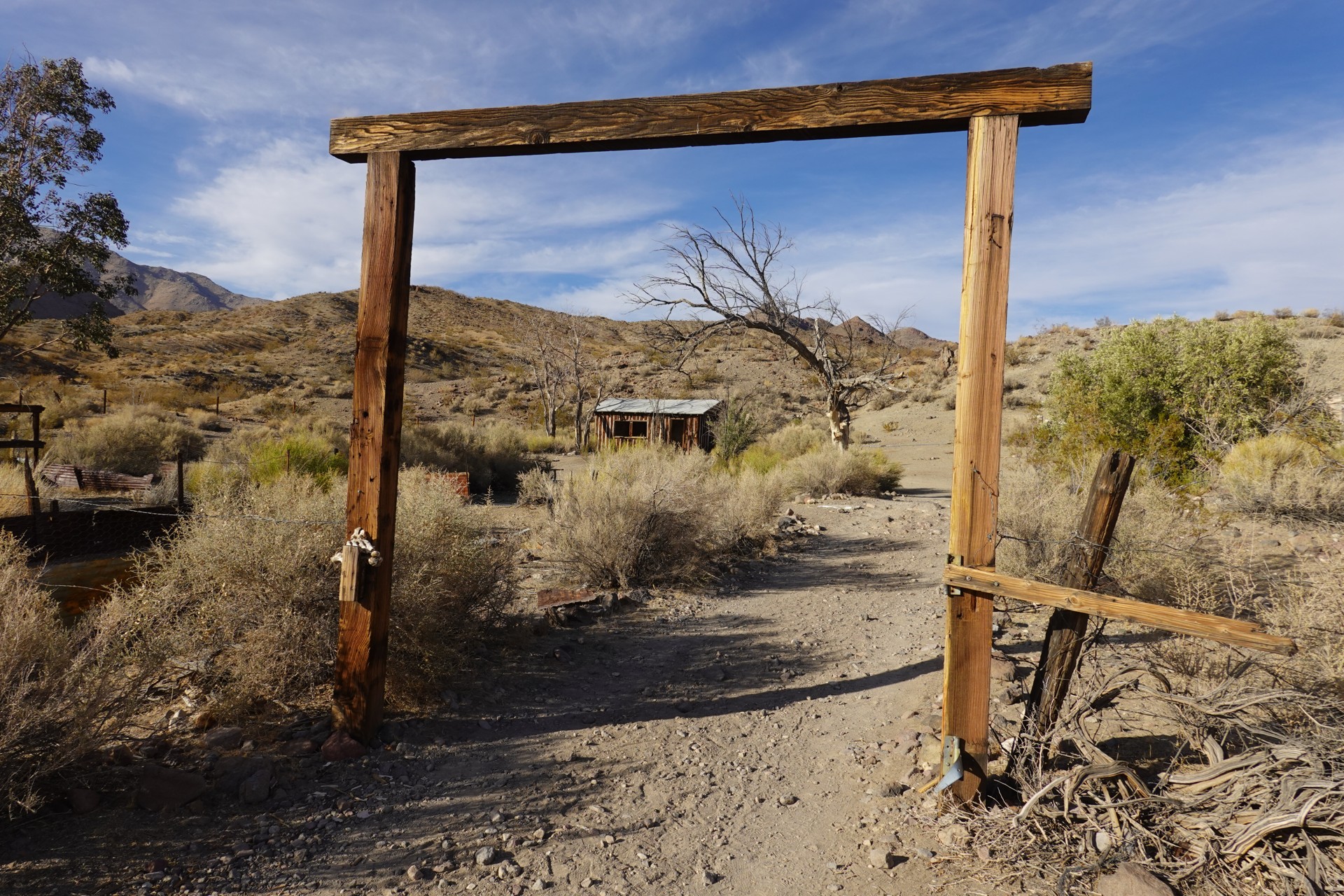
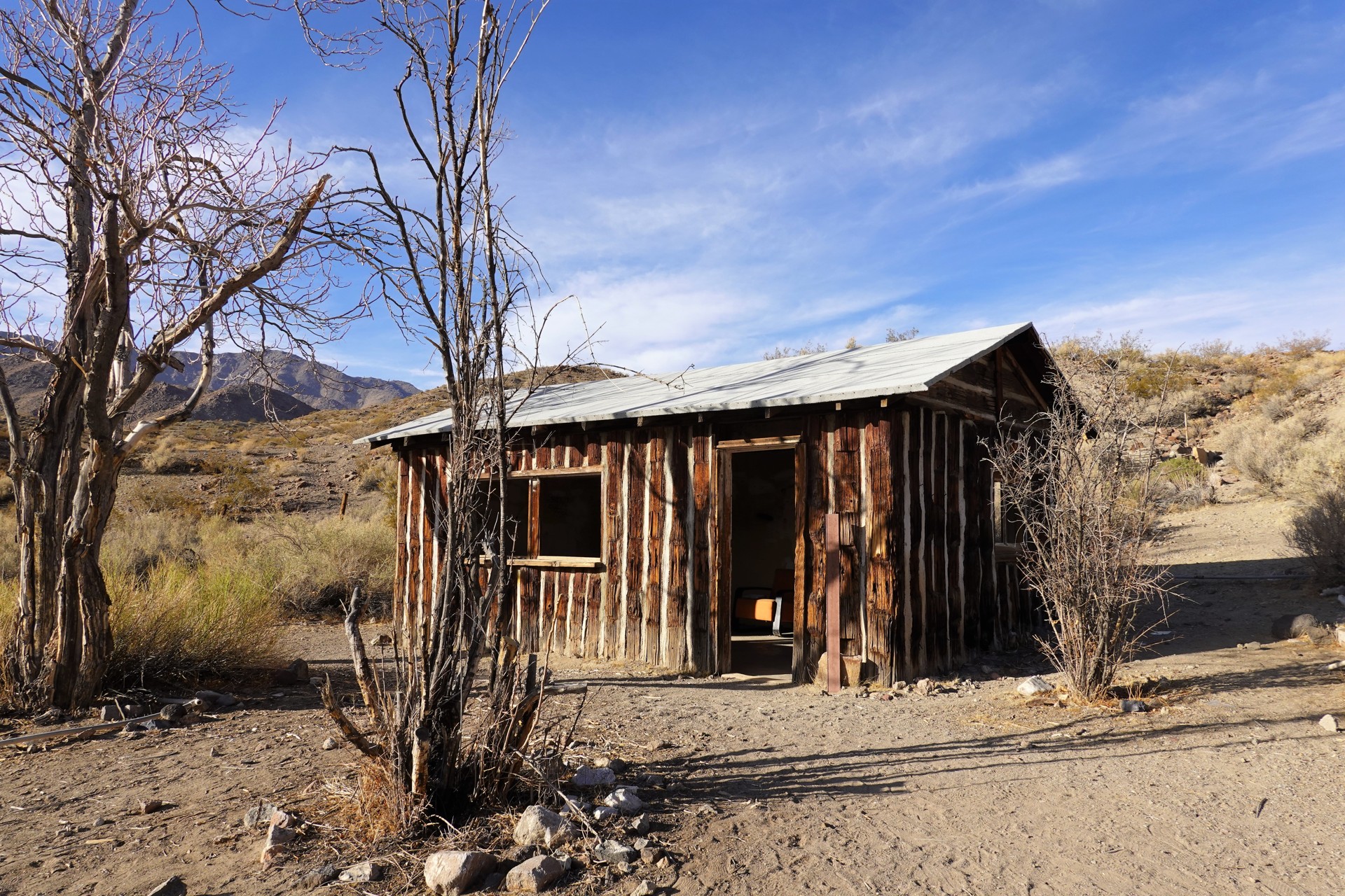
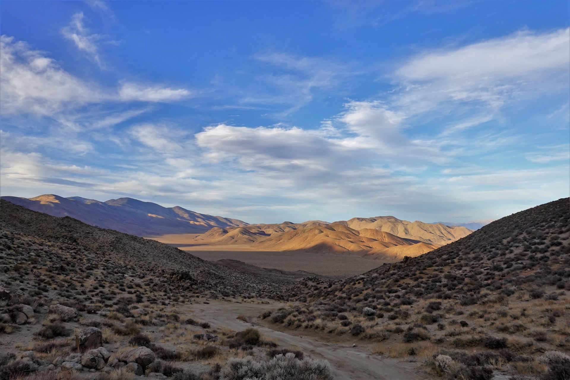
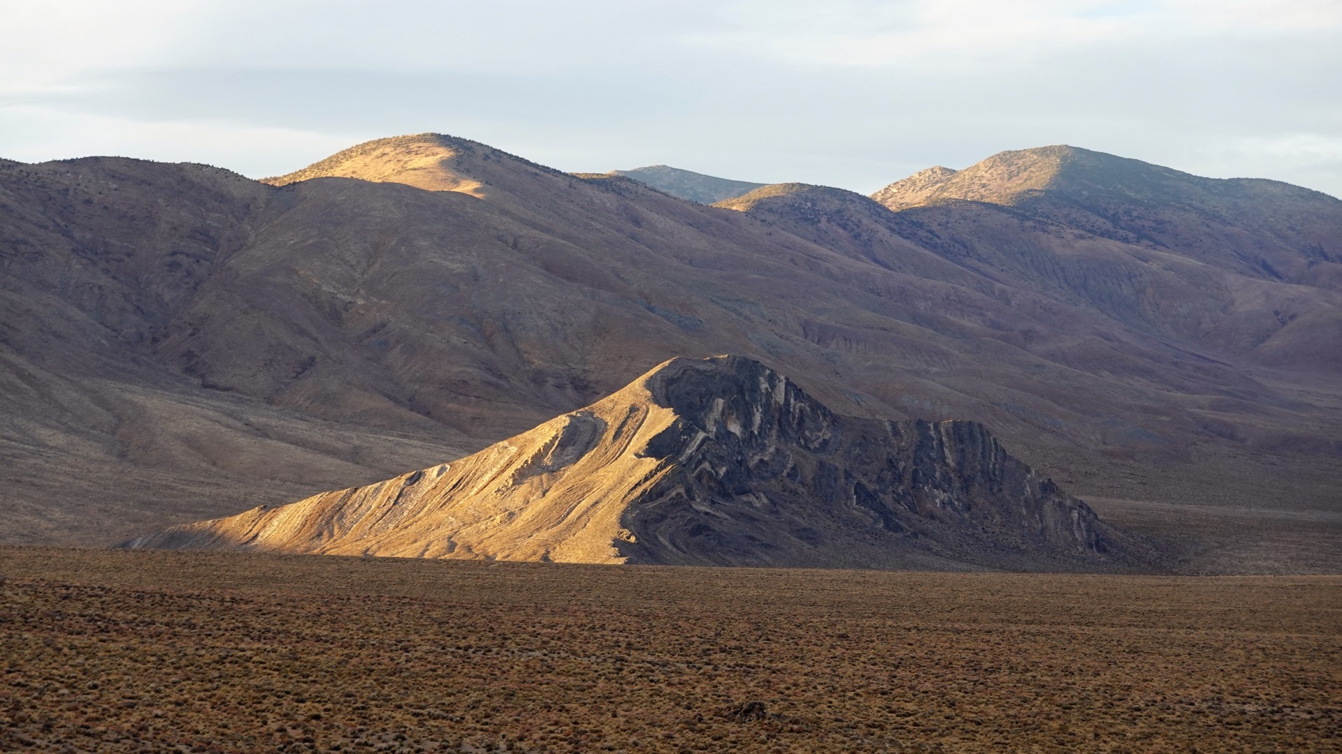
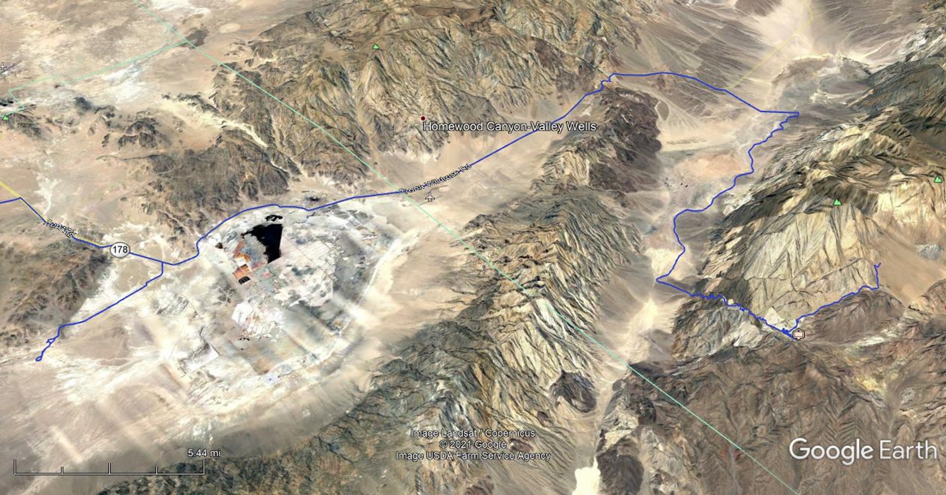
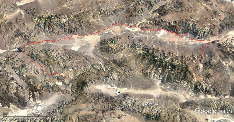
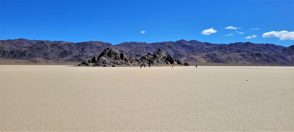
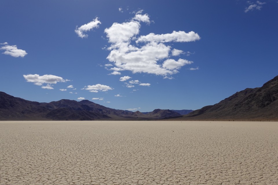
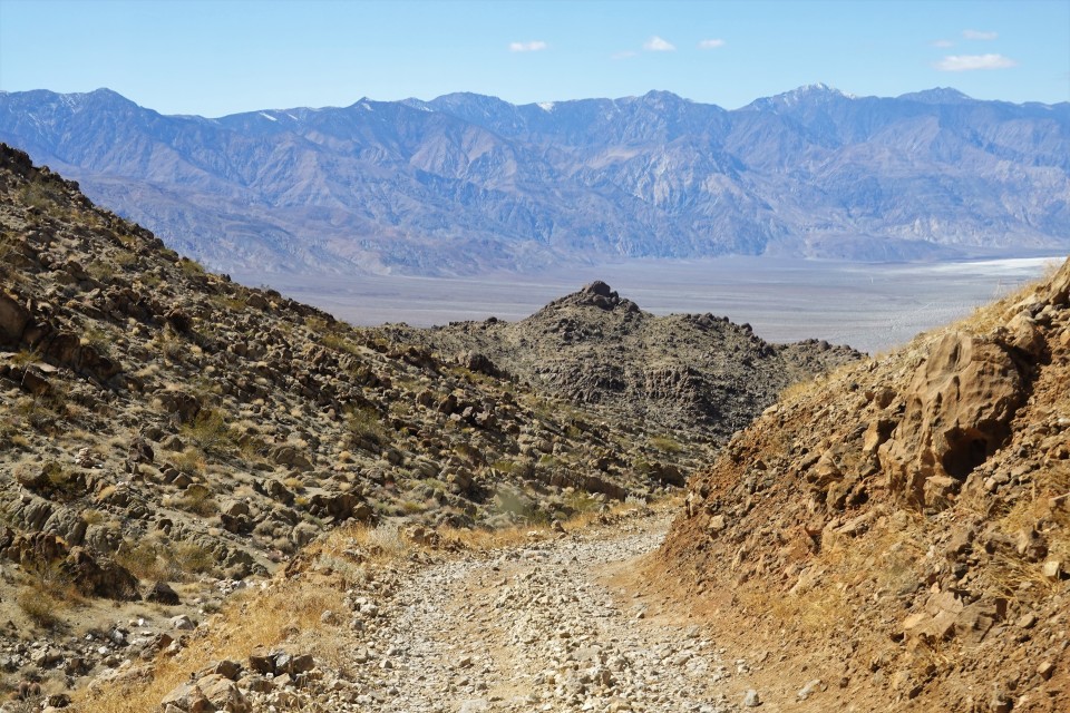
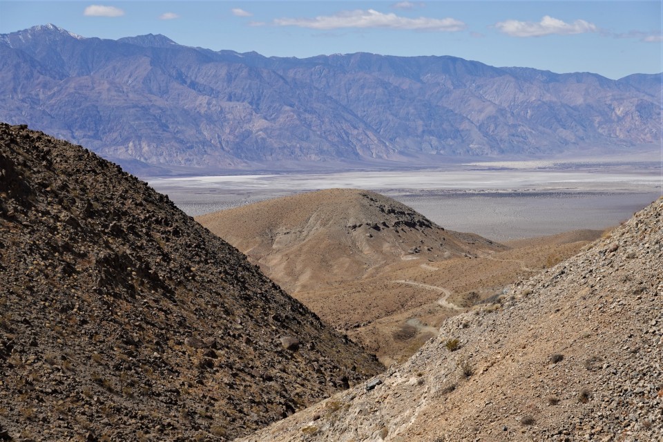
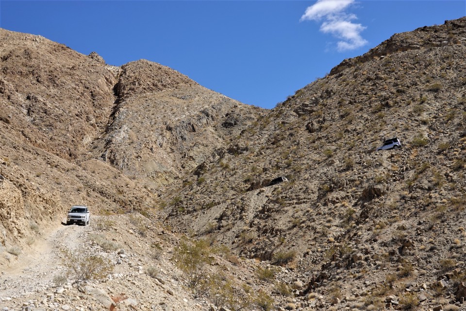
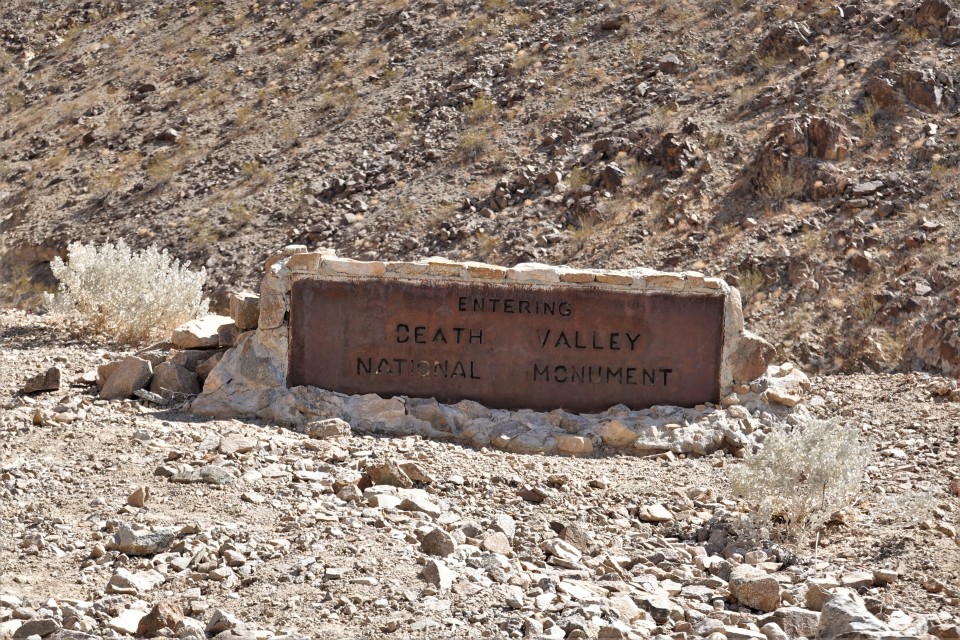
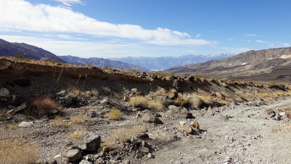
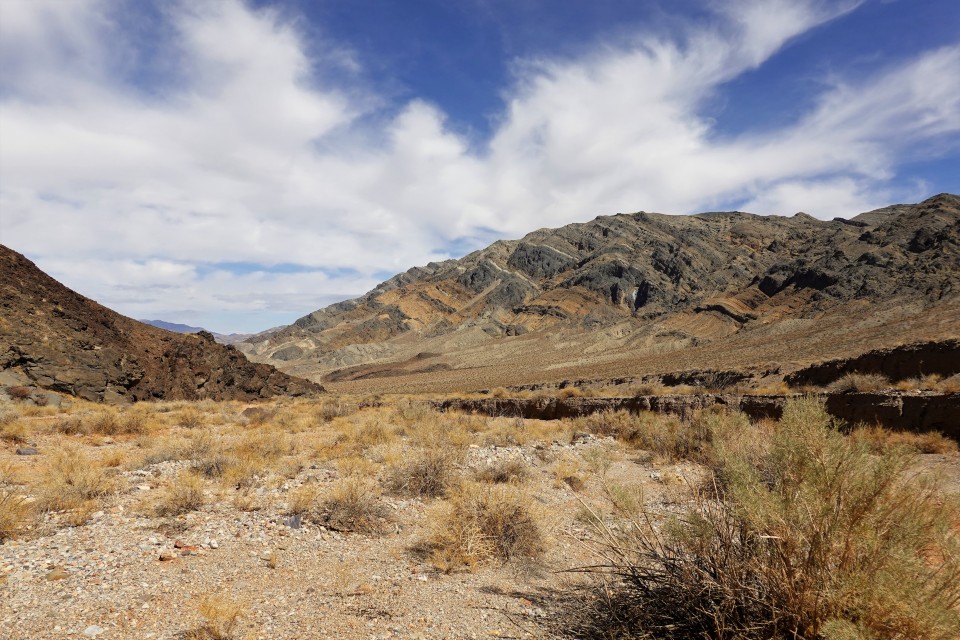
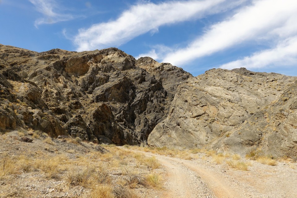
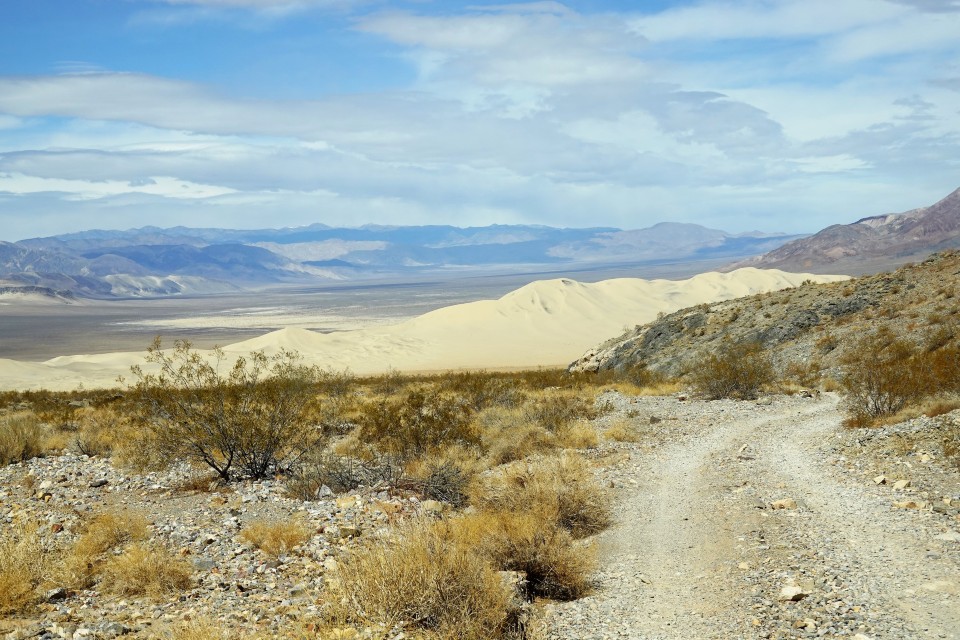
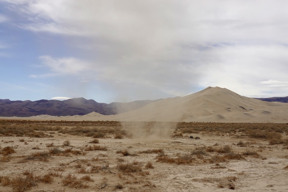
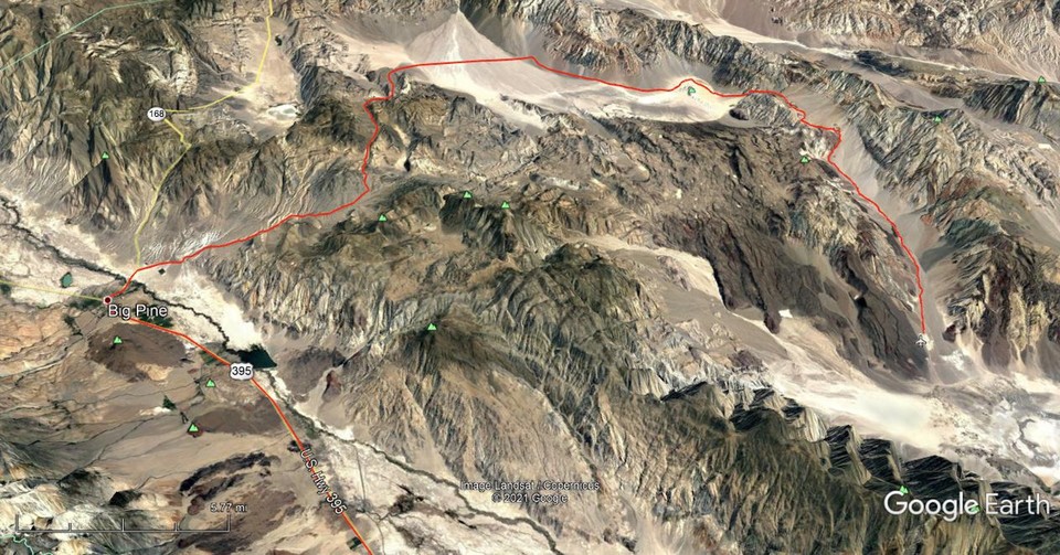
San Diego - Trona Pinnacles - Ballarat - Barker Ranch - Mengel Pass - Striped Butte

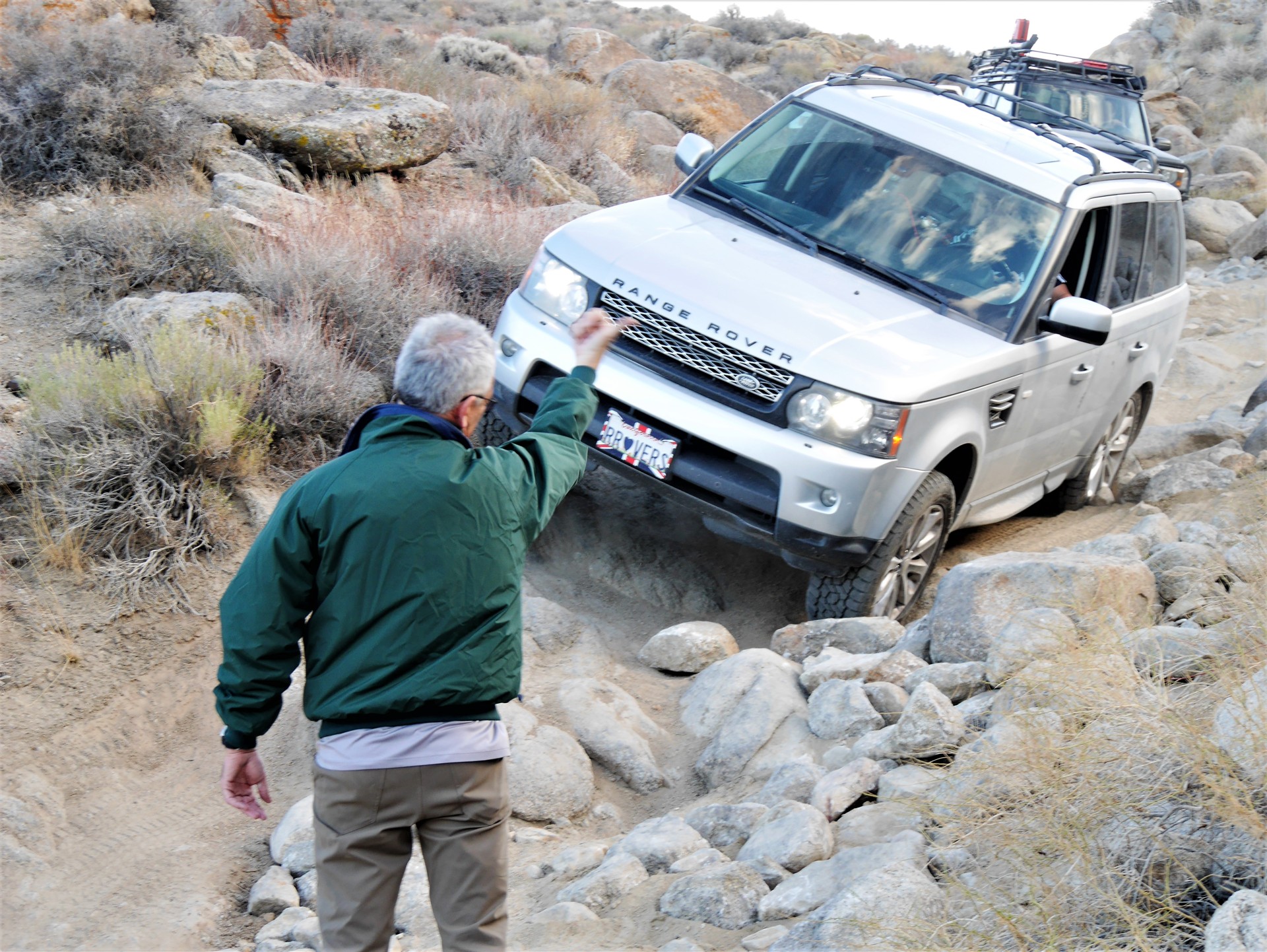
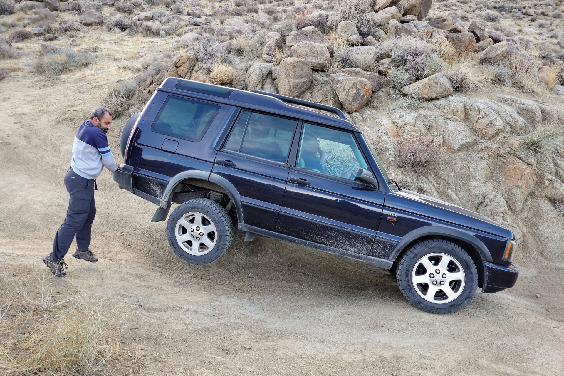
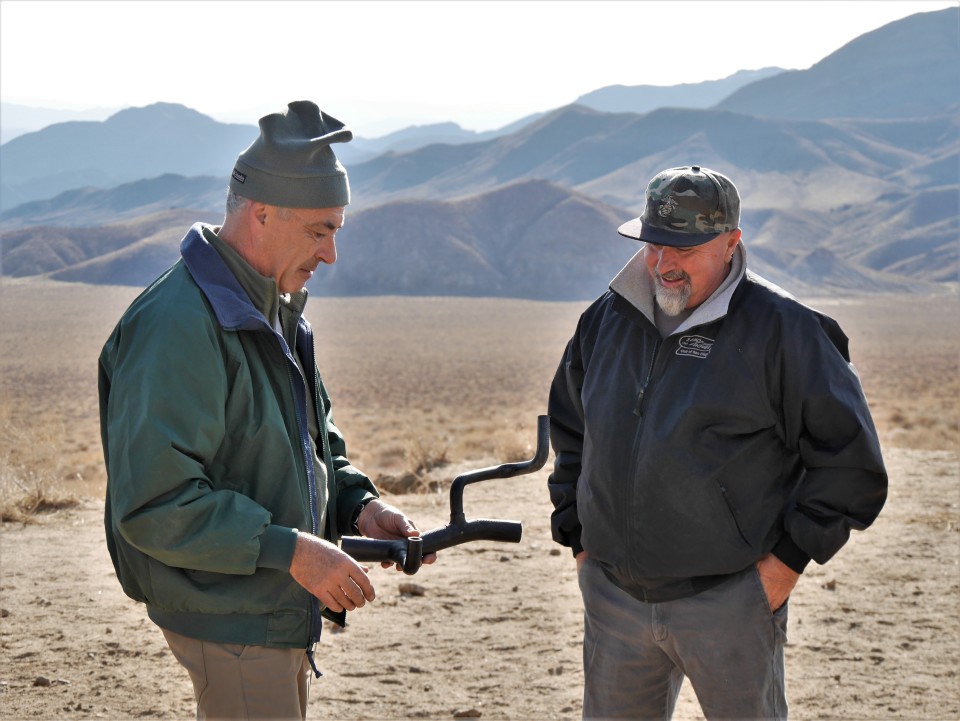
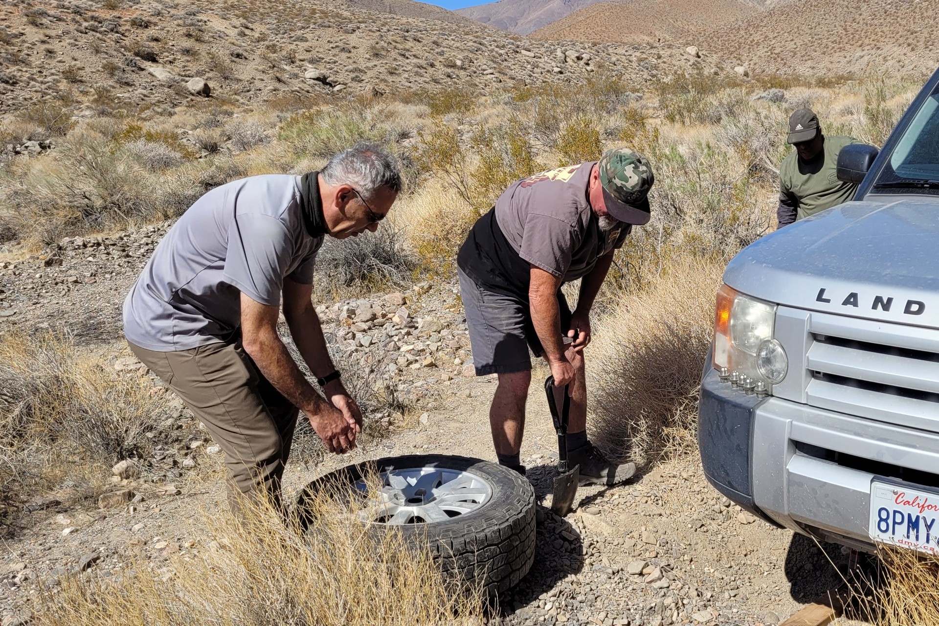
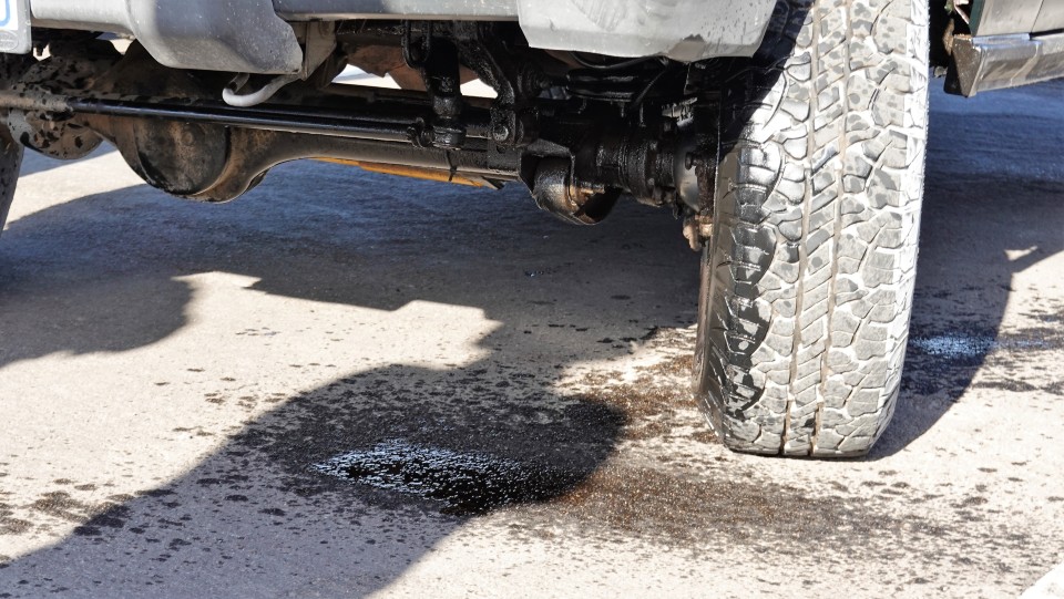
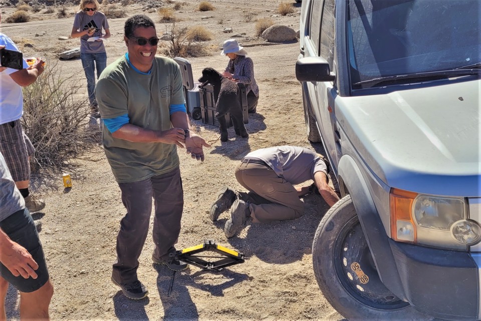
At the first fuel stop in Hesperia, the first piece of "the finest British craftsmanship" falls of a Disco 2: a downpipe divorces from the exhaust manifold flange. Breaks off the flange, that is. Don takes it in stride and heads out to the nearest muffler shop, and we continue.

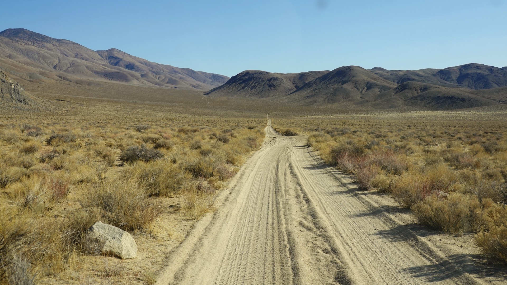
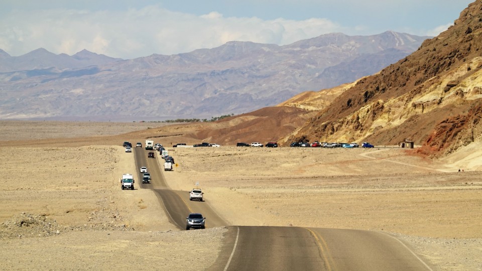
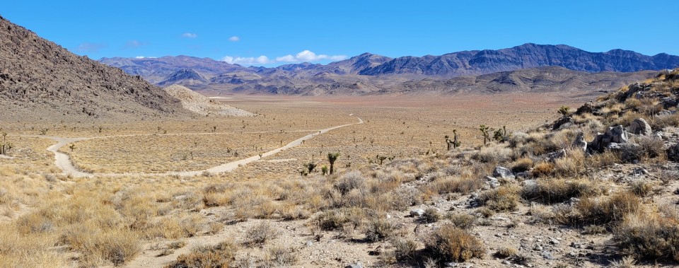
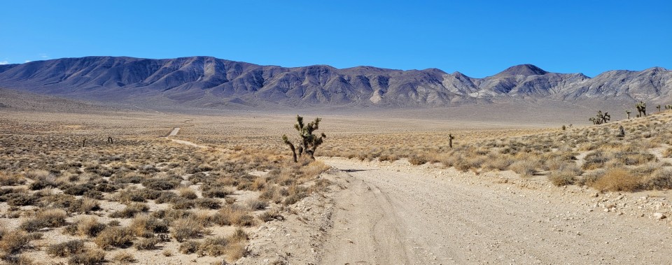
While we're on our way through a thousand of randomly-switched traffic lights in Adelanto, I am pondering our options - we need to take a scenic detour just so we'd meet Don near Ballarat, give or take.

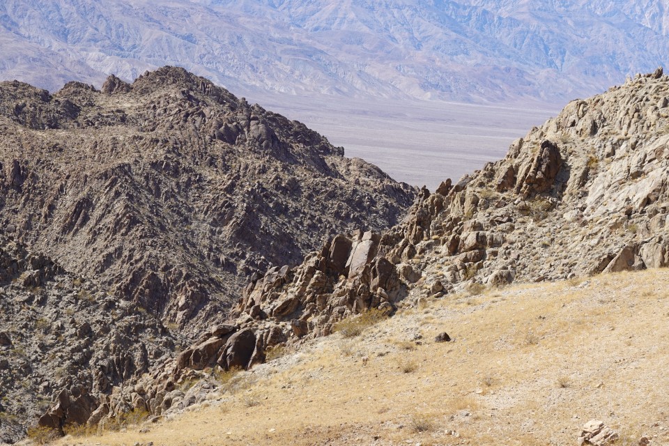
A few miles short of Trona the scenic detour presents itself: Trona Pinnacles.

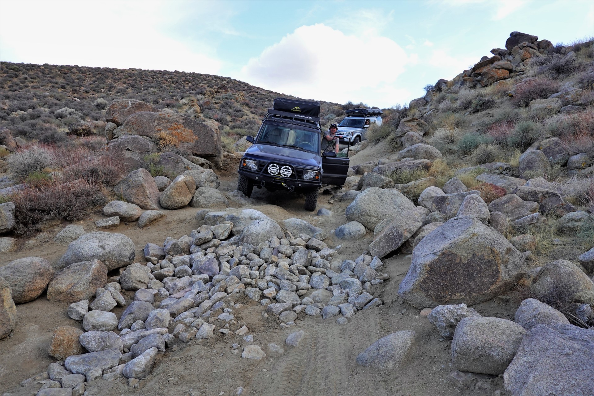
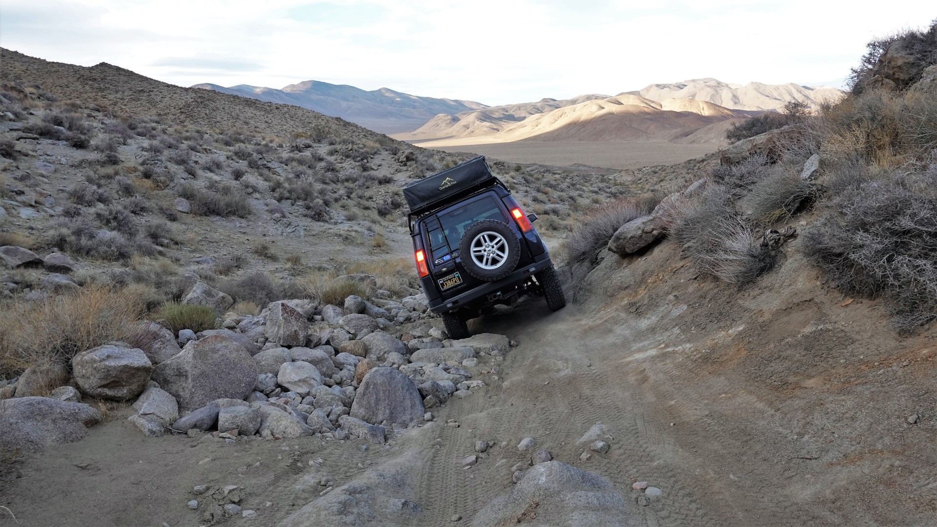
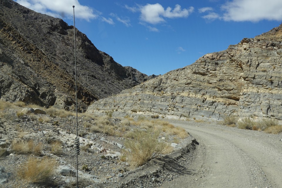
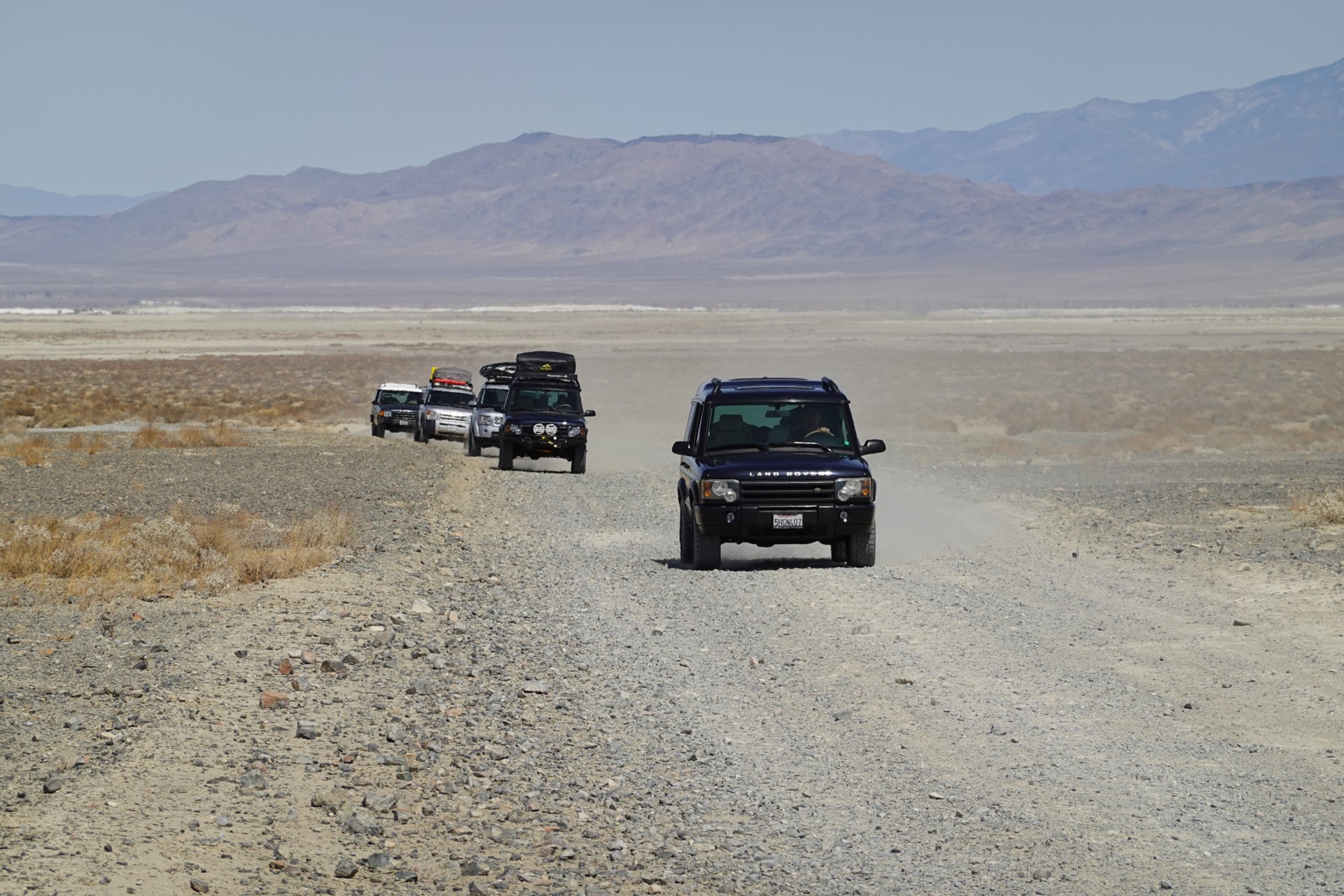
We're off pavement as soon as we can, and get our first - very gentle! - taste of washboard on the way to Pinnacles.

DVL04492.JPG


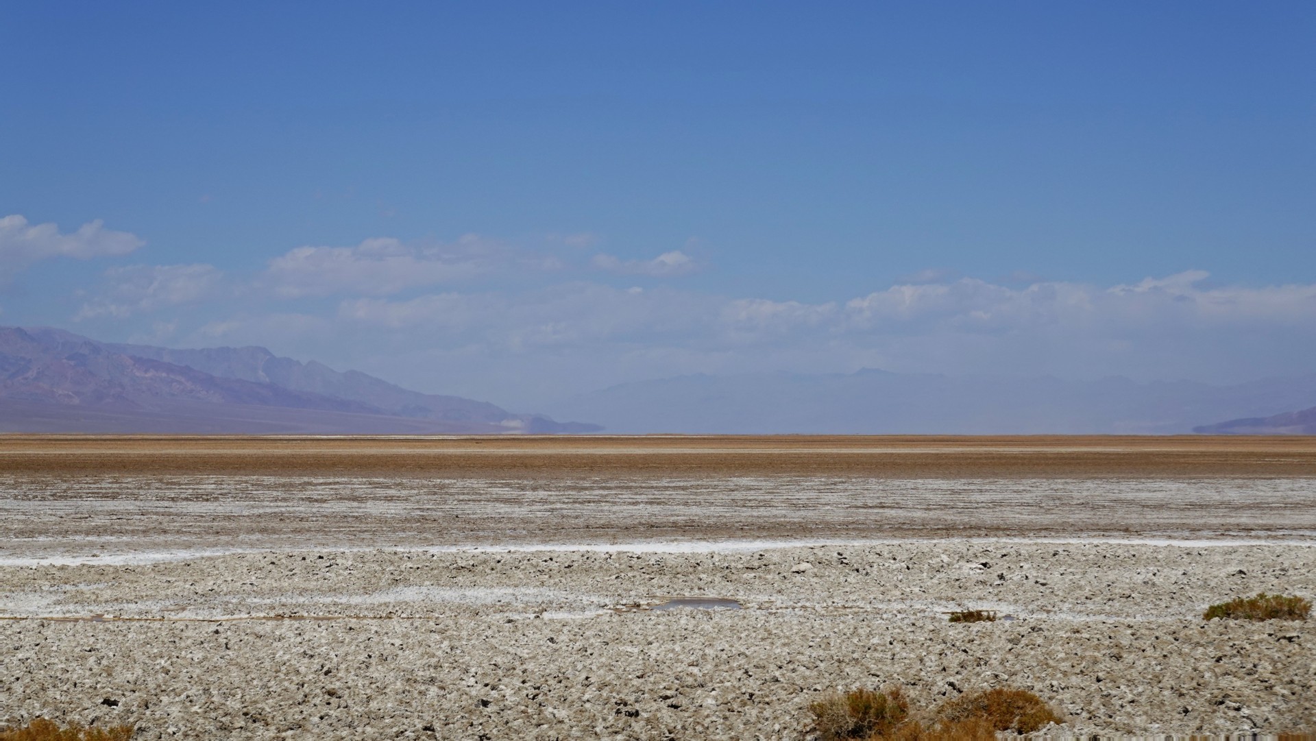
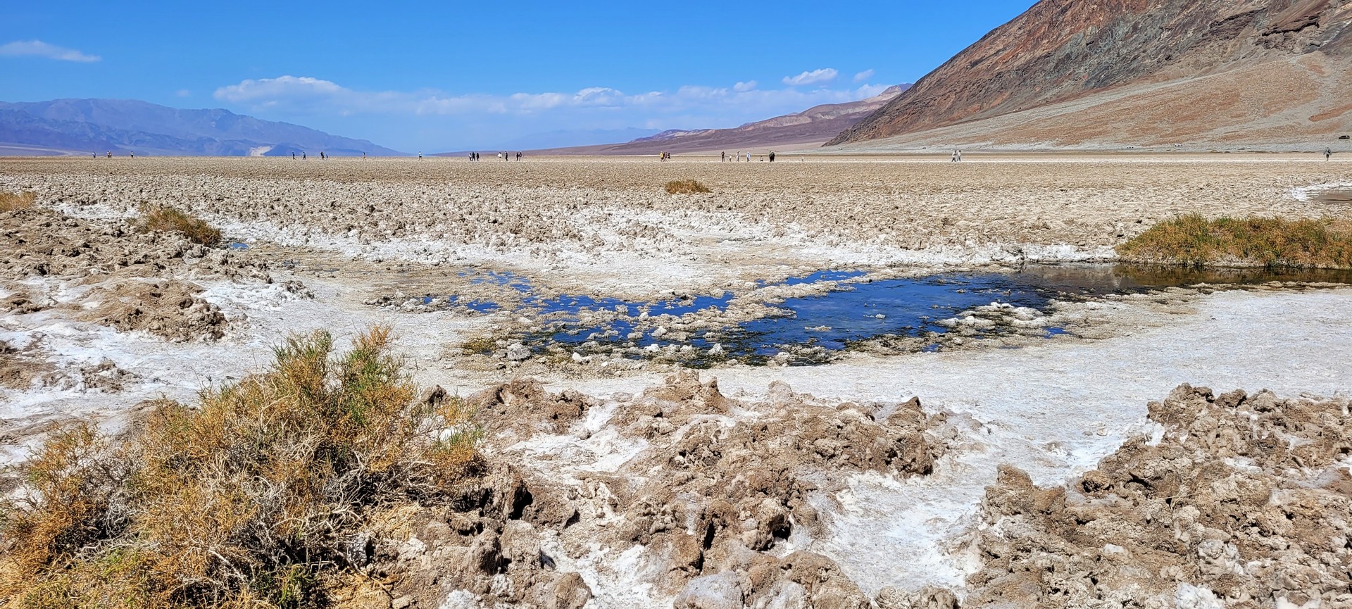
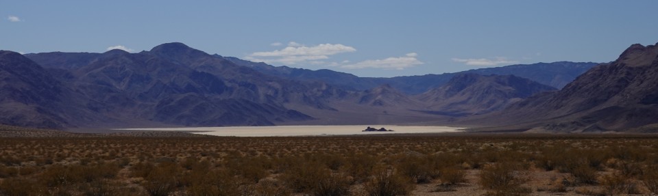
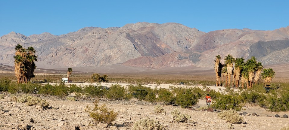
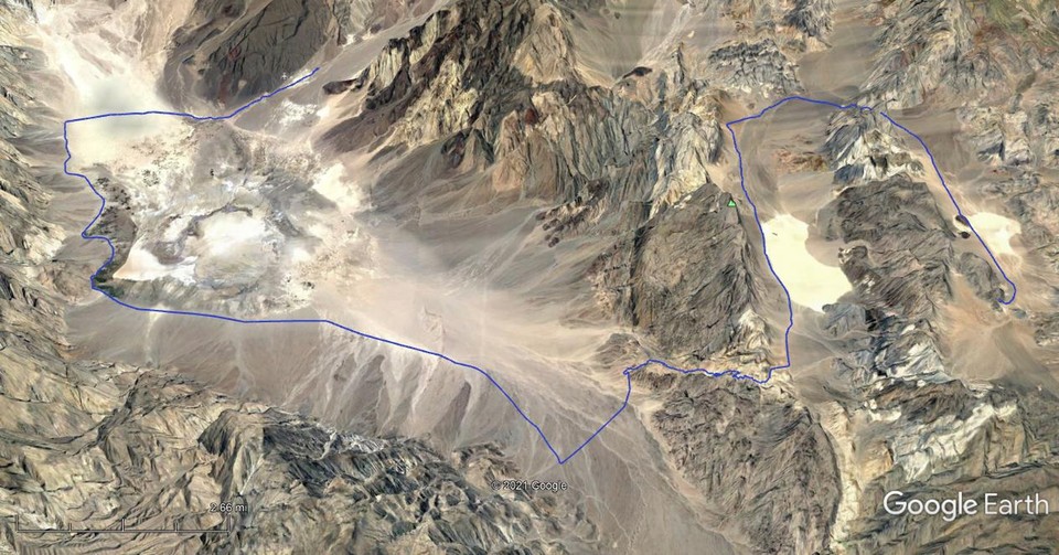
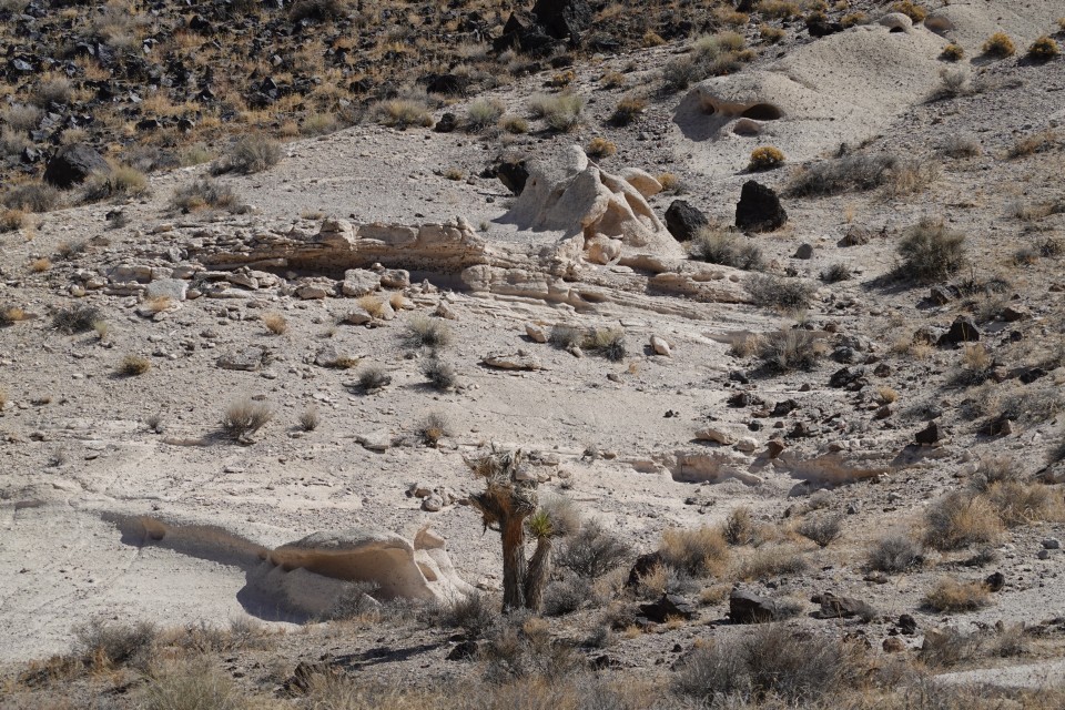
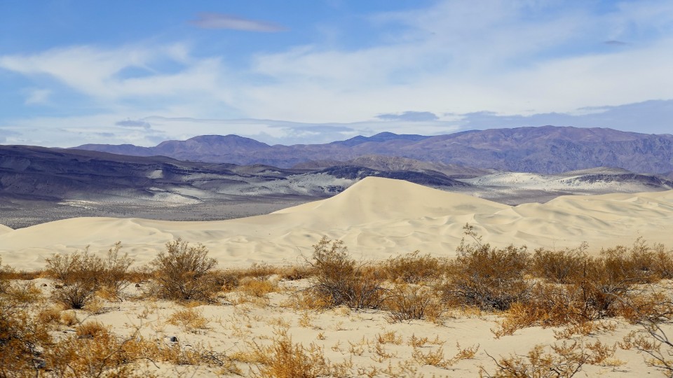
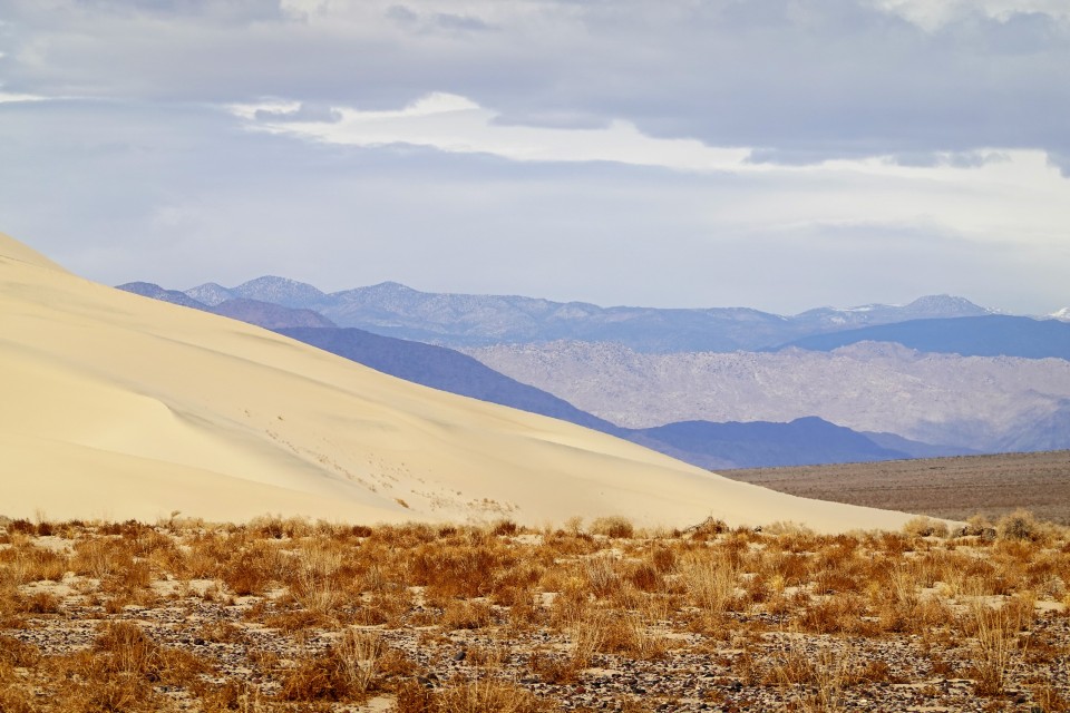
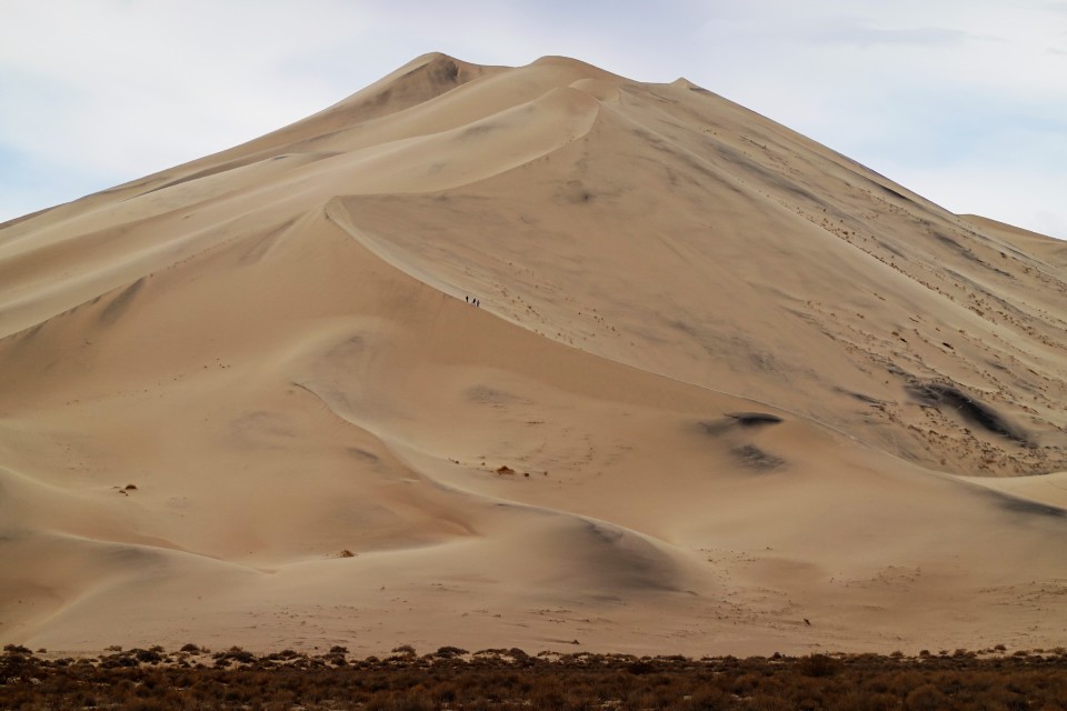
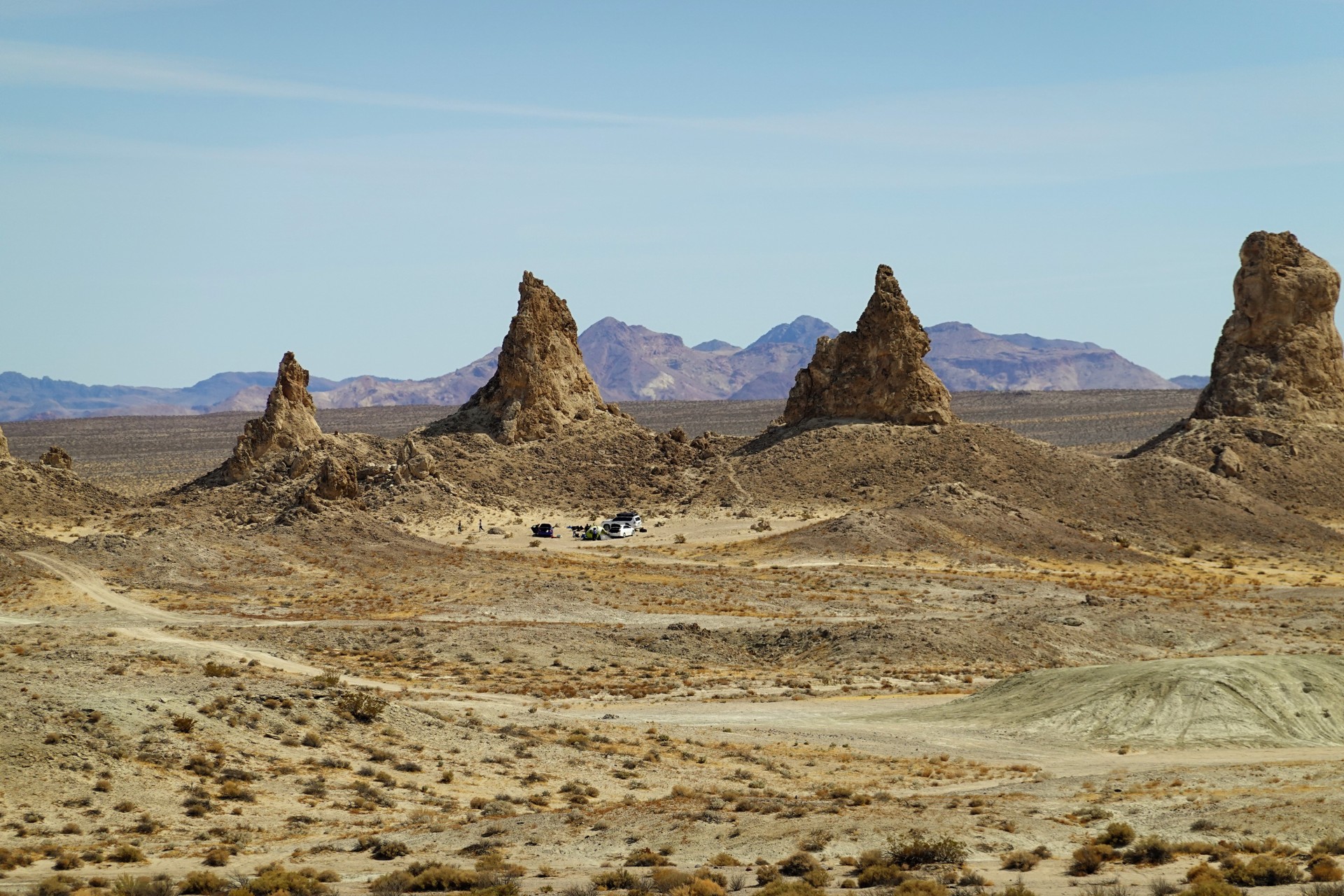
Trona Pinnacles is a collection of several hundred of odd-looking tufa spires, rising up to 140 feet off the floor of now-dry Southern end of of the Searles lakebed. Their origin is the same as the famous tufa towers of Mono lake.

DVL04493.JPG


DVL04497.JPG


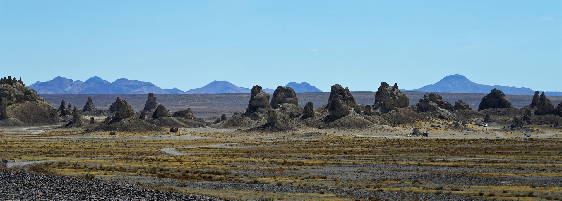
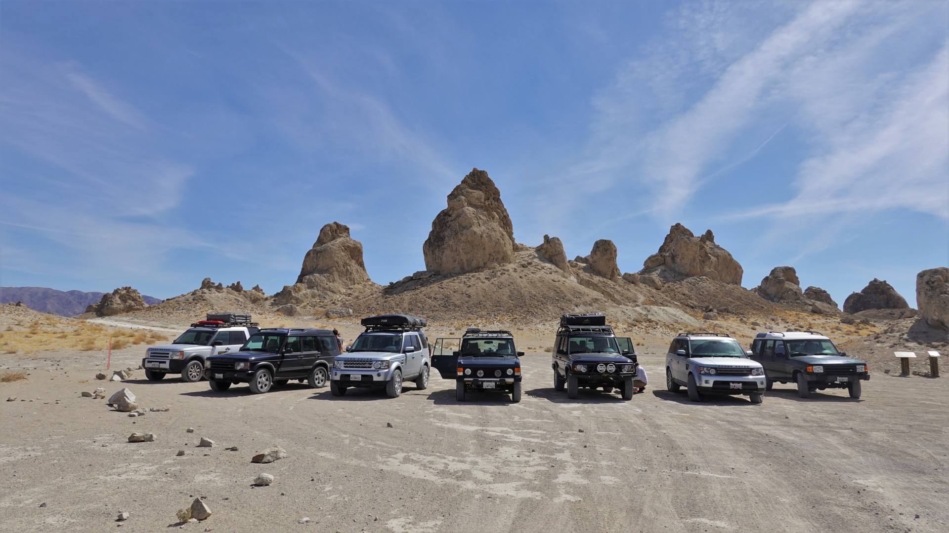
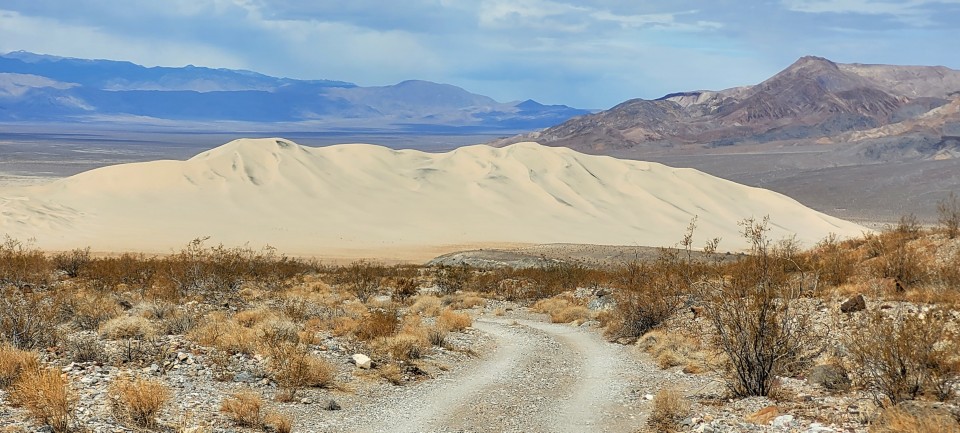
The Pinnacles are very scenic, and spread over a large area - enough to drive around them, and camp in a secluded spot if so desired.

DVL04501.JPG


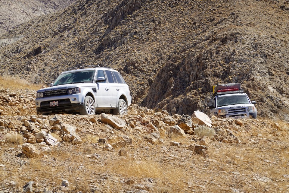
Out of the blue, we meet a small group of two late-model Land Rovers: one Range Rover Sport and one LR4. The owners speak fluent Russian, and make their living with software development in Bay Area. They have some vague plans for Death Valley, but we feel like we're going to meet again.

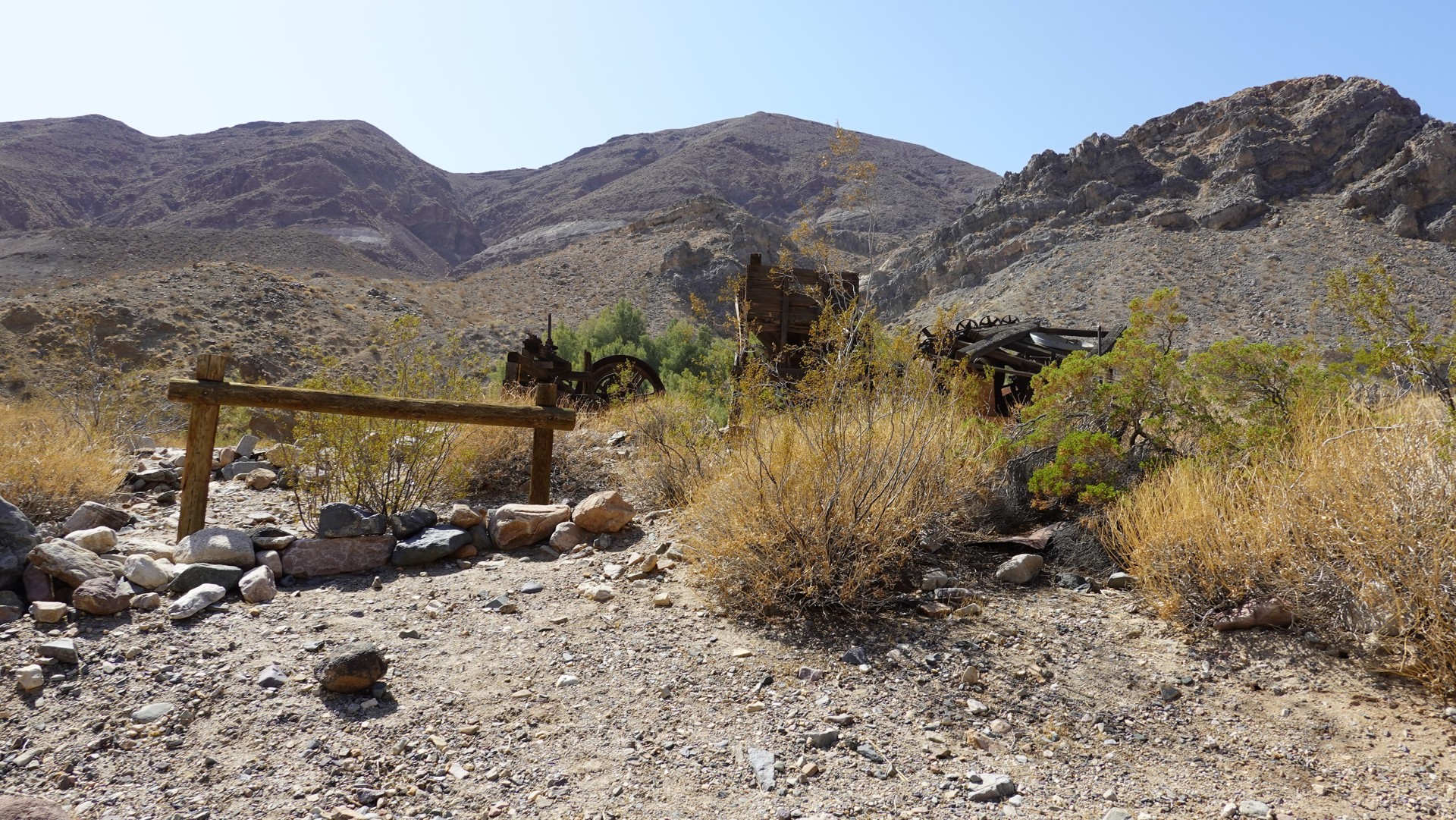
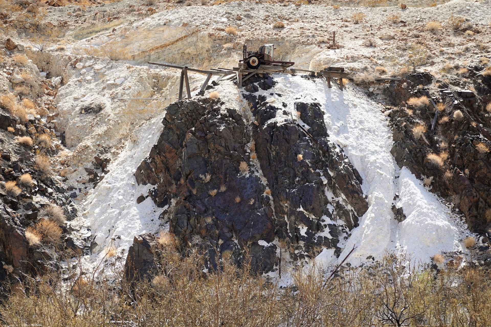
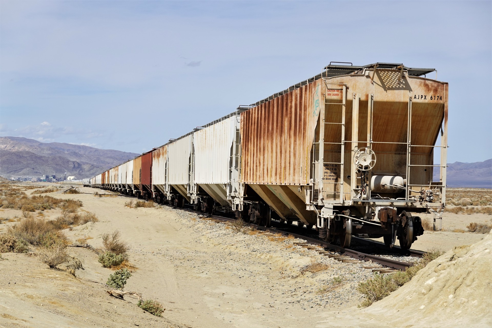
On the way back to Trona, the train pointed at the Searles Valley Minerals' soda ash processing plant is somewhat out of Max Max movies. Can't pass that up.

DVL04525.JPG
 

p m

Administrator
Staff member
Apr 19, 2004
15,630
863
58
La Jolla, CA
www.3rj.org
In Trona (one of the only two towns in CONUS with the high school football team playing on dirt), we have a mandatory fuel stop - and I receive a text message from Don, saying that he's going to be in Ballarat in 10 minutes or so. It is incredible, meaning he's ahead of us already - but he turns up right there at the gas station.

Now all eight vehicles are back in formation, and we leave pavement for a long while, and going towards the ghost town of Ballarat. On the way, we pass one of many ground control radars serving China Lake Naval Weapons Station.

DVL04535.JPG


We stop by the convenience store in Ballarat, I learn that Rocky Novak no longer lives there, and my hopes for apple-pie-flavored monshine are dashed.
I have to tell you guys - that one time I bought a jar of that moonshine, I drank it alone just in case I go blind and my friend could take me to the nearest medical facility. I am happy to report that all of that moonshine was consumed without any [unusual] after-effects.

DVL04537.JPG


The new caretaker of town tells us this 1942 Dodge truck belonged to Charles Manson's gang, and was driven by him and Tex Watson (his right hand in Sharon Tate's murder). If you're so young that you've never heard of Manson, there will be more on that subject later.

DVL04544.JPG


15 miles South of Ballarat, we turn left from Wingate Road to Coyote Canyon Road, towards Goler Wash. It is a good place to air down - for those with the tire sidewalls tall enough to benefit from it.

DVL04545.JPG


Airing down - or up - was a subject discussed at great lengths on this trip, since the sidewall ratios ranged from 50% to 100%. To fast-forward this thing - no shocks were broken on this trip, but we've had two sidewall blisters (both on Toyo Open Country, and both appeared to be manufacturing defects) and two flats (on the group's vehicles).

The road slowly climbs up an alluvial cone for about a mile and a half, and enters the narrow Goler Canyon.

DVL04549.JPG


Halfway up Goler Canyon, there's turn-off towards a questionable attraction - Barker Ranch (click on this and other links if interested). It could have been one of many slowly-decaying ranches in the greater Death Valley, but it harbored Charles Manson and his gang. They have been finally captured and arrested here in October of 1969, practically by a chance.

DVL04559.JPG


DVL04560.JPG


The county law and DVNP LEOs were looking for some vandals/graffiti artists, and they only by a chance realized who they snared at Barker Ranch. Manson himself hid under the kitchen sink in the stone building (mostly burned down, with only walls and foundation remaining - in a group photo below), but was found and booked.
It took nearly two years to prosecute the gang and put them behind bars. There's a bone-chilling scene in "Once upon a time in Hollywood" movie - when one of the main characters wanders into a ranch in San Fernando Valley occupied by Manson's gang. Watch it if you haven't. This scene is worth watching.
 

p m

Administrator
Staff member
Apr 19, 2004
15,630
863
58
La Jolla, CA
www.3rj.org
P1340448.JPG

(photo by my brother Nikolay Matusov)

A lone burro watches us mulling around the ranch buildings. Hundreds of these donkeys have been left behind the early settlers of California, and they continue to thrive in this harsh climate.

DVL04562.JPG


It is getting late - and we still need to find a campsite. So we're off from Barker Ranch, and making our way up Goler Wash - all the way to Mengel Pass. The road is not difficult, but our progress is somewhat slow and laborious.

DVL04566.JPG


There isn't a lot of room at the Mengel Pass, so I sneak up a photo of my Range Rover and my brother's Discovery before the rest of the group has a chance to catch up.

DVL04575.JPG


At the pass there's a memorial for Carl Mengel, a prospector from late 1880s to 1940s. His cabin still stands and is used by passers-by on first come, first serve basis.

20210319_180709.jpg

(Photo by Nikolay Matusov)

Beyond the pass, we can see the Butte Valley, getting the last rays of sunshine.

DVL04568.JPG


The descent from Mengel pass into Butte Valley proves to be far more challenging. We have a few vehicles wide and low enough to need spotting through the rocky places; I remember my friend's G-Wagen needing help from all three lockers going in the opposite direction.

P1340457.JPG

(Photo by Nikolay Matusov)

DVL04576.JPG


DVL04579.JPG
 

p m

Administrator
Staff member
Apr 19, 2004
15,630
863
58
La Jolla, CA
www.3rj.org
DVL04586.JPG


P1340464.JPG

(Photo by Nikolay Matusov)

It doesn't help matters that two Toyotas caught up with us - a wildly-built Tundra and a far more modest 80-series Land Cruiser. They seem to be in a real hurry - we let them pass, just to see the Tundra driver kick up rocks right and left, slam his bed into the rock on the side of the trail, bend the hitch receiver on a rock underneath, and continue in a trail of dust. The Land Cruiser driver is more conservative.

DVL04592.JPG


Now we're in the Southern reaches of the Butte Valley, looking at the Striped Butte at the sunset, near the Geologist's Cabin and "all the good stuff." Undoubtedly, all cabins are already taken, and I see a group of vehicles camping near the Willow Springs area at the distance.

I relay to the group the basics of the story of the German family that disappeared in the Willow Springs / Anvil Canyon area in 1996. Their remains have not been found until 2010, and would likely never have been found if not for the enthusiast / SAR operator, who also wrote this story. Read it - it is well written and is extremely captivating.

Just as the story is about to sink in, we come across a beautiful group campsite with a view of the entire valley. It is rather small - but we have enough room, and start setting up the sleeping quarters and cook dinner.

DVL04595.JPG


On the upside: burnt ends with fried vegetables is on our dinner menu tonight.

On the downside: Knob Creek Rye turned pitch black after a day in a steel can, and the taste doesn't match our memories. We probably won't go blind or anything, but we don't want to find out. Bulleit Rye it is.

There's still enough of beer and whiskey left for an extended after-dinner chat. My Airedale Jules elects to retire to the Range Rover before me.

The night is cold and very windy, and the sleep is fitful. Not sure if the guys in rooftop tents are enjoying it, either.

The tally for the day:

  • total distance: 307 miles
  • off pavement: 47 miles
  • total driving time: 7:28
  • max elevation: 4250 ft
  • min elevation: 150 ft
The KML of the day's labors, and here's the Google Earth screenshot:

San%20Diego%20to%20Striped%20Butte.jpg
 

p m

Administrator
Staff member
Apr 19, 2004
15,630
863
58
La Jolla, CA
www.3rj.org
Striped Butte - Badwater - Titus Canyon - Ubehebe Crater - Teakettle Junction - Hidden Valley

In the morning, the sun paints the Geologist's Cabin nearby, the Striped Butte, and the rest of the valley.

DVL04596.JPG


DVL04597.JPG


My Airedale Jules insists at me getting out, and giving him water and food. My brain and fingers are too slow even for basic tasks like lighting up the stove and starting the coffee.

DVL04599.JPG


DVL04602.JPG


When most of the crew wakes up, we share stories about how bad the sleep was last night. Yes, it was windy - but it always is in Death Valley.

20210320_084806.jpg

(Photo by Nikolay Matusov)

Some time is allocated for a daily discussion of idiotic engineering solutions by Land Rover. Case in point: lower radiator hose on late Classics and all Disco 1.

P1340472.JPG

(Photo by Nikolay Matusov)

Despite all the banter, we get underway remarkably early. The plan for the day: drive to the Eastern end of Warm Springs Valley, continue on West Side Road along Badwater Basin, fuel up at Furnace Creek, and proceed to Ubehebe Crater and then on towards the Racetrack. I offer an alternative with a trip to Titus Canyon; everyone is excited, so we don't even stop to look at the ruins of Warm Springs Talc Mine.

DVL04610.JPG


DVL04612.JPG


DVL04615.JPG


We make great progress, until I get a call on the VHF about a flat tire on an LR3.

I get back to "oversee" the tire-swapping process and offer some deep thoughts, should those be necessary; but the thoughts were way on the surface: Temporary spare tires should be prohibited in Death Valley.

20210320_102228.jpg

(Photo by Nikolay Matusov)

20210320_105053.jpg

(Photo by Nikolay Matusov)

The flat tire in question has an inch-long sidewall cut; we can and will perform some kind of a band-aid repair in the evening, but for now we borrow a full-size (and slightly larger) spare tire from the LR4 (thank you Stephen!) and swap it in.

Now, we just may have to change our plans. Driving all the way out to Pahrump seems way too far, and we need to be conservative with driving on roads with sharp rocks (meaning all unpaved roads in Death Valley). Thus we drive to Ashford Mills ruins, and turn North on paved Badwater Road, towards Furnace Creek.

The plan is to continue to Furnace Creek, then cross the state line to Beatty, Nevada, and try our luck in finding a tire before heading back to Rhyolite and Titus Canyon.
 
Last edited:

p m

Administrator
Staff member
Apr 19, 2004
15,630
863
58
La Jolla, CA
www.3rj.org
We hit pavement on Badwater Road and make our way North.

DVL04625.JPG


Now, this is Death Valley proper.

DVL04627.JPG


We make a lunch/sightseeing stop at Mormon Point; we have to park at the shoulder way before the official parking lot - it is teeming with people and overflowing with vehicles.

DVL04636.JPG


20210320_131137.jpg

(Photo by Nikolay Matusov)

Crowds are one giant reason to stay away from pavement in Death Valley...

DVL04645.JPG


... so we blast by all the niceties of the Death Valley National Park (Artist's Drive, Zabriskie Point, you name it).

20210320_135035.jpg

(Photo by Nikolay Matusov)

Furnace Creek: we top off the fuel - most of us, that is. There's a tiny tire shop at the gas station - we have to wait about 20 minutes for the mechanic to show up, and, unsurprisingly, he does not have any 19-inch tires in his collection of beat-up rejects. He's skeptical about Beatty, too - but promises to make a run to Pahrump and drum up one or more of these tires.

I see no options to keep the group together to arrange a not-guaranteed next-morning tire repair, and, armed with slightly oversized tire in the right front corner, the LR3 can continue until Saline Valley - from where the owners are going home anyway. We punt on the tire shop and head North.

The stop at Furnace Creek put us another hour and a half behind schedule, so the option of driving through Rhyolite and Titus Canyon is off the table. At the very least, we can drive up to the mouth of Titus, park, and walk a little bit up the canyon - and that's what we do.

P1340503.JPG

(Photo by Nikolay Matusov)

DVL04658.JPG


The parking lot at the bottom of the canyon is full. The traffic through the canyon is crazy enough to abandon the adventure not even twenty minutes up the snaking road between the walls.

DVL04659.JPG


DVL04663.JPG


Back on Scotty's Castle Road, and North towards the Ubehebe Crater. As we drive by the Northern extents of Badwater Basin, the wind kicks up a little dust storm.
 

p m

Administrator
Staff member
Apr 19, 2004
15,630
863
58
La Jolla, CA
www.3rj.org
DVL04664.JPG


In my memory, the Ubehebe Crater is really close to Titus Canyon. In reality, it is about 27 miles away, and all of those we are laboring uphill and somewhat into the wind - so it takes us nearly an hour to get there.

20210320_165209.jpg

(Photo by Nikolay Matusov).

Ubehebe Crater is not a true volcanic crater - it is a "phreatic" crater, basically water leaking down to hot magma, and blowing up steam and mud.

DVL04670.JPG


Back at the parking lot, I notice an oil drip trail - and follow it all the way to Nikolay's Disco. A large puddle of transmission fluid is pretty prominent in the location suggesting some sort of power steering failure; a quick inspection shows that it was a completely loose transmission cooling line, overlooked by a Russian-owned service shop. Nice job, fellas.

DVL04672.JPG


And that once was my "nice" D1... At least, now the left side is very thoroughly rustproofed.
Fortunately, fixing it is not even one-minute job with an open-end 24-millimeter wrench. How would I know this...?

Soon, we're on the Racetrack Road, headed towards Teakettle Junction. The road is usually terrifying: no matter what you did and how fast you drove, the washboard would have a perfect period to shake your truck to bits. There's a reason for this: washboard is created by fast-moving vehicles, and people haul their behinds trying to fly over the washboard ridges and get to the Racetrack in a hurry.

In ten minutes, we witness two convoys of Jeeps and Toyota pickups flying Eastbound in a trail of dust that must be visible from the Moon. Sadly, Toyota trucks are today's side-by-sides, as far as trail etiquette is concerned. Sorry guys, you know well who you are and aren't.

But - lo and behold - we see another wagon train, made of burly lifted 4x4 Sprinter vans, complete with tens of thousands of lumens of LED bar lights. So much for trying to escape the crowds by getting off pavement and onto one of the ugliest roads in Death Valley. At least, this particular crowd was led by a gent in an LR4, who enthusiastically returned my lazy wave.

DVL04677.JPG


When we are at the Teakettle Junction, the dust finally settles. We don't have a plan to visit the Racetrack tonight, and the chances of finding enough of camping space at Homestake dry camp by Lippincott Mine are nil. We turn North on Hunter Mountain Road - through a narrow canyon and into Hidden Valley.

DVL04678.JPG


DVL04679.JPG


Three miles from the Teakettle Junction, I see a rather bizarre sight: a Huyndai sedan on street tires, with front right already replaced with a dinky spare. As I drive by, a person inside looks at me, waves, and looks back into the cell phone screen. Assuming everything is in order, two of us take a left turn towards Lost Burro Mine, to look for camping accomodations.

As we climb a steep grade towards the mine, the radio wakes up and delivers the news: there's a young lady in that car, with the spare used and another completely flat tire, stuck in soft sand, and asking the directions to Lone Pine.

Wow.

The closest route from this infrequently-traveled corner of Death Valley to Lone Pine takes one over the Hunter Mountain - the snow has already mostly melted, but it is guaranteed to have deep mud and ruts. Another route takes her down Lippincott Road - which can be travelled downhill in a low-clearance car, with roughly 50% chance of success of getting to Saline Valley floor and 100% guarantee that the car would never be the same.

The radio fades away as we get closer to the mine; there's enough room to camp, but the ground is rock hard and badly sloped downhill. A lone camper - a laid-off software developer from Bay Area - is very accomodating, and it looks like he could use some company. We make lame excuses and head down to Hidden Valley.

At the intersection, the commotion continues. Don and Nikolay found some questionnable cans of Fix-a-Flat, and used one on the girl's flat tire. The girl declines the offers of sleeping bags, food, or water, but leaves her phone number - just in case. It is decided that Don and Nikolay would accompany her back to the Racetrack Road, and see if she could continue to nearest paved road. The rest of us, including two software engineers from Bay Area we met at Trona Pinnacles, continues in search of the suitable camping area.

Fortunately, I know of one - camped there exactly a year ago - and it is wide open and unoccupied. It is about four more miles from the intersection, and the turn-off to it is not very prominent. Unable to raise Don or Nikolay by the radio, I leave a lit flashlight at the high berm, pointed at the campsite. We park our trucks and begin to settle.

Nikolay and Don return after a long while. The car had another flat in three miles to the Racetrack road, requiring another can of Fix-a-Flat. Now, if there's any place AT&T mobile coverage is better than Verizon's, it is Death Valley: AT&T placed a little tower somewhere on the Inyo Mountain ridge. Don calls 9-1-1 and requests the assistance on behalf of the lady in Huyndai.

It is already pitch dark, and very late. So much for my desire to have a short day and early camp.

Our dinner menu: duck magret and fajita veggies, washed down by IPA and Rye.

Our new friends from Bay Area join the late-night party, and tell us stories of amazing rock-climbing and white-water rafting feats.

The tally for the day:

  • total distance: 156 miles
  • off pavement: 53 miles
  • total driving time: 5:43
  • max elevation: 5244 ft
  • min elevation: 290 ft below sea level.

The KML of the day's labors, and the Google Earth screen grab:

Striped%20Butte%20to%20Hidden%20Valley.jpg
 

El Ed

Well-known member
Apr 20, 2004
309
11
San Diego
Peter, Great write-up with lots of details! The pictures are amazing! Thanks for sharing!!!!
 
  • Like
Reactions: p m

p m

Administrator
Staff member
Apr 19, 2004
15,630
863
58
La Jolla, CA
www.3rj.org
Hidden Valley - Racetrack - Lippincott Road - Saline Valley - Saline Warm Springs

Everyone seems to have taken up the sleep deficit from the previous day.

20210321_094707.jpg

(Photo by Nikolay Matusov)

1617928091989.png
(Photo by Simon Lowitt)

Except for the dogs... Jules forces me out of the truck, which I am trying to do as quietly as possible. He gets his water and kibble, and I absent-mindedly watch the giant moka pot to spit out coffee. Eventually, everybody gets up, we have our breakfast, and I busy myself with plugging the holes in the LR3's tire (very, very questionnable three-plug repair) and our friends from Bay Area (large hole in the tread, takes two plugs before the air stops hissing).

Today has a few things in store for us: the Racetrack, going down Lippincott Road into Saline Valley (where the folks who want to be home on Sunday bail out, but we continue), then - Saline Warm Springs, and I have great hopes to camp somewhere on Steel Pass Road or close to Dedeckera Canyon.

Hoods get popped open; we discover some insufficient fluid levels, and a blister on the sidewall of Simon's Range Rover Sport right rear tire. That will have to be watched carefully.

20210321_094839.jpg

(Photo by Nikolay Matusov)

View of Hidden Valley from our campsite:

20210321_101635.jpg

(Photo by Nikolay Matusov)

If there ever was a single photo that captures the essence of Death Valley, that would be this one. I could print it out as my office wallpaper, and stare at it all day long.

20210321_101541.jpg

(Photo by Nikolay Matusov)

We sail out way late, but our Russian friends from Bay Area are still behind. Their plans match ours to a tee, so we'll see them yet.
Our first sight is that of the canyon leading to Racetrack Valley:

DVL04685.JPG


Out of the canyon, we can see the Racetrack before even reaching Teakettle Junction.

DVL04691.JPG


Most of the crew have never seen the Racetrack, so we have to stop by the Grandstand. The parking is already crowded, and an overly-enthusiastic Ford pickup owners promptly buries his vehicle in deep dust.

DVL04710_04712.JPG


We walk out to the 'Stand.

20210321_120141.jpg

(Picture by Nikolay Matusov)
 

p m

Administrator
Staff member
Apr 19, 2004
15,630
863
58
La Jolla, CA
www.3rj.org
In just a few minutes, the playa is full of people - running in circles, climbing the Grandstand's rocks, doing all sorts of bizarre gymnastics. The perfectly flat honeycombed surface of the playa is inviting.

DVL04722.JPG


P1340543.JPG

(Photo by Nikolay Matusov)

Nobody seems to be interested in the Western end of the Racetrack...

DVL04699.JPG


DVL04707.JPG


... where most of the racing action occurs:

DVL04716.JPG


DVL04718.JPG


It is not very surprising that somebody asks me - when and where do they have the races at the Racetrack?


Finally, we're had our fill of Racetrack vistas and photos. We return back to the parking area, and find a gentleman neatly covered in finest Racetrack dust reading a manual for a Toyota Tundra: namely, the section about tire changes.

His left rear tire is flat and the rim is firmly on the ground. He does have a full-size spare, just a little bit different from the rest, but... The lug nuts on his truck seem to have suffered in brave hands of tire shop gorillas armed with impact guns. It takes several whacks of a long-handled ax to seat the lug wrench on each of these, and they finally yield with a loud groan.

That was also todays #1 encounter with a scissors jack. Nice and compact design, it is completely unsuitable for a heavy vehicle, and not very stable on soft ground.

We leave the gentleman with his wife and a spare tire mounted on the truck, and drive off towards the Lippincott.

There's a nice wide area near the top of Lippincott road - enough to take a group photo.

DVL04740.JPG


I use the occasion to give a little spiel about the perils of Lippincott Road. Basically, it is very steep: it loses 2000 feet in elevation in two miles, making it on average a 10-percent slope. It is also a shelf road - meaning facing a near-vertical wall on one side, and a very steep drop-off on the other. It is also very narrow.

All of which means - use low range in the transfer case, and be judicial about the choice of the 1st and 2nd gears in the transmission - and don't rely on brakes.

If that sounds simple - that's because it is.

DVL04739.JPG


Everybody's saddled up, and we're heading downhill.

DVL04743.JPG
 

p m

Administrator
Staff member
Apr 19, 2004
15,630
863
58
La Jolla, CA
www.3rj.org
The initial section is kind of okay, not much to worry about.

... Until I get a call on the VHF from somebody concerned that the driver in front of him has never let his foot off the brake pedal during the descent.
I raise the driver in front of him on the radio (it is his truck to be rear-ended first, after all), and ask to walk back and make sure the vehicle behind is in low/first.

Guess the reason? Trying to find out how well Hill Descent Control works. I hope somebody sues Land Rover for deceptive advertisement some day. "Off-road" ABS is bad enough, but HDC is on the next level.

Speed control is sorted out, we can continue.

P1340587.JPG

(Photo by Nikolay Matusov)

Soon we come to a washed-out spot that's very, very narrow. In the past, it had a decent retaining wall made out of steel rods driven into the rock bed, a steel mesh spanning the rods, and the pocket they form filled with rocks. It looks like a winter rockfall took the whole thing out, and the drivers took it upon themselves to stash some rocks to make a semblance of a road bed.

Look at the distance between the left tire of vehicle passing this spot and the edge of the little pile of rocks: a slip of the rear tire into the hole means a multiple barrel roll into the ravine.

P1340610.JPG

(Photo by Nikolay Matusov)

The LR4 is wider than a Discovery Series 2 - by about 2 inches - but it is already causing some concern. The left side of the hood is almost in contact with the rock wall.

This is definitely a spot where open differentials are much more driver-friendly... And where narrow-body Land Rovers (up to the last Defender) shine.

P1340612.JPG

(Photo by Nikolay Matusov)

After the trip, Eddie (El Ed) texts me with an inquiry from the trip leader of the Sprinter wagon train: can they take the Lippincott? You be the judge!

Soon, we all are out of this section, and "in the open."

20210321_143156.jpg

(Photo by Nikolay Matusov)

DVL04745.JPG


It is fun to take photos of the trucks looking up at nearly a 20-degree angle, with the zoom maxed out in the camera.

DVL04754.JPG


DVL04751.JPG


DVL04765.JPG


DVL04761.JPG


DVL04771.JPG
 

p m

Administrator
Staff member
Apr 19, 2004
15,630
863
58
La Jolla, CA
www.3rj.org
Soon, we get a glimpse of Saline Valley floor:

DVL04767.JPG


We still have a long way to go down:

DVL04784.JPG


... And the road is still very steep:

DVL04785.JPG


We pass by a sign that once denoted the boundary of Death Valley National Monument - not even a Park yet, so the sign is at least 27 years old.

DVL04791.JPG


Finally, we are almost at the Saline Valley floor. Here our paths split - three vehicles leave for San Diego, and five soldier on towards the North. But before we part ways, the full-size spare tire must be returned to the LR4, and LR3 would have to continue with the factory spare (and somewhat patched sidewall on the original tire).

1617930446513.png
(Photo by Simon Lowitt)


That's where the factory Land Rover scissor jack shines.

Before I have a chance to walk back to my Range Rover and grab a beer from the fridge, I hear some commotion.

Just as the large tire comes off the hub and the spare is ready to get back, the jack folds under the truck. Rhys (what a reaction!!!) barely has time to bail out from the Land Rover, and it lands on the brake rotor, with the spare tire jammed in the wheelwell.

Whew.

Take a look at this dinky thing with the yellow sticker - it is supposed to safely raise a corner of a vehicle with long wheel travel and close to three tons in gross weight.

The jack is undamaged, however; we proceed with using two older Land Rover hydraulic jacks to slowly raise the control arm from sand, and the LR4 jack as a rudimentary safety measure supporting the frame.

20210321_151209.jpg

(Photo by Nikolay Matusov)
 

p m

Administrator
Staff member
Apr 19, 2004
15,630
863
58
La Jolla, CA
www.3rj.org
Meanwhile, the Black 2004 Discovery 2 brotherhood is celebrating the event with an "I got your Jeep thing" composition.

DVL04795.JPG


Now we bid each other goodbye, and continue on Saline Valley Road: 3 vehicles going South, 5 - North.

We have to cover about 20 miles of Saline Valley Road; this road rivals Racetrack Road in ugliness of washboard, but, unlike earlier visits, now the Racetrack Road appears recently graded - and Saline Valley does not. The best speed for this section is about 40 miles an hour. However, you are guaranteed to slam into one of multiple washouts, which can be up to six inches deep. There's no escaping from the washboard on the shoulders, either - for the same reason. So... find a speed at the limit of your (vehicle) tolerance, and suck it up.

As parts of our group drive in opposite directions, I attempt to communicate with Don - his is the only vehicle besides mine equipped with a mobile VHF/UHF transceiver and vehicle-mounted and tuned antenna. I make a call every mile; I can copy Don's mileage reports up to approximately 12-13 miles (and a shallow mountain pass) between us. This is considerably more than using handhelds.

We pass by the remnants of Saline Valley Salt Tram, past whatever little water Saline Valley has, and a ridge of shallow sand dunes.

20210321_163334.jpg

(Photo by Nikolay Matusov)

20210321_163711.jpg

(Photo by Nikolay Matusov)

20210321_165141.jpg

(Photo by Nikolay Matusov)

Finally, we come to a junction with the road crossing the vast alluvial fan of Saline Valley and going to Saline Warm Springs.

This road offers yet another kind of drivers' entertainment: whoop-de-doos. We are in mid-afternoon already, and the sun is shining right from the back - so the ridges and troughs of the whoop-de-doos are impossible to see. I do my best to guess where the holes are - but lose it at some point, causing the Range Rover to jump in the air and land hard on the bumpstops. Nothing is broken and nothing has even shifted behind the front seats - but it scares the crap out of my Airedale, and Jules launches across the center console, and lands on my lap.

Have you tried to drive a vehicle with a hundred-pound dog between you and the steering wheel, firmly planted on your lap? I have, for about six miles.

Soon, the whimsical sign pointing us to the Warm Springs shows up, and the Springs are close by.

DVL04796.JPG


In a few minutes, the panorama of Saline Warm Springs unfolds:

20210321_173725.jpg

(Photo by Nikolay Matusov)

We slowly tour the grounds - two upper tubs are pretty busy - and return to a large spot where we camped four years ago.

DVL04799.JPG


Before we even set camp, our friends from Bay Area catch up with us. They drive around for a while looking for a better spot, but come back.

We make a trek to one of the upper tubs, and take it over. A couple of grizzled locals - clothed optionally, like some of us - entertain us with tales of them and other people stuck in Death Valley with broken vehicles and without communications. The water is lukewarm, and the air is cooling off quickly. At some point, we decide to bail out - the combination of very low humidity and air temperature makes this process ridiculously cold.

What's for dinner tonight? Lamb Ribs, leftover Rye, an IPA or a few, and Tequila brought by our new friends.

Jules goes to the sleeping quarters early, and can't wait for me to join him.

20210321_205510.jpg

(Photo by Nikolay Matusov)


The tally for the day:

  • total distance: 53 miles
  • off pavement: 53 miles
  • total driving time: 3:50 (that was it???)
  • max elevation: 4849 ft
  • min elevation: 975 ft.

Here's the KML of the day's labors, and a GE screen shot.

Hidden%20Valley%20to%20Saline%20Warm%20Springs.jpg
 

p m

Administrator
Staff member
Apr 19, 2004
15,630
863
58
La Jolla, CA
www.3rj.org
Saline Warm Springs - Steel Pass Road - Marble Bath - Dedeckera Canyon - Eureka Sand Dunes - San Diego

The Inyo Mountains are awesome in early morning.

20210322_074327_074332.jpg

(Photo by Nikolay Matusov)

The night was windy, but warm. Today's the last day of the trip - we still have a sizable off-pavement distance to cover, before we embark on a ~330-mile highway ride home.

The dogs are the first to get out - and they immediately find a lonely burro, calmly walking along his own path by the campground. The guarding, herding, and hunting instincts are immediately at the surface, and most of them surround the burro and voice their emotions.

DVL04807.JPG


After a little while, the burro has enough - he turns to the dogs and yells at them.

I have to admit to never having heard a donkey yell. The closest comparison is the train horn near a busy railroad crossing; it is close in tone and volume. The dogs forget their business and scatter around. Jules, oh the cautious one, was lazily barking at the burro a few steps from me; he simply turns around and goes to his food, as if nothing happened. No dignity lost whatsoever.

DVL04808.JPG


We get rolling just a little after nine in the morning. The collective vote was not in favor of a morning dunk in the warm tub, so we just plow along the gentle rocky climb up Steel Pass Road.

DVL04814.JPG


Contrary to what the Internet would want you to believe, this road is not particularly difficult. There are, however, many protruding sharp rocks - both on the side and in the middle of the road. This is a slow road, so washboard is nearly absent - but... it takes about 20 miles from Saline Warm Springs to Steel Pass.

DVL04816.JPG


Just before the pass (almost two hours after we left camp), we pull over for a short trek to Marble Bath.

DVL04818.JPG


Yes, there's a cast-iron bathtub in an obscure corner of Death Valley National Park, filled with blue marbles and yellow rubber ducks:

DVL04819.JPG


Jules has seen it already, but not the other dogs - so they are immensely curious. This is a stupidity way out of ordinary for these bipeds.

DVL04822.JPG


"And who the hell are you?"

DVL04826.JPG


OK, now the dogs had enough and are ready to go.

DVL04831.JPG


But we take turns trying to make ourselves comfortable in the marbles - not bad, if you don't think of critters who might share the tub with you.
Time to get going again. The pass is just a few hundred feet beyond the Marble Bath.

DVL04838.JPG
 

p m

Administrator
Staff member
Apr 19, 2004
15,630
863
58
La Jolla, CA
www.3rj.org
Sometime in the future, I'd love to explore these wind caves near the road.

DVL04843.JPG


The road goes gently downhill from the pass, and we begin to see the colorful walls of Dedeckera Canyon.

DVL04844.JPG


Ten more minutes of gentle descent, and the fun begins.

DVL04848.JPG


DVL04850.JPG


The main obstacles in Dedeckera Canyon are three narrow dry waterfalls, creating about two-foot tall ledges. The road is traveled, however, and there is plenty of rocks stacked under the ledges to make climb and descent easier.

DVL04853.JPG


DVL04854.JPG


DVL04855.JPG


DVL04858.JPG


Some places are rather narrow - the "pinch" of the sidewalls is already felt in moderately-wide vehicles like Discovery Series 2, more pronounced in LR3/4, and requiring full attention for something like a Series 100 Land Cruiser (which is about as wide as a Tundra or other full-size pickup trucks).

DVL04860.JPG


DVL04864.JPG


DVL04867.JPG


DVL04868.JPG


DVL04874.JPG


Remarkably, going uphill is easier. It takes much less time to spot a 100-series Land Cruiser on its way to Steel Pass than for us to descend out of Dedeckera Canyon.

And just as the canyon ends, the majestic Eureka Sand Dunes open up.
DVL04875.JPG
 
  • Like
Reactions: whowa004 and stu454

p m

Administrator
Staff member
Apr 19, 2004
15,630
863
58
La Jolla, CA
www.3rj.org
DVL04880.JPG


20210322_123108.jpg

(Photo by Nikolay Matusov)

We descend to the Eureka Valley floor between the 700-foot-tall dune and the colorful 3000-foot-tall cliffs of the Last Chance Range.

20210322_134132.jpg

(Photo by Nikolay Matusov)

First things we encounter in the valley are deep ruts filled with finest silt (probably turning into a quagmire should a few drops of rain occur here), and a two-wheel-drive F-150 pickup fully and thoroughly mired in this dust. The truck is a rental; its driver is incredulous at seeing me driving diagonally across the ruts in sand, and positioning the truck so I could offer him a tug.

After the first unsuccessful attempt to pull an F-150 with locked rear wheels, I have to admit to having taken more than a passing glance to find where the goddamn thing had the electric switch for the parking brake. After that it was a breeze.

In the meantime, the groupies went for the deepest ruts and loosest dirt, and the mighty LR4 got stuck. Not too difficult for a Discovery 2 to pull. Soon, we all are on relatively solid ground, covered with the finest dust Eureka Valley has to offer.

We are happy to crack a cold beer, but... The right rear tire on a stock Disco 2 that had a blister before (a blister on the second Toyo Open Country in the trip!) is now completely flat.

... And we quickly discover that a handy Home Depot hydraulic jack is too tall to fit under the axle housing when the tire is flat. A stock Land Rover bottle jack comes out, along with a gorilla DeWalt impact gun, and we're sorted out in a little time.

20210322_134442.jpg

(Photo by Nikolay Matusov)

P1340726.JPG

(Photo by ... who took it?)

Finally, we are treated to our very own Death Valley air show.

DVL04884.JPG


P1340746.JPG

(Photo by Nikolay Matusov)

P1340747.JPG

(Photo by Nikolay Matusov)

We enjoy the views for a while - while the beer lasts.

DVL04886.JPG


DVL04888.JPG


DVL04891.JPG


I am trying to convince Stephen that the driver's seat in a Range Rover Classic is perfectly suitable even with a large dog on one's lap:

P1340750.JPG

(Photo by Nikolay Matusov)

Then - off we go. Nine or ten miles of ugly washboard to North Death Valley Road, and a little bit along the latter until we see pavement again. Now's the time to air up, and get going.

Oh, the gas situation... we have about 45 miles to cover, from the elevation of about 3000 ft up to a 7600-ft pass and then back down to 4000 feet. I've used up my spare 5-gallon jerry can and hope I have enough; Angas and Stephen split Stephen's five gallons between them. Brian and Nikolay seem to have enough.
 

p m

Administrator
Staff member
Apr 19, 2004
15,630
863
58
La Jolla, CA
www.3rj.org
DVL04896.JPG


The climb to the pass is slow - partly due to our desire to make it to the gas station. There's still snow above seven thousand feet.

DVL04898.JPG


Nikolay settles a little back and takes photos of snowed-in Sierra Nevada as we descend into Owens River Valley.

20210322_164336.jpg

(Photo by Nikolay Matusov)

P1340760.JPG

(Photo by Nikolay Matusov)

Back on U.S.395 in Big Pine, I find out that I could have almost made it without a spare jerry can. Almost, like 1.5 gallons short.

DVL04913.JPG


We have a quick late lunch in Big Pine, and head South on the U.S.395. It has been a while since I departed home from this neck of the woods so late - it is already 6 pm.

For a while, we enjoy the views of High Sierra and the foothills. Then, it gets darker, and there's nothing really to see.

DVL04910.JPG


DVL04921.JPG


I-15 and I-215 are a blur of taillights on the way home. We don't really encounter any traffic, and get to San Diego close to midnight.

The tally for the day:
  • total distance: 413 miles
  • off pavement: 64 miles
  • total driving time: 10:18
  • max elevation: 7600 ft
  • min elevation: 180 ft.
The KML of the day's labors, and a Google Earth map.

Saline%20Warm%20Springs%20to%20Eureka%20Dunes.jpg


It was a great trip - a lot of places, gorgeous views, and no broken vehicles. A "boring" trip without horror stories is a good thing, every now and then.

* * *
 

p m

Administrator
Staff member
Apr 19, 2004
15,630
863
58
La Jolla, CA
www.3rj.org
Does one need a Land Rover to visit Death Valley? Not necessarily, but... If you think a Subaru with an RTT is a suitable alternative ...

Inyo County Sheriff's Office said:

Inyo County Sheriff's Office
-UPDATE-

INYO COUNTY, CA, APRIL 8, 2021, 4:00PM UPDATE– The two missing individuals: 32 year-old Alexander Lofgren, and 27 year-old Emily Henkel, both from Tucson, AZ, were located today shortly after noon. They were spotted through aerial reconnaissance in a very remote area of Death Valley National Park near Willlow Creek on a very steep ledge. A hoist operation was attempted, but due to the extreme location the two team members who rappelled down were unable to reach Lofgren and Henkel. It is unclear at this point what condition Lofgren and Henkel are in.
This evening an Inyo Search and Rescue technical team will travel to Death Valley National Park and will descend the canyon as soon as they arrive.
The missing white Subaru was located first by Death Valley National Park at approximately 11:00am off of Gold Valley Road. A note was located in the vehicle that read, “Two flat tires, headed to Mormon Point, have three days’ worth of water.” This note proved to be a crucial tip in directing search efforts. The location of the vehicle was not included in Lofgren’s backcountry itinerary.
The search was initiated Tuesday April 6, after Inyo County Sheriff’s Office received notification that Lofgren and Henkel had not returned by their due date of April 4. Lofgren’s backcountry itinerary was thoroughly checked along with every attraction and tourist site along highway 190 with no results.
The Inyo County Sheriff’s Office would like to thank the following agencies: Inyo County Search and Rescue, Death Valley National Park, CalOES, and China Lake Naval Weapons Base for aerial.

DEATH VALLEY NATIONAL PARK MULTIAGENCY SAR

INYO COUNTY, CA, APRIL 8, 2021 – On Tuesday April 6 at approximately 6:15pm Inyo County Sheriff’s Dispatch was notified of two potentially missing individuals. According to the reporting party, 32 year-old Alexander Lofgren, and girlfriend 27 year-old Emily Henkel, both from Tucson, AZ left Helendale, CA for a camping trip in Death Valley National Park and were due to return Sunday April 4.
On April 6, after receiving notification of the two potentially missing individuals all hotels were checked in the Death Valley National Park (DVNP) area, and a “be on the lookout” (BOLO ) was sent to CHP and DVNP for their white 2018 Subaru Forester with Yakima roof rack. Additionally both were left messages on their cell phones to contact the Inyo County Sheriff’s Office as soon as possible; both phones went straight to voicemail.
On April 7, the entire Death Valley Highway 190, from Death Valley Junction to Lone Pine, was driven and every monument and attraction along to route was checked. DVPN assisted in checking every site listed on Lofgren’s backcountry itinerary. Lofgren had entered a backcountry registration log listing the following destinations while they were in the park: Artist Drive, Devils Golf Course, Racetrack, and Badwater Basin. All the areas were checked and some were checked morning and afternoon with no results.

On April 7, Lofgren and Henkel were entered into the Missing and Unidentified Persons (MUPS) database. Forensic analysis of both parties’ cell phones did not provide useful information due to the remote location and lack of cellular service.
Today, both aerial support and ground support will be utilized throughout the Death Valley area.
Both Lofgren and Henkel are described as experienced campers. Lofgren is believed to have jugs of water and at least one day’s worth of food as well as camping gear. Lofgren is known for camping in remote areas that are not designated campgrounds.
Assisting agencies currently: Inyo County Search and Rescue, Death Valley National Park, Inyo Sheriff, and China Lake Naval Weapons Base for aerial. The public is asked to contact the Inyo County Sheriff’s Office at 760-878-0383, option 4, with any information that may assist in the search.
[/quote]