| Author |
Message |
    
Jose A Cabrera (Jcabrera)
| | Posted on Friday, March 01, 2002 - 01:07 pm: | 


|
Ready to buy one or the other. Need some expert opinion from those of you that have one of these. Please help me make a wise decision!
Thanks! |
Jose A Cabrera (Jcabrera)
| | Posted on Friday, March 01, 2002 - 01:47 pm: |
|
Come on.... give me some expert opinion here! |
Ho Chung (Ho)
| | Posted on Friday, March 01, 2002 - 01:51 pm: |
|
not really an expert opinion, but i'd go with streetpilot. bigger screen, recordable chips, easy to use.... |
Dave B
| | Posted on Friday, March 01, 2002 - 01:54 pm: |
|
I have the GPSIII+ and have been very happy with it. The only negitives on it are the display is small and can difficult to see while driving and the memory size for downloading maps is to small.
The street pilot is larger, easier to read display and does not have the memoery size issue.
What are your needs for the GPS? That should point you at which one is best for you. If the unit is for vehicle use only, go with the larger unit. I went with the GPSIII+ since I use it for hiking, mountain bike, travel and for off-road navigation. The GPSIII+ had the right combination of small size for portability and is full featured.
You might also want to considder the new GPSV since it has improvements over the few GPSIII+'s short comings.
With either unit you wont need an external antenna for use in a vehicle. The stock antenna works fine when the unit is mounted on the dash board-
Dave |
gp (Garrett)
| | Posted on Friday, March 01, 2002 - 01:55 pm: |
|
you can come up with a better answer than that Ho. you meant to say the Garmin 176 i think!!! bigger screen even more so.
get one and your life worries will go away. mine did.
 |
gp (Garrett)
| | Posted on Friday, March 01, 2002 - 01:56 pm: |
|
i would advise against the V. only reason being that the screen is small. had one for a few months then upgraded to the 176. |
Ho Chung (Ho)
| | Posted on Friday, March 01, 2002 - 02:00 pm: |
|
gp, can i use the recordable chips in the 176? |
Dave B
| | Posted on Friday, March 01, 2002 - 02:12 pm: |
|
A few more things to think of... Garrett in the post above is right about the display size issue and I forgot to mention the 176 is a good unit also-
If the GPS is for vehicle use only, you want the larger display. You might also want to think about a color display vs. monochrome. The color displays are much easier to read in bright light. I have a very hard time reading the GPSIII+ display with my sun glasses on while driving in daylight. Color displays make a difference.
So to summerize:
1. If you want compact size, portability and a go anywhere GPS, the GPSIII+ or GPSV are your answer.
2. If you want a GPS for the vehicle thats easy to use and read while driving, you probebly want the Streetpilot or GPS176.
Depending on your budget- Color is better then monochrome LCD displays. If you have the $$$ get the color.
I have the GPSIII+, had for two years. Any GPS is a great tool and a great toy. Get which one fits you needs best. Play with it and get a feel for how it works and you'll be happy.
That's my input based on my experience for what it's worth...
Dave |
gp (Garrett)
| | Posted on Friday, March 01, 2002 - 02:18 pm: |
|
recordable chips Ho?? you mean data cards? they range in size from 8mb to 128mb. pretty pricey though.....about $225+ for the 128. $90 for 32mb.
good points dave. i would like to have gotten the color, but more $$$. the resolution on the 176 is much better than the V as well. but you can use the 176 as a mobile unit as well. takes batteries and is really not all that bulky at all. but those batteries are not going to last more than 12 hours i am guessing. bigger screen and all.
only feature the 176 does not have that the V does it the auto routing feature.
and the V comes with 19mb of RAM and you cannot expand on that. the 176 can go to 128 mb and that 19mb gets used up quickly on the V. |
Ho Chung (Ho)
| | Posted on Friday, March 01, 2002 - 02:23 pm: |
|
ahh, so the 176 takes advantage of the data cards?
i can record the details of one particular area, pop it in, and find the nearest taco hell? |
Ned
| | Posted on Friday, March 01, 2002 - 02:35 pm: |
|
I've got the Streetpilot. Solid for onroad uses. "Decent" offroad (the tracking capabilities are nice going down a trail you've never been down before).
Check out: gpsworldsupply.com
They sell reconditioned units for cheap. Got mine for $225, think it was something like $750 new. As far as I can tell, mine IS new. I think what they do is update out of date models. (They can explain better than me.) Anyway, good prices. |
gp (Garrett)
| | Posted on Friday, March 01, 2002 - 02:35 pm: |
|
taco bell, exxon, rest area, park, but no whore houses damit!!! what's up with that. not even a vegas version.
well most of the garmins have the date cards i guess. but with the mapsource cd's there is just a ton of info on them. detailed street mapping, hotels, gas stations, exits, etc. and of course there are other cds you can get like topo, recreation, and many more. so once you start 'layering' all those maps the amount of space you need really goes up. i have 32 mb for now. i think the only maps i am going for are the topo and the city select for the northeast.
then you can select quads that you want to download directly to the gps unit.
my favorite is the cheesy goridita crunch!!!! mmmmmmmm. good. |
Ho Chung (Ho)
| | Posted on Friday, March 01, 2002 - 02:40 pm: |
|
ahhh, i think i am liking the 176s.... |
Leslie N. Bright (Leslie)
| | Posted on Friday, March 01, 2002 - 03:21 pm: |
|
'Til now, I've been wavering as which to actually buy. I have one of the cheapie DeLorme ones that was given to me for the laptop, and at work we have some REALLY sweet Trible survey ones. So I hadn't forked out any cash yet for one.
Problem was, I'd like X feature and Y feature. And I could find units with X and Z features, or with Y and Z features, but not X & Y.... (did that make sense??)
Anyway, Garmin's coming out with the GPSMAP 76S soon. It's about like an eTrex Vista, but it's a little bigger. The reason why I' going to get it is that it can take an external antenna input whereas the Vista can't.
This isn't the greatest screen... it's not color, and it's not large. It's more for backpacking. But, because I'll be using it in conjunction with a laptop when in a vehicle, then take it out and hike with it, it works better for me.
FWIW....
-L |
Ali
| | Posted on Saturday, March 02, 2002 - 09:59 am: |
|
Is it possible to download topo stuff into a streetpilot? Just curious. |
Jose A Cabrera (Jcabrera)
| | Posted on Saturday, March 02, 2002 - 01:50 pm: |
|
This is great... keep posting, Ho the 176 is sounding better....I just can not see spending that kind of money...the StreetPilot can be purchased for $199 "refurbished"... we'll talk further on the 7th.
keep posting! |
gp (Garrett)
| | Posted on Saturday, March 02, 2002 - 03:19 pm: |
|
well check with Garmin about refurbs on the 176. that or check Ebay once in while. on Garmins site they have prices on what it costs to overhaul any of their units. they range from $69 for an etrex to $150 for my 176. and others are higher. but nice to know that for that kind of money once your warranty is up you can basically have it back to news specs.
about downloading topo to a streetpilot. i am not positive but i think you can. but with limited memory you will not be able to download it all. just in sections of couse. check the garmin site to be sure. it will explain the abilities there. |
M. K. Watson (Lrover94)
| | Posted on Saturday, March 02, 2002 - 03:57 pm: |
|
i dont know if its been said, but get something with a BIG screen! |
gp (Garrett)
| | Posted on Saturday, March 02, 2002 - 06:23 pm: |
|
not only does the 176 have the big screen it has all the 'blue charts' for boating folks. so in case you have a boat or will have one, you can swap the 176 into it and have all the info preloaded on your gps. has hazards, ports, shoreline data, etc. already on the unit and ready to go.
big screens are nice. |
M. K. Watson (Lrover94)
| | Posted on Saturday, March 02, 2002 - 08:13 pm: |
|
yea thats the one, buy that one....go now..run, fast, no take a Porsche and drive fast and BUY that ONE...no other, get that one..big screen, no its not a penial envy thing BIG IS BETTER (in this case)... |
Wes Legaspi (Wes)
| | Posted on Saturday, March 02, 2002 - 10:02 pm: |
|
can any of these GPS units be connected to an external screen? |
Mike D1
| | Posted on Saturday, March 02, 2002 - 10:59 pm: |
|
My first post here since the site came back up.
I think I may have started the 176 craze last year when I posted quite a bid about it. Maybe not. Anyway I went with (Xmas gift from my wife) the 176C after I looked close at the 176C and the street pilot. The 176 is water proof and small enough to remove from the dash mount and take in a small day pack for hiking (uses 4 AAs). The SP III is a bit of a brick. The 176C screen is slightly larger than the SP III and has higher resolution too. It does not have the little voice inside telling you what to do. This lack of voice is a plus to me. But then I have a problem with authority. |
gp (Garrett)
| | Posted on Sunday, March 03, 2002 - 02:49 pm: |
|
well maybe if that voice was jennifer lopez or someone like that you would think differently.....like i was saying in another post......similar to the japanese guys in cannonball run with the talking radar detector.
"smokey ahead" |
Mike D1
| | Posted on Sunday, March 03, 2002 - 05:33 pm: |
|
My wife talks enough, I don't need it from my gps too. Thanks anyway. |
Ed Johnson
| | Posted on Sunday, March 03, 2002 - 10:53 pm: |
|
Have you ever heard of "CoPilot 2002 by TravRoute". This is the GPS system that I use. You can't beat it for a mapping system. It is absolutley amazing. The map system shows almost every trail and track that exist. It always knows where you are and if you put in a destination it will provide driving directions. Check it out.
I made a support for the laptop that mounts on the center console.
Check out this link: www travroute.com |
PerroneFord
| | Posted on Sunday, March 03, 2002 - 11:00 pm: |
|
How does it compare to Delorme StreetAtlas? I've been using that system for years and have a hard time imagining anything better or more coplete..
-P |
Leslie N. Bright (Leslie)
| | Posted on Sunday, March 03, 2002 - 11:24 pm: |
|
Perrone,
For the most part I agree... I've used Street Atlas for years too. The earliest versions had contour lines; current versions don't.
DeLorme has a program that uses contour lines... looks okay, but coarse resolution (nowhere close to a 20'c.i.). The also have another series of topo map programs that actually use USGS 7.5min topos.... problem w/ it, though, is that it is by-state... you can't seam from one state to another... I live on a state-line, so I'd have to flip between two different versions all the time.
Garmin has their own line of software... I've never used it, but would like to see their Topo program.....
FWIW...
-L |
PerroneFord
| | Posted on Monday, March 04, 2002 - 01:09 am: |
|
Leslie,
We've spoken about this before. The StreetAtlas stuff is terrific, but lacks the contour lines as you say. Of course, I don't need them, but I know you do for your work. I have Delormes TOPOUSA 3.0 which has the countours and other stuff, but is much too hard to use. Really kludgy interface, but I use it sometimes.
The Garmin stuff is not in the same league. I gave the StreetAtlas to a guy I wheel with, and he also pilfered a copy of the Garmin and installed it. He looked it over, and promply uninstalled it. He said it was terrible by comparison. I've not found any reason to install it. Maybe I will just for grins. I suppose there is a review on the Mehaffee site though.
-P |
gp (Garrett)
| | Posted on Monday, March 04, 2002 - 08:23 am: |
|
hmm. interesting stuff. i am right in the process of deciding what software to get and have been trying to figure what is better......the DeLorme stuff or the Garmin MapSource CD's. i was under the impression that much of the DeLorme software was not downloadable to your GPS Except waypoints, etc), but just for use on a laptop. the price of the DeLorme software for the most part is cheaper too. least from where i have seen it. i was looking at DeLorme Street Atlas 9.0 and Deluxe. also was looking at the topo 3.0. its really hard to tell without using them, which it better. they both do pretty much the same thing and look pretty similar. using the 7.5 min. quads.
the MapSource software is certainly more expensive, but is there any benefit to it? anyone use it extensively and for any amount of time?
i know for sure you can upload the topo to your GPS using MapSources topo software.......is this the same with DeLormes? you can get entire US coverage for $99.
and the same with Street Atlas......it's only $49 for a region. |
Leslie N. Bright (Leslie)
| | Posted on Monday, March 04, 2002 - 08:44 am: |
|
Garrett, I think you've summed it up well.
The only advantage to Garmin's software that I can see is that it will readily download to your unit.
With DeLorme's software, run it on a laptop, plug your GPS into the laptop, and just use the laptop instead of the handheld GPS's display.
AFAIK, you can't download much from Delorme into your Garmin GPS, (maybe waypoints, maybe) nor upload everything from your GPS to Delorme on your computer (maybe a route).
Perrone,
Need for the contour lines isn't so much for work, as we are using ArcView/Autocad and Trimble here, but more for wheelin' and hikin'... It's nice to know if a stream valley is gonna be a very steep SOB to climb, or if a stretch of trail is gonna give me a coronary if I try to bike up it... 1/2 of the population can't read a map anyway, and those that do, less than half ever use contour lines, so.... it makes sense for Str.At. to not concentrate on them... I'm just demanding.... lol....
++++++++
Garrett....
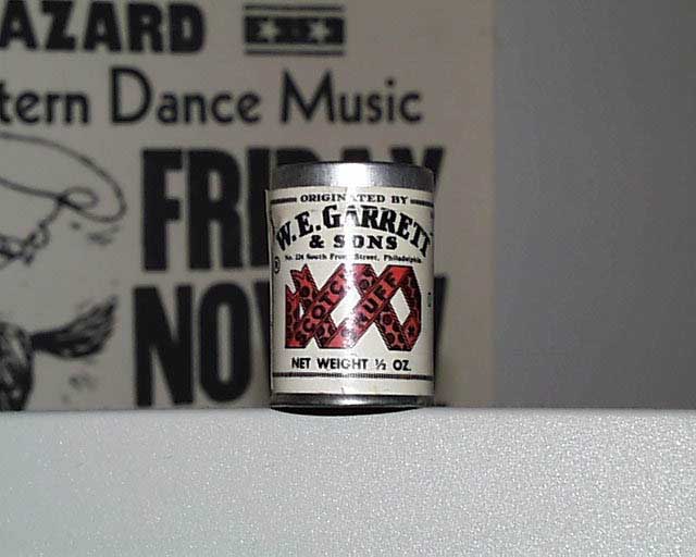
Question for ya: Once upon a time, I noticed that a photo that you posted had a can of Garrett's snuff in it, as in Garretts of PA... which I know that you're also in PA... is there any relation there? Or just coincidence?? Just curious....
-L |
gp (Garrett)
| | Posted on Monday, March 04, 2002 - 09:01 am: |
|
ah ya mean this can. 
hope it posts fine.......
it is actually W.E. Garrett & Sons. so that is the name Garrett used as a sir name. usually is found that way. especially with the 2 't's
so no relation there. just saw it on ebay and thought it was kinda cool. still has the snuff in there. the patent on it is from 1870 and is made in memphis, tennessee. (conwood corp./american snuff div.)
my last name is porterfield. actually there is a big clan of them in the virginia area, along with some other southern states. blacksburg, leesburg, etc.
and about that GPS software......sucks.....only seems that MapSource is my only option to go with. i have not seen any other programs out there that can do what it can. i used it a little when i first had my Garmin V, but was unable to use the same software with my 176, since you have to buy it and it does not come with the unit. bastards!!! well i guess it is the MapSource CD's for me then. |
gp (Garrett)
| | Posted on Monday, March 04, 2002 - 09:03 am: |
|
ok that was 50k damit!!
once more here at 39k.
 |
PerroneFord
| | Posted on Monday, March 04, 2002 - 09:05 am: |
|
What is it mapsource can do that Delorme can? You've got me curious now!
-P |
Leslie N. Bright (Leslie)
| | Posted on Monday, March 04, 2002 - 09:11 am: |
|
Leslie is a Scottish family name (yes, there really is a Clan Leslie, w/ tartan and all). Go back far enough, and yes, that's where my grandfather's name came from, was Leslie... Quite often last names from 'back then' end up as first names later on, just to keep the family names going. That's why I asked....
BTW... you actually bought the can off of Ebay? Why not a new can at a drugstore? The stuff's still available, in the same exact can.... oticed it for sale last week....
+++++++
Perrone,
Do you mean "What is it mapsource can do that Delorme can't?"
Mapsource is downloadable into a Garmin Mapping GPS. If there's an area that you're particularly interested in, you can pick sections and copy it into the GPS. I'v not played w/ it in person, but I did a similar thing w/ the laptop w/ Delorme's Street Atlas... I used the extractor to load east TN/southwestern VA/western NC onto my laptop's hard drive... that way, I didn't have to have the CD-Rom w/ me to use the program, and it runs faster than accessing the CD-ROM anyway.
I just wish the extractor would let you put it into a Garmin GPS! Sigh.......
-L |
gp (Garrett)
| | Posted on Monday, March 04, 2002 - 09:41 am: |
|
yep what leslie said. the mapsource topo and city select CD's come as 'regions'. you can then take a a section of a state or entire state or even a region and download it to the GPS unit. this way of course you have the detailed maps/topo/recreation/etc right on the GPS screen. and of course if your GPS is compatible it gives you the 'turn by turn' directions.
they take up alot of memory, so you have to have be selective in what you want to download. but it is basically the same info you download to your PC. detailed info like gas stations, bars, parks, rest areas, etc. are right in the unit now. select an exit # and it tells you what is there and the address.
garrett is actually irish and porterfield is scottish. my dad has a very detailed book dating back to the 1200's on them. my parents have traveled quite a bit over in scotland to trace the family stuff. actually found the porterfield castle in kilmalcolm, scotland. some of it has fallen to pieces, but for the most part it is still there. pretty interesting stuff.
i had no idea they still make that stuff. i just thought it was some old company no longer around. just like the garrett wine bottles i see once in while. i mean there is the levi garrett stuff of course. hell i use to use the 'plug' variety once in a while. |
Leslie N. Bright (Leslie)
| | Posted on Monday, March 04, 2002 - 09:50 am: |
|
http://www.mr-bills.com/mr-bills/pages/snuff.html
$2.30 a can...
Go back 200 years, and all of my family was already in southwestern VA, eastern TN, or western NC... I can't find anyone who wasn't already here by the Revolution. I have 1 person from Switzerland.... everyone else is from the British Isles.... mostly England, but lots from Ireland & Scotland and Wales, too.
++++++++
I'm still eyeing Garmin's GPSMAP 76S... when it comes out, I think it's the one I'm going to get... FWIW...
-L |
gp (Garrett)
| | Posted on Monday, March 04, 2002 - 09:59 am: |
|
well all be. and my can says 1/2 oz. damn.....most likly paid more for my dried up can of crap. not that i am a snuff user, but still.
have not spent too much time in the south. last MAR was the farthest south i have been in many years. hoping to get down to nashville some time in the next year. there is a bar called Roberts there i would not mind stopping at. BR5-49's hang out.
little trivia for anyone. what does BR5-49 mean? or where did it come from? |
Rob Davison (Pokerob)
| | Posted on Monday, March 04, 2002 - 10:10 am: |
|
So Mrs Garrett from facts of life isn't your mom...
ahh, i think i finally get it.
rd |
gp (Garrett)
| | Posted on Monday, March 04, 2002 - 10:19 am: |
|
no, but Tuti must have been that wet dream you still are having.
i was a fan of the brunette chick......the bad ass biker girl. what was her name? i liked her.
facts of life......the porn industry never capitalized on that.
|
PerroneFord
| | Posted on Monday, March 04, 2002 - 10:38 am: |
|
Ok Garrett. I understood about the downloading stuff to the Garmin GPS, but I just use the laptop for those kinds of things. It's far easier to read, and more comprehensive. I am very interested in this new 176 unit from Garmin though, as it would be nice to have a larger screen for those times when I am not using the laptop. Someone mentioned color was worth it, but I've found the opposite to be true. I find it very distracting on the occasions I've used it (color streetpilot) but maybe my eyes are wacky!
-P |
gp (Garrett)
| | Posted on Monday, March 04, 2002 - 10:58 am: |
|
yeah. i like the 176. has pretty much everything i want with a good size screen. i just don't want to have a laptop up front with me at the same time. i am sure that i could do more with the addition of a laptop, but i just want to have as few things as possible up there with me. but you can get up to 128 mb or RAM on the 176 and that is usually sufficient memory for different types of mapping that you want to add to the GPS.
the resolution on the 176 is pretty good. (320X240) i have never used or seen a color GPS, but am happy with the mono color version of mine. sharp and clear at night too. i think people think i am watching a TV or something.
once i get this thing loaded up with the goodies i want i will be happy. mapsource roads and recreation and the topo will be good enough for me. least i think so.
for the best prices (least that i have found) on GPS and software go to: http://www.selectzone.com talk to larry if you have questions. |
|