
Death Valley - from Ashford Mills to Darwin
- Thread starter p m
- Start date
You are using an out of date browser. It may not display this or other websites correctly.
You should upgrade or use an alternative browser.
You should upgrade or use an alternative browser.
Looks awesome! I need to do a better job of writing notes/keeping a journal on vacations.
Mostly, I remember even minute details of the trip for a long while after a trip - but the desire for writing a trip report tends to fade away as the time goes by.
Mostly, I remember even minute details of the trip for a long while after a trip - but the desire for writing a trip report tends to fade away as the time goes by.
Same.
The Atacama makes Death Valley look like a zoo set in a botanical garden.(From the "Road Fever" by Tim Cahill)
"Have you seen the goldfish?"
What goldfish? We're in the desert!
"Well... There are goldfish in that pond - walk around the reeds, you'll see them."
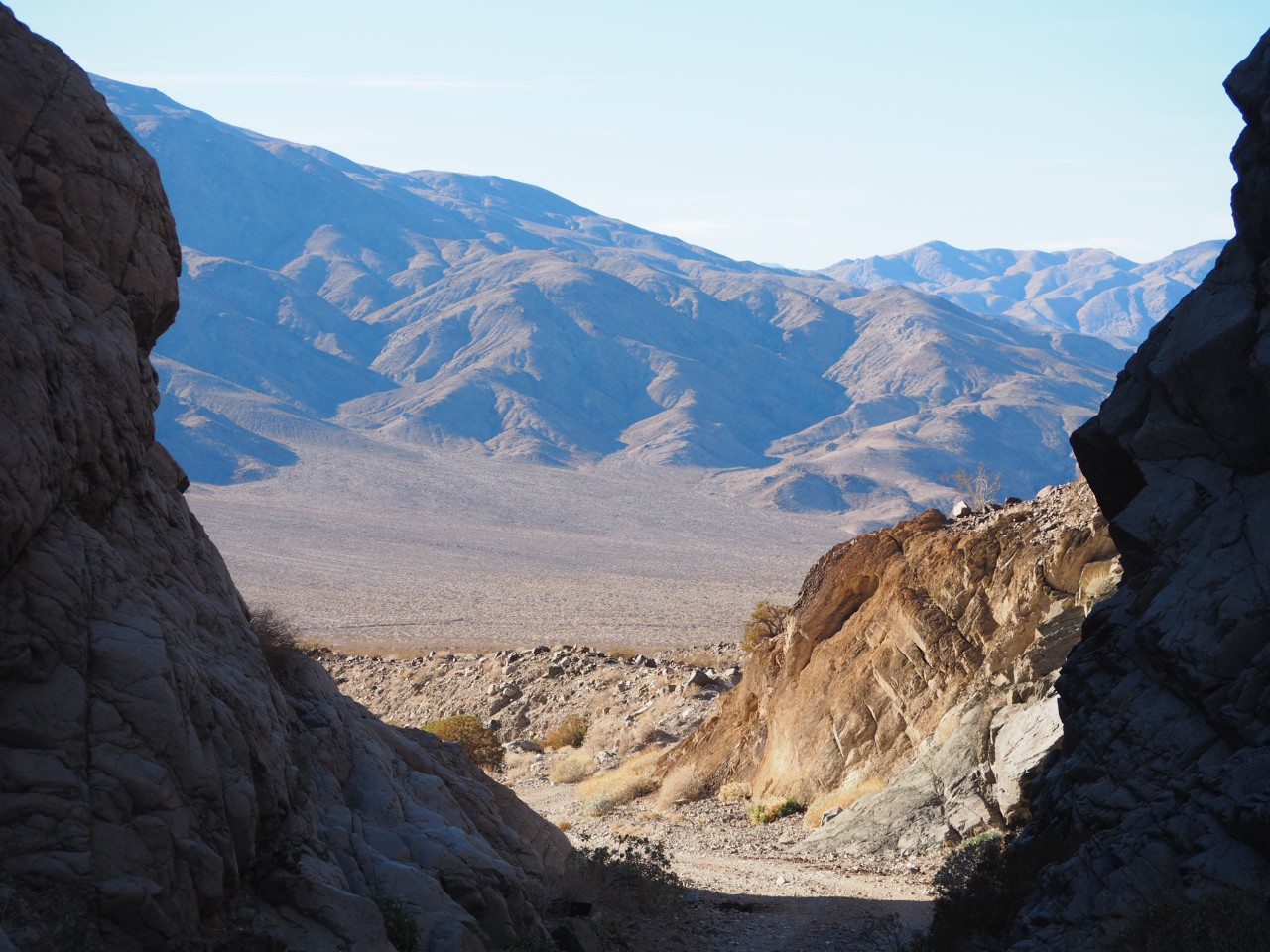
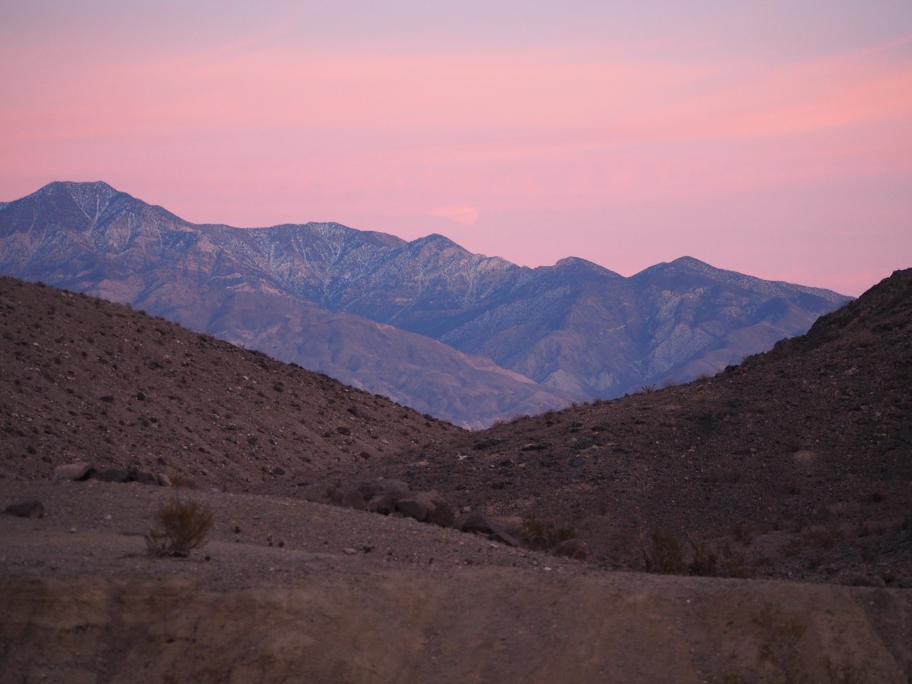
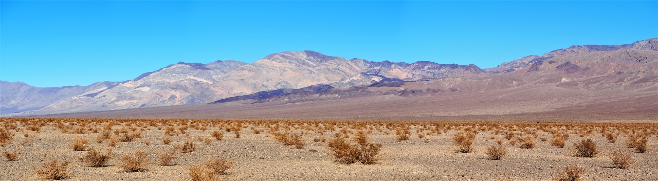
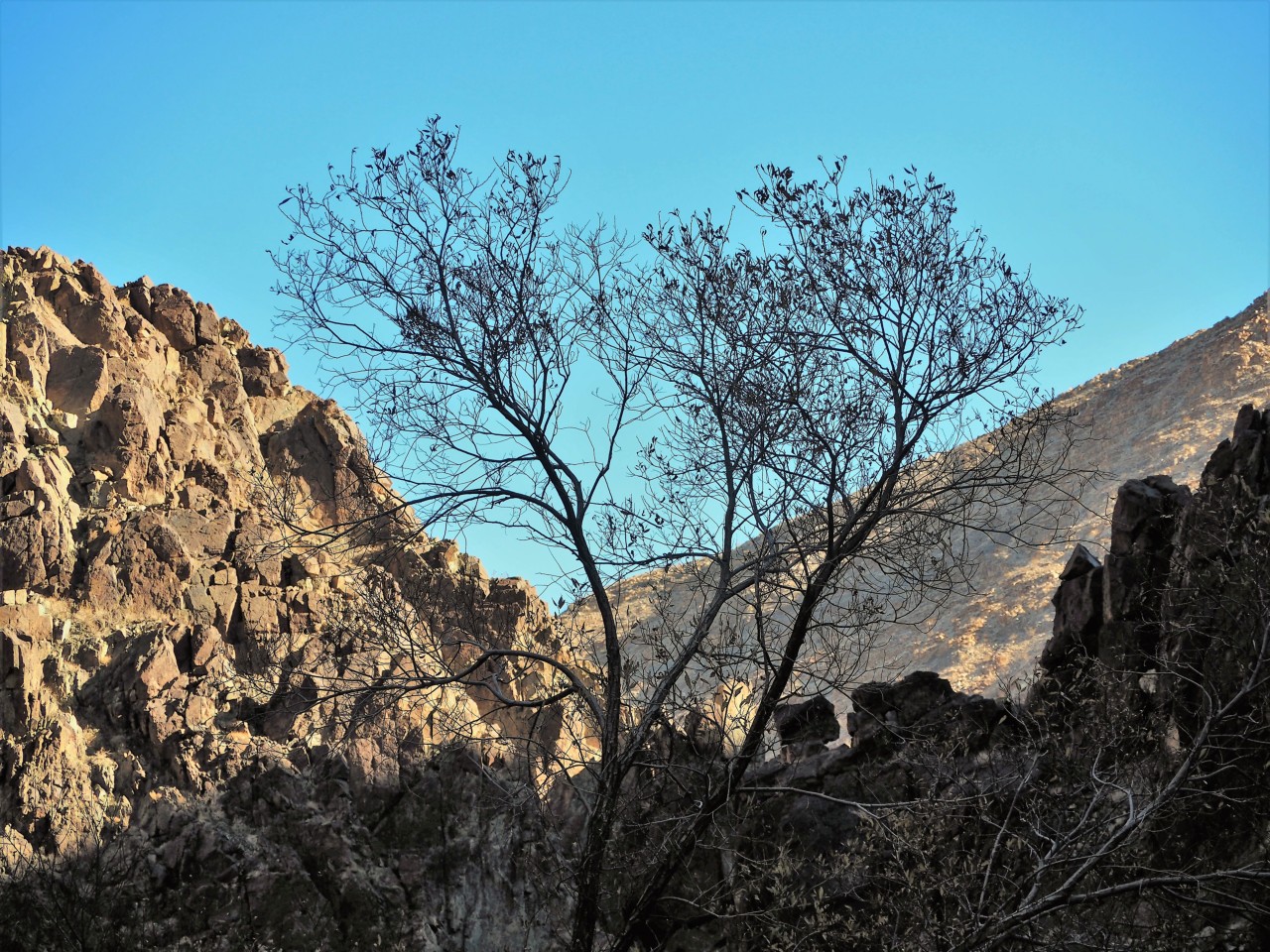
Death Valley, to me, is not unlike Waterworld or Fury Road scene; it's one giant, vast, country, largely empty and majestic in its emptiness, with little nuggets of something completely out of ordinary in places totally unexpected.
Any time I plan a trip to Death Valley and its environs I make a mistake of assuming well too little time for any road or area to explore. This trip was no exception.
I figured we've had North Death Valley well covered by now (which is not actually true), so we'd concentrate on the South.
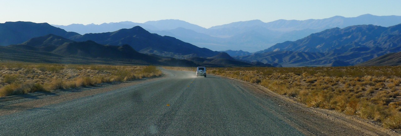
Military bases at China Lake and Fort Irwin flank the Southwestern corner of Death Valley well - leaving California highway 127 from Baker the closest approach route.
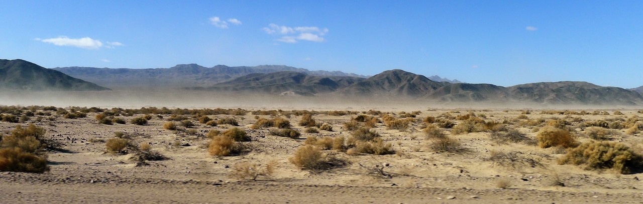
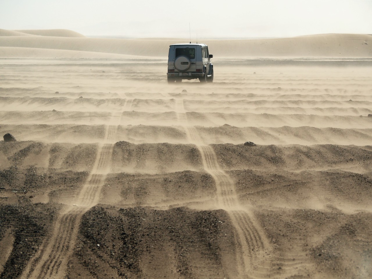
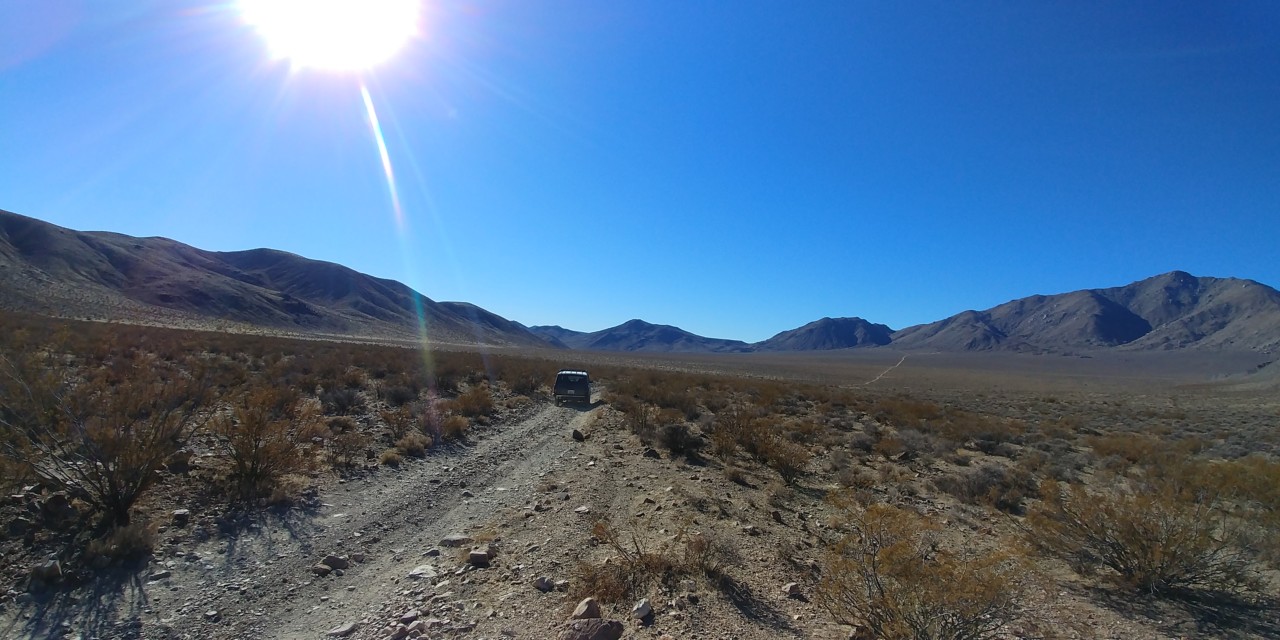
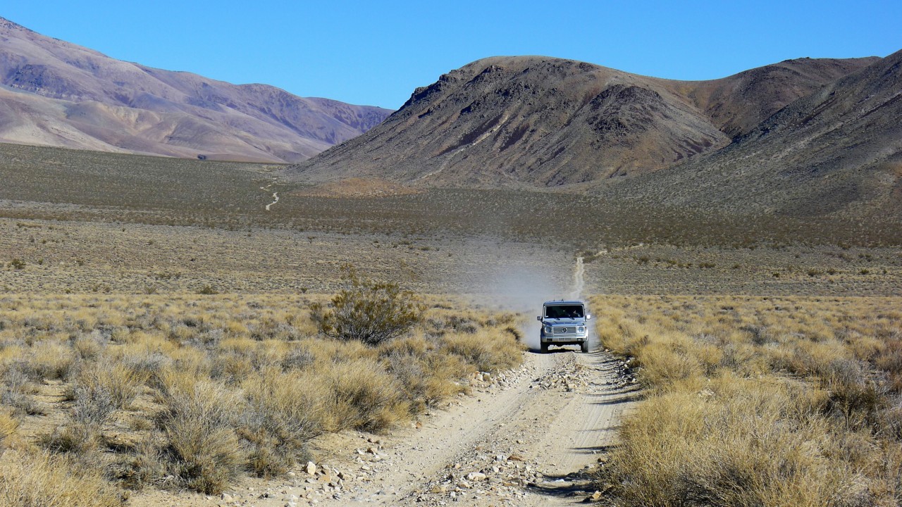
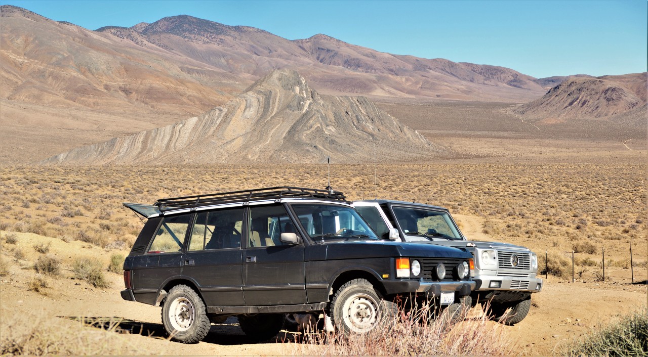
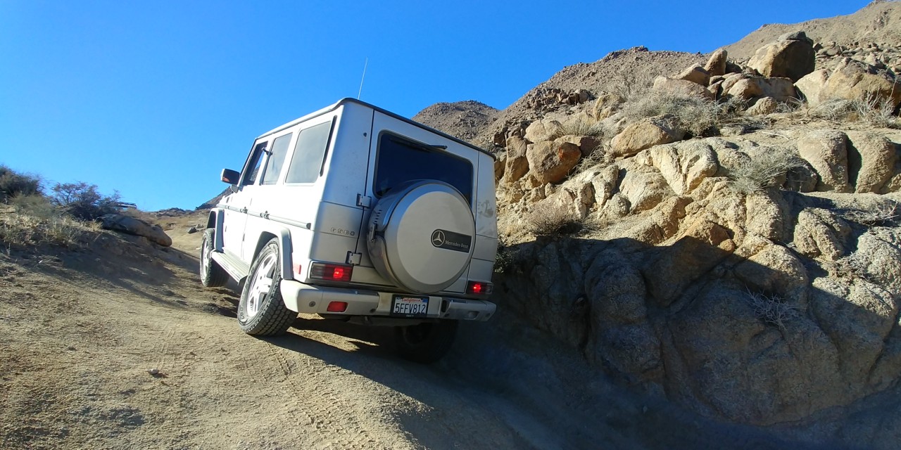
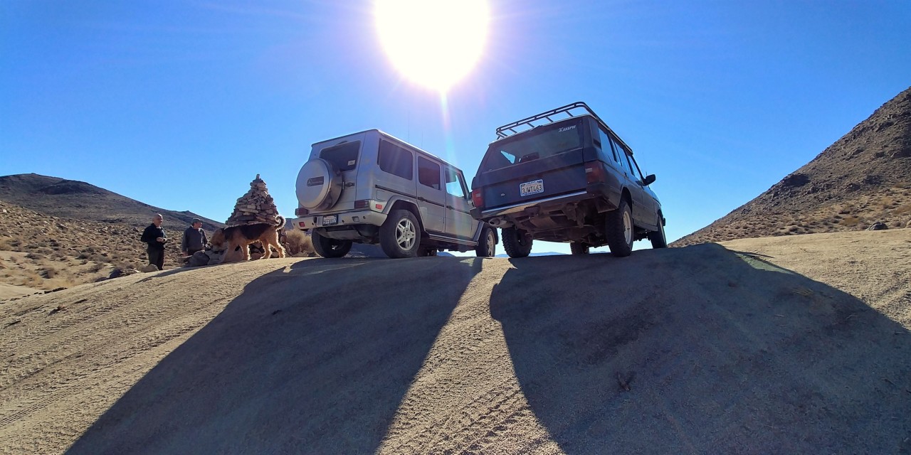
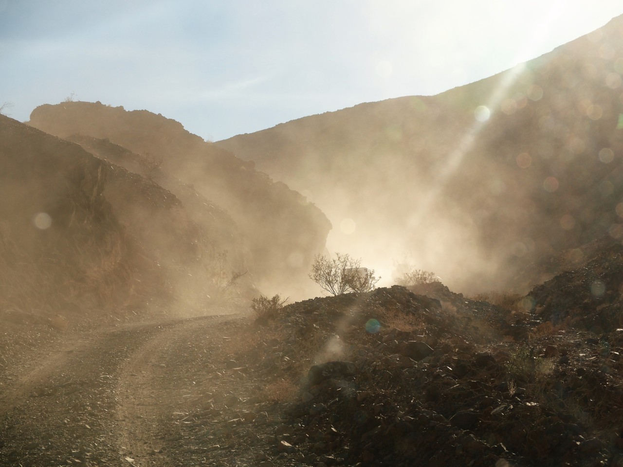
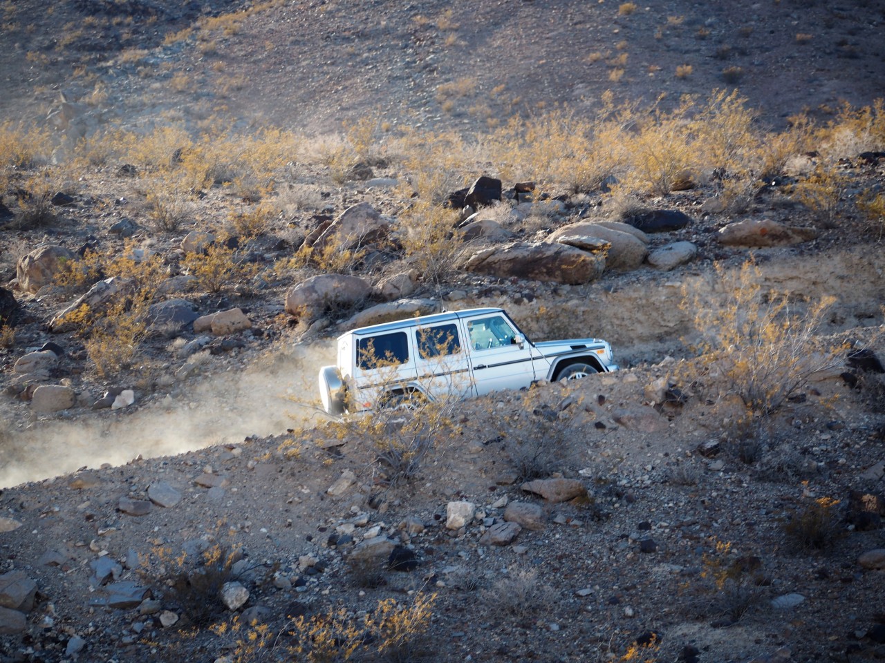
So one day in late December of 2018, that's the road we hit - with Matt and Thao in their Gelaendewagen. It is windy as hell - we get in and out of the plume of dust raised by North-easterly wind. Halfway between Baker and Shoshone, Matt calls me on the radio and inquires if I'd be interested in visiting Dumont Dunes. I could see no reason at all to skip the dunes, so we hang a right turn and bounce around the easy washboard going East.
"Have you seen the goldfish?"
What goldfish? We're in the desert!
"Well... There are goldfish in that pond - walk around the reeds, you'll see them."
Death Valley, to me, is not unlike Waterworld or Fury Road scene; it's one giant, vast, country, largely empty and majestic in its emptiness, with little nuggets of something completely out of ordinary in places totally unexpected.
Any time I plan a trip to Death Valley and its environs I make a mistake of assuming well too little time for any road or area to explore. This trip was no exception.
I figured we've had North Death Valley well covered by now (which is not actually true), so we'd concentrate on the South.
Military bases at China Lake and Fort Irwin flank the Southwestern corner of Death Valley well - leaving California highway 127 from Baker the closest approach route.
So one day in late December of 2018, that's the road we hit - with Matt and Thao in their Gelaendewagen. It is windy as hell - we get in and out of the plume of dust raised by North-easterly wind. Halfway between Baker and Shoshone, Matt calls me on the radio and inquires if I'd be interested in visiting Dumont Dunes. I could see no reason at all to skip the dunes, so we hang a right turn and bounce around the easy washboard going East.
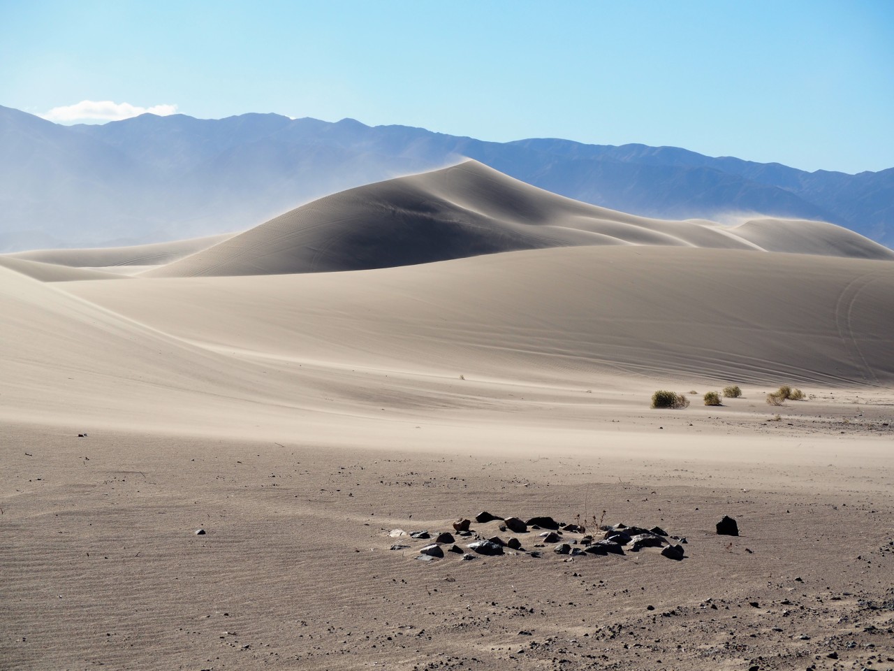
Dumont Dunes
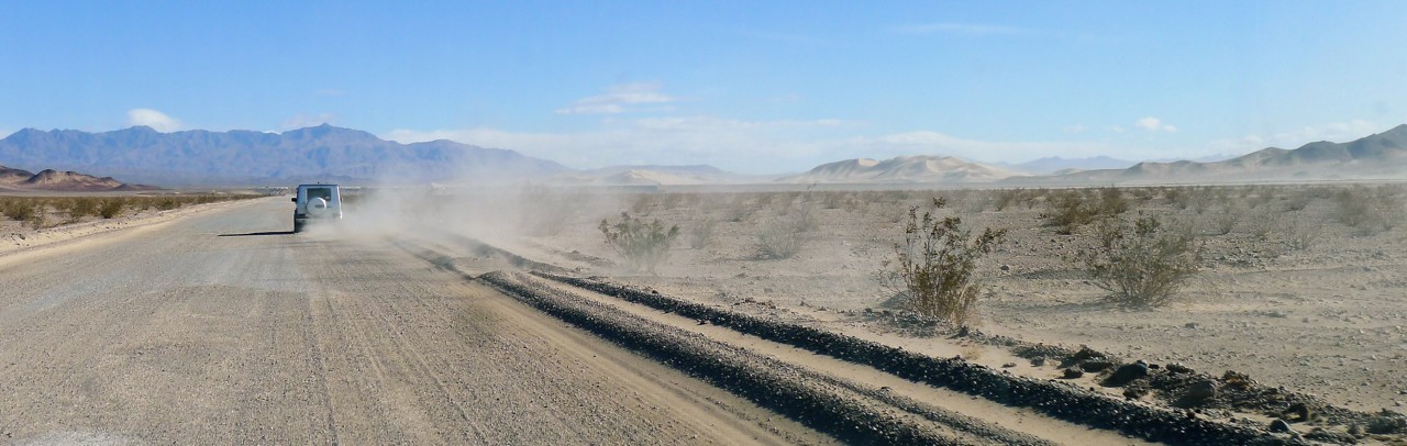
The government shutdown was to thank for a long strip of entrance tickets hanging from the defunct automated pay booth. We cross the shallow creek in Sperry Wash, and climb up to the plateau from which the dunes rise - nearly 500 feet above the plateau.
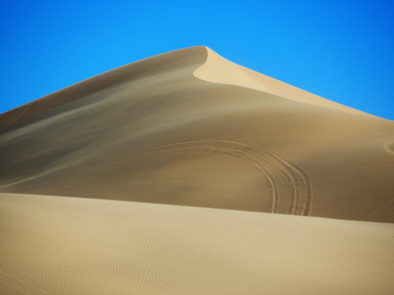
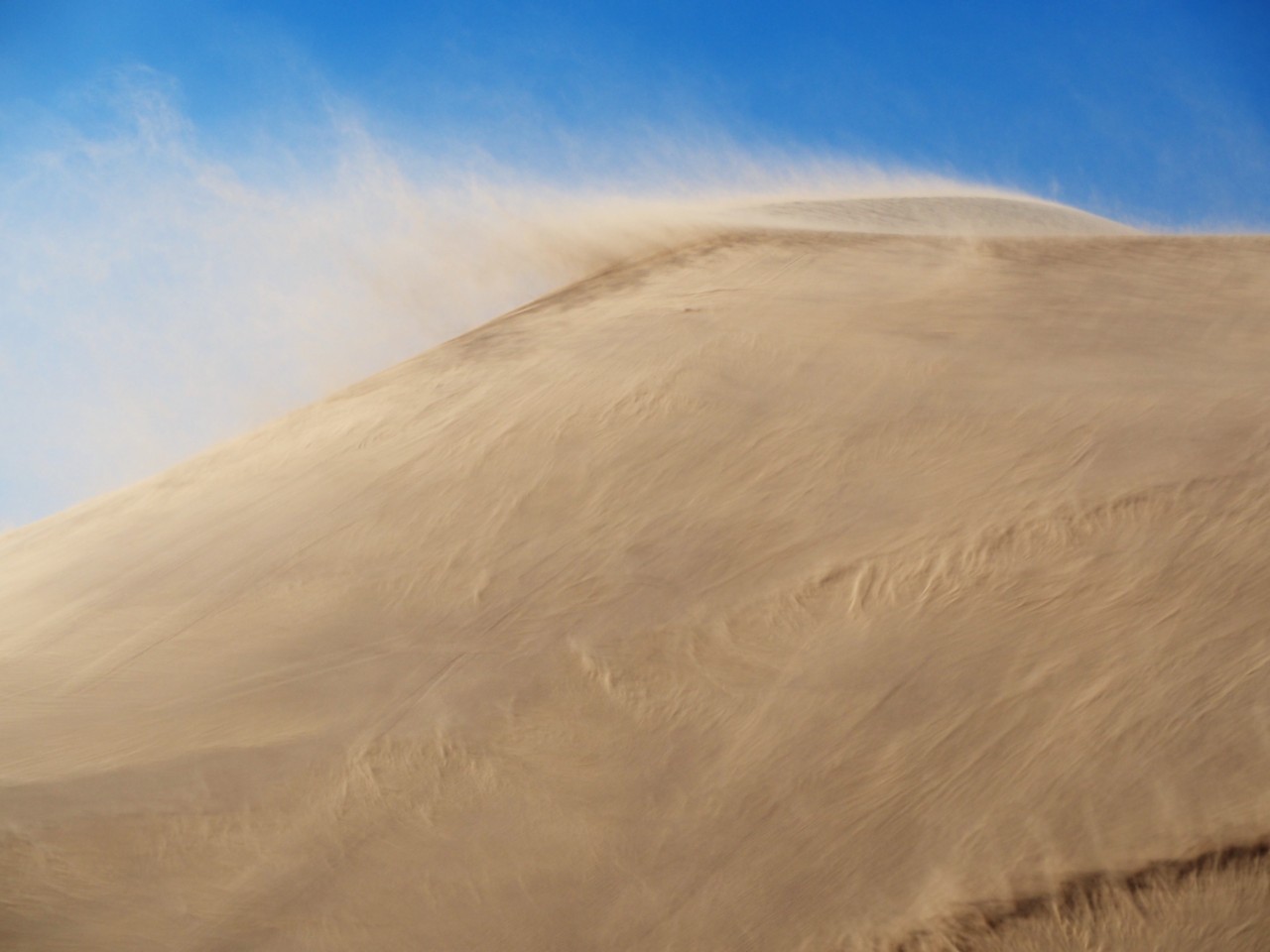
With the gale-force wind, we can see exactly how the dunes rise. Wing gusts force walls of sand to roll up and over the face of a dune; sometimes the gust fades, and the wall of sand "reflects" off the crest of the dune and rolls back downhill. Watching this process is more mesmerizing than watching surf, or flames of a campfire, or even Caltrans crew at work.
Matt leads me through the opening between the dunes to Competition Hill - the tallest of all Dumont.

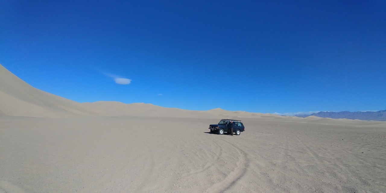
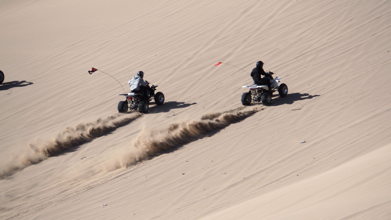
I can't come up with a way to photograph the gradeur of a 400-foot dune face, and move the truck this way and that to provide a bit of a reference. There's not a hint of a thought of driving an underpowered 5000-lb Range Rover on dinky 7.50-16 mud tires up the dune slope; I just watch the kids to race their quads up to the top, streak across the concave dune face, and fly downhill. Occasionally, there's a dune buggy or a sand rail sending rooster tails of sand, with roar of their engines overcoming the howl of the wind.
We discover that it is a challenge to drink our beers without sand in it... By the time we're done with the first Sculpin, sand is in every crevice of our bodies - and it seems to stick to flat surfaces just as well.
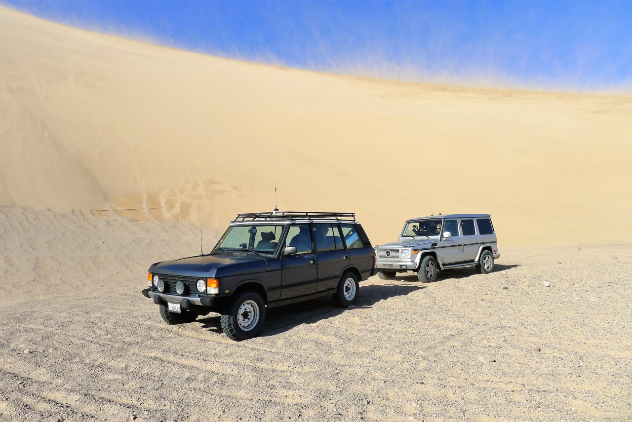
On the way back, we find some shallow dune hillock and try our trucks on it. The mighty G-Wagen succeeds to produce a measurable rooster tail upon acceleration - just before the Daimler-Benz heavy-handed traction control kills all the joy. The Range Rover performs better than expected (the expectations were low enough to ensure success), and no tow rope is necessary.
It is already afternoon, and we still have a lot of ground to cover. We hightail to Shoshone for lunch, topping off our gas tanks and firewood.
Shoshone's only gas station and convenience store greets us with $5.20 per gallon of premium, and $12.36 for a single - last - bundle of firewood. Not sure what is the significance of four significant digits in the otherwise insane firewood price tag...
The government shutdown was to thank for a long strip of entrance tickets hanging from the defunct automated pay booth. We cross the shallow creek in Sperry Wash, and climb up to the plateau from which the dunes rise - nearly 500 feet above the plateau.
With the gale-force wind, we can see exactly how the dunes rise. Wing gusts force walls of sand to roll up and over the face of a dune; sometimes the gust fades, and the wall of sand "reflects" off the crest of the dune and rolls back downhill. Watching this process is more mesmerizing than watching surf, or flames of a campfire, or even Caltrans crew at work.
Matt leads me through the opening between the dunes to Competition Hill - the tallest of all Dumont.
I can't come up with a way to photograph the gradeur of a 400-foot dune face, and move the truck this way and that to provide a bit of a reference. There's not a hint of a thought of driving an underpowered 5000-lb Range Rover on dinky 7.50-16 mud tires up the dune slope; I just watch the kids to race their quads up to the top, streak across the concave dune face, and fly downhill. Occasionally, there's a dune buggy or a sand rail sending rooster tails of sand, with roar of their engines overcoming the howl of the wind.
We discover that it is a challenge to drink our beers without sand in it... By the time we're done with the first Sculpin, sand is in every crevice of our bodies - and it seems to stick to flat surfaces just as well.
On the way back, we find some shallow dune hillock and try our trucks on it. The mighty G-Wagen succeeds to produce a measurable rooster tail upon acceleration - just before the Daimler-Benz heavy-handed traction control kills all the joy. The Range Rover performs better than expected (the expectations were low enough to ensure success), and no tow rope is necessary.
It is already afternoon, and we still have a lot of ground to cover. We hightail to Shoshone for lunch, topping off our gas tanks and firewood.
Shoshone's only gas station and convenience store greets us with $5.20 per gallon of premium, and $12.36 for a single - last - bundle of firewood. Not sure what is the significance of four significant digits in the otherwise insane firewood price tag...
Shoshone to Warm Springs Camp
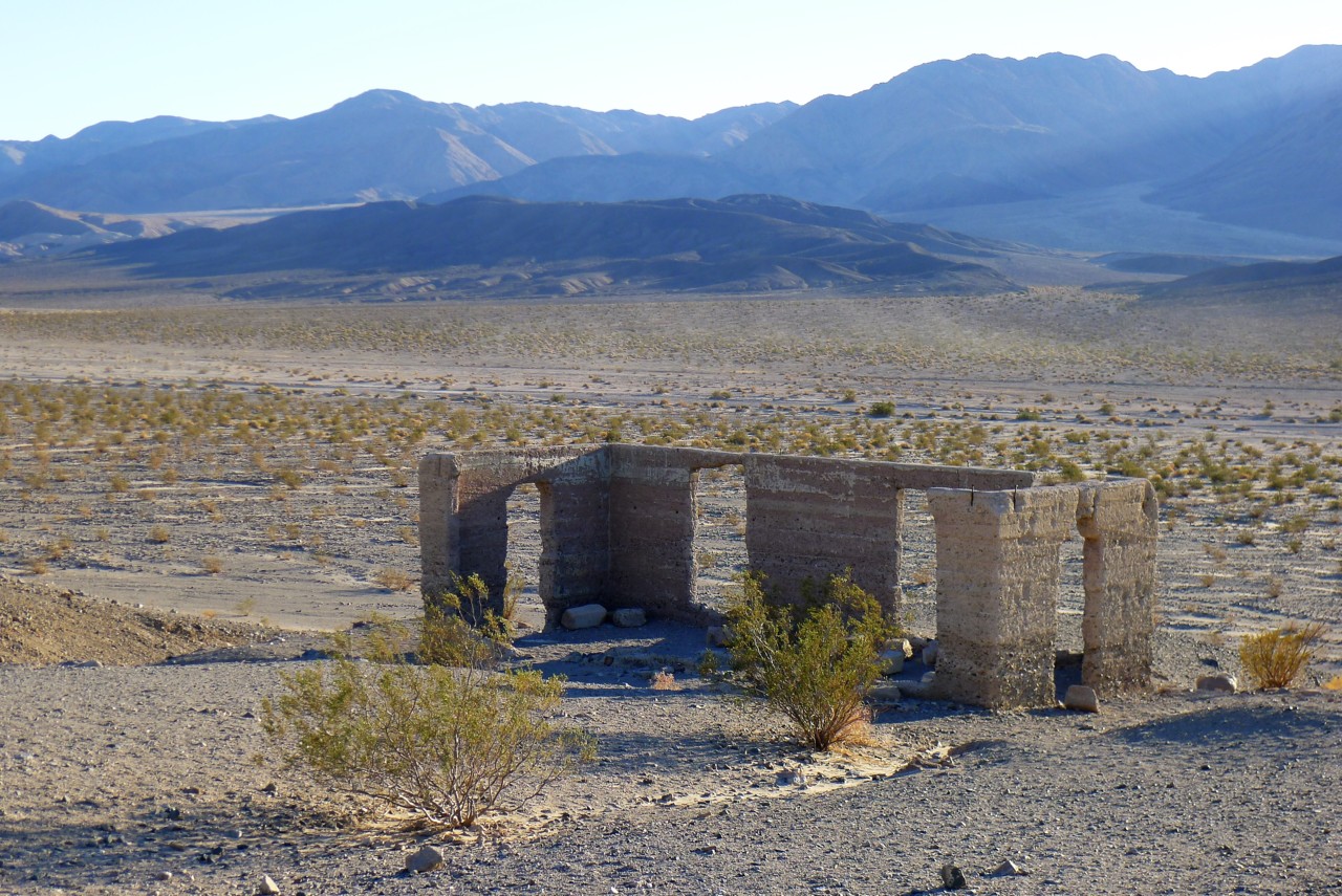
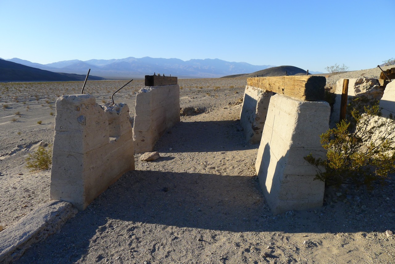
About thirty miles and so many minutes from Shoshone, near California Highway 178, sit ruins of Ashford Mills - sad remains of physical and legal toils of Ashford brothers from 1907 to 1941. Legends of America website has a nice article on Ashford Mine and Mill.
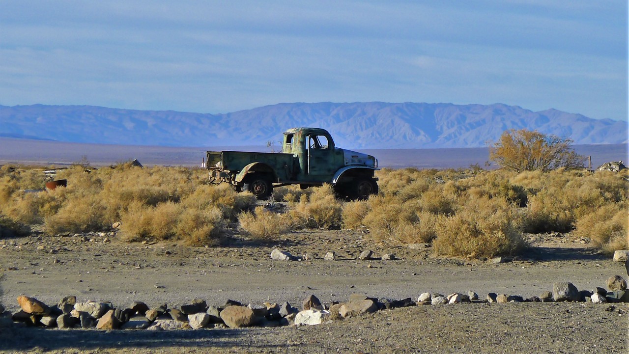
We take a couple of photos of crumbling concrete foundation of the mill and a few wooden beams, and depart. By the way, looking forward - Death Valley is littered with broken dreams of prospectors gold, copper, talc, and whatever else, and the mines and rusting away mine equipment is everywhere. Only a little is visible from paved roads, however, Ashford Mills ruins being probably the least significant mining artifact we come across.
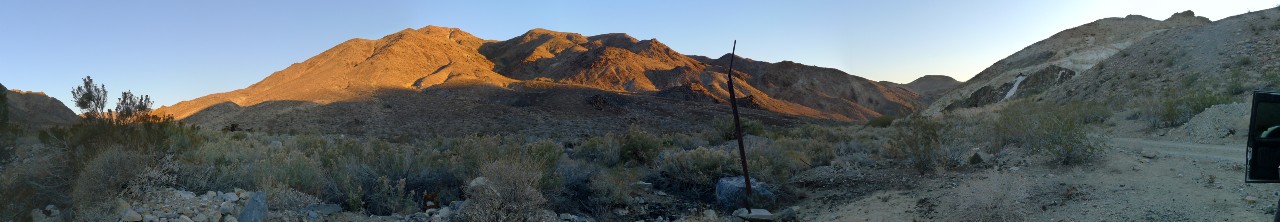
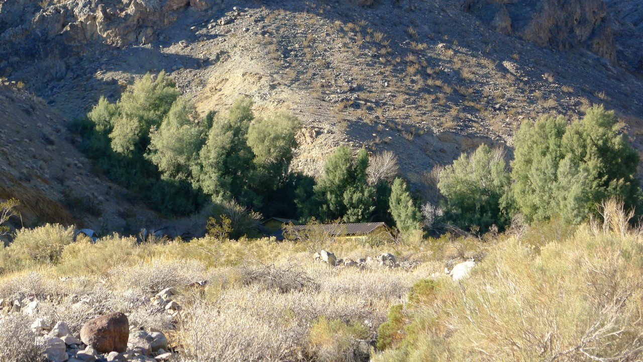
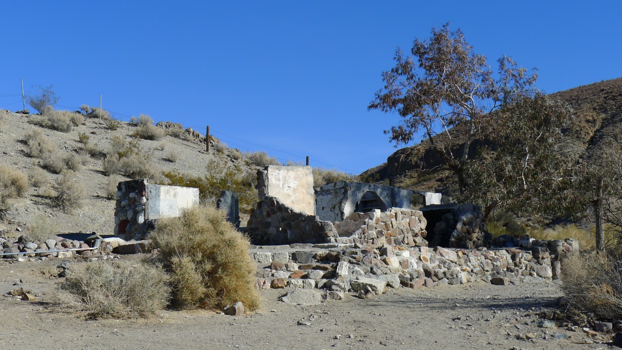
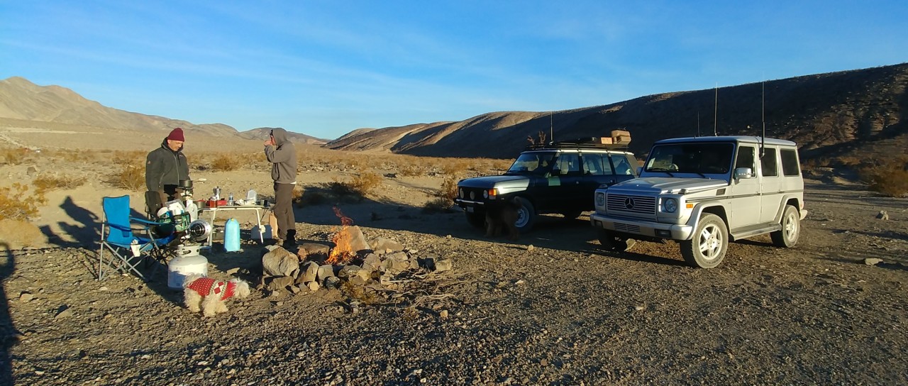
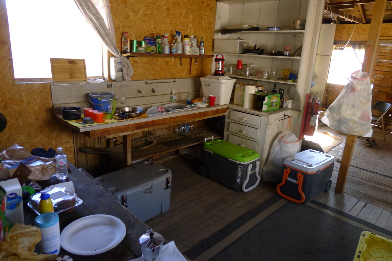
Our stop for the night is Warm Springs Camp. Anything indicating warmth in the name is a very attractive place for me as a prospective camping location in Winter in Death Valley (Furnace Creek is a notable exception). Apaprently, it was so for hundreds of years for Shoshone indigenous population - they seeked shelter from the wind and warmth of the still-flowing spring water.
The Camp itself was a ranch from 1880 to 1897; an enterprising woman named Louise Grantham saw the place fit for talc mining, and built the camp for mine workers in 1930. The mine produced close to a million tons of talc from 1930 to early 1980s, until its last owner - Pfizer - donated the land and buildings to Park Services in 1984. The currently-standing buildings and empty swimming pool date back to 1967 - likely, one of the newest of standing structures in Death Valley.
Now the buildings are in disrepair, however, the warm spring still flows and its course is cleared of debris and growth. It sill is a popular camping location - we counted four different groups of total of close of 30 people within a quarter-mile from the Camp. Don't know if it is a desire to stay close to the other humans, or lack of motivation at sunset - that makes us to stay there; there are far nicer camping locations not far away from the Camp, without a century's worth of buried trash.
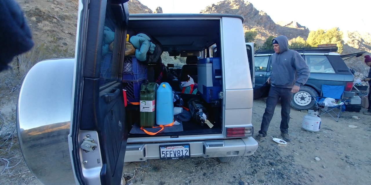
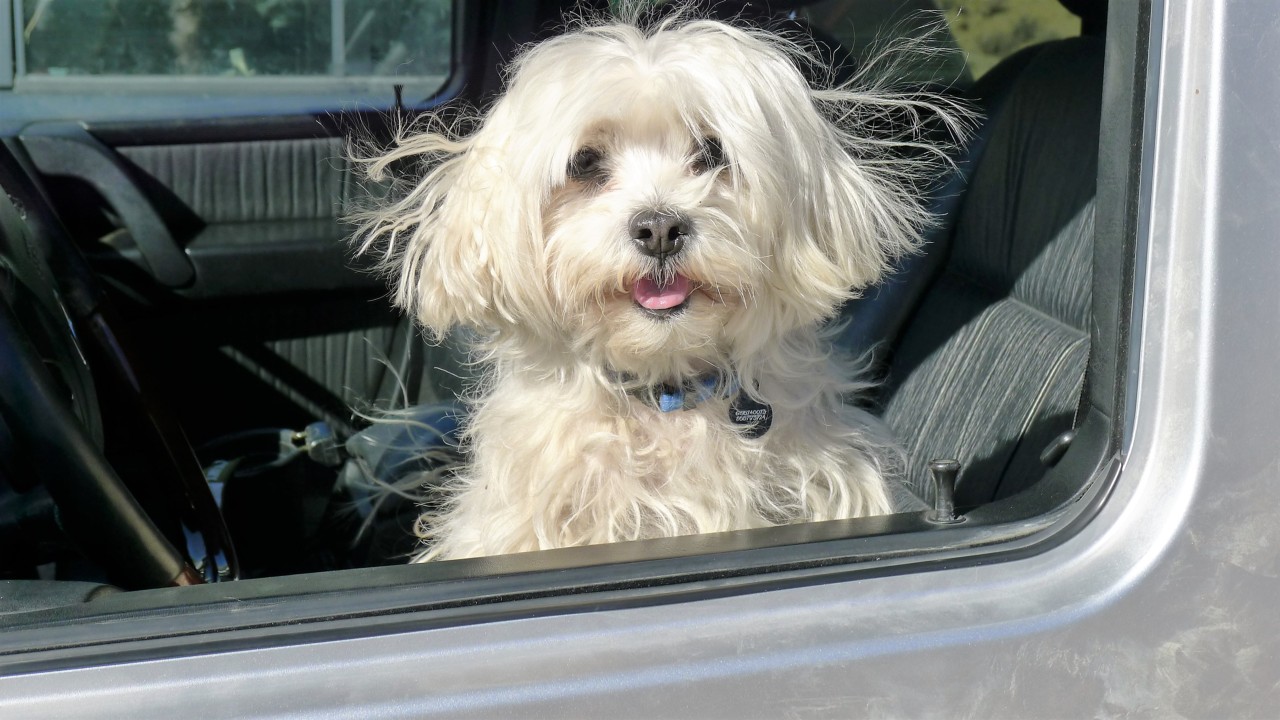
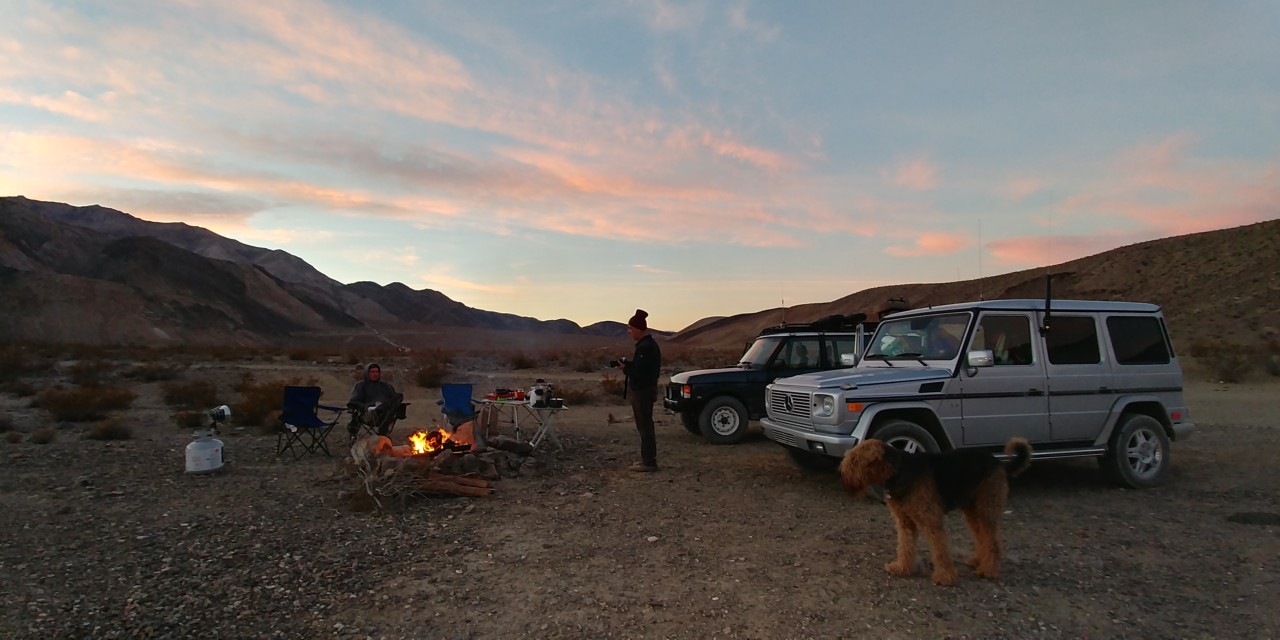
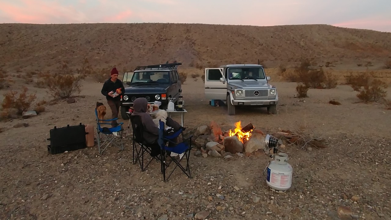
We park our trucks, let the dogs out - Jules heads out to seek amorous entertainment with the nearest neighbors' dog.
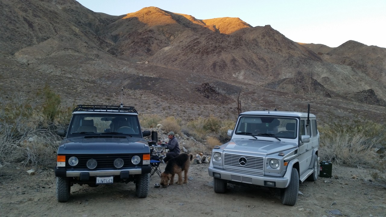
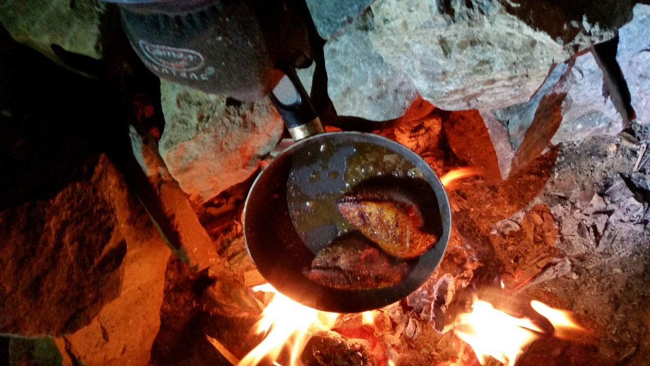
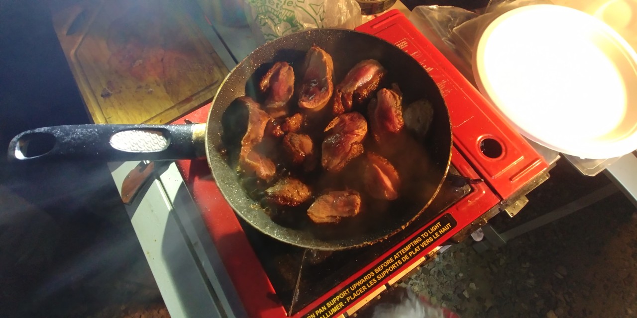
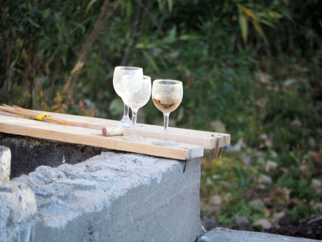
The main course for tonight's dinner is duck magret - or fried duck breast. Campfire roars up faster than the miserable butane stove, so the frying pan is quickly relocated to hot coals in the fire ring.
The sun sets just as we have the fire and cooking going, and it becomes bitterly cold fast. Beer is quickly replaced with 110-proof single malt whiskey, and we don't even remember how the bottle becomes empty. Finally we turn in around 10 pm, and go to sleep in our trucks - which is now by far our most-preferred camping in the desert.
About thirty miles and so many minutes from Shoshone, near California Highway 178, sit ruins of Ashford Mills - sad remains of physical and legal toils of Ashford brothers from 1907 to 1941. Legends of America website has a nice article on Ashford Mine and Mill.
We take a couple of photos of crumbling concrete foundation of the mill and a few wooden beams, and depart. By the way, looking forward - Death Valley is littered with broken dreams of prospectors gold, copper, talc, and whatever else, and the mines and rusting away mine equipment is everywhere. Only a little is visible from paved roads, however, Ashford Mills ruins being probably the least significant mining artifact we come across.
Our stop for the night is Warm Springs Camp. Anything indicating warmth in the name is a very attractive place for me as a prospective camping location in Winter in Death Valley (Furnace Creek is a notable exception). Apaprently, it was so for hundreds of years for Shoshone indigenous population - they seeked shelter from the wind and warmth of the still-flowing spring water.
The Camp itself was a ranch from 1880 to 1897; an enterprising woman named Louise Grantham saw the place fit for talc mining, and built the camp for mine workers in 1930. The mine produced close to a million tons of talc from 1930 to early 1980s, until its last owner - Pfizer - donated the land and buildings to Park Services in 1984. The currently-standing buildings and empty swimming pool date back to 1967 - likely, one of the newest of standing structures in Death Valley.
Now the buildings are in disrepair, however, the warm spring still flows and its course is cleared of debris and growth. It sill is a popular camping location - we counted four different groups of total of close of 30 people within a quarter-mile from the Camp. Don't know if it is a desire to stay close to the other humans, or lack of motivation at sunset - that makes us to stay there; there are far nicer camping locations not far away from the Camp, without a century's worth of buried trash.
We park our trucks, let the dogs out - Jules heads out to seek amorous entertainment with the nearest neighbors' dog.
The main course for tonight's dinner is duck magret - or fried duck breast. Campfire roars up faster than the miserable butane stove, so the frying pan is quickly relocated to hot coals in the fire ring.
The sun sets just as we have the fire and cooking going, and it becomes bitterly cold fast. Beer is quickly replaced with 110-proof single malt whiskey, and we don't even remember how the bottle becomes empty. Finally we turn in around 10 pm, and go to sleep in our trucks - which is now by far our most-preferred camping in the desert.
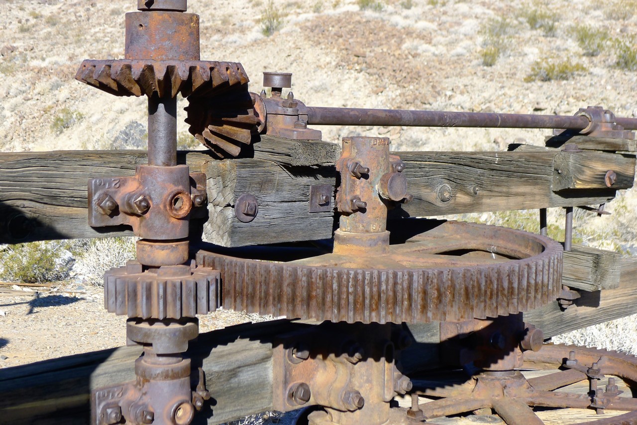
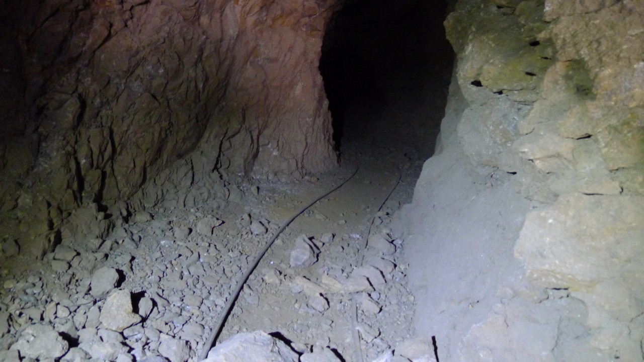
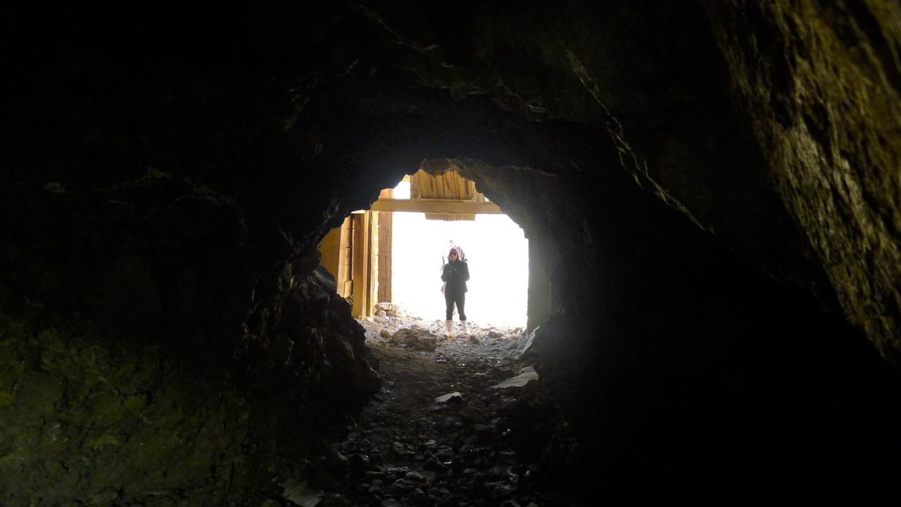
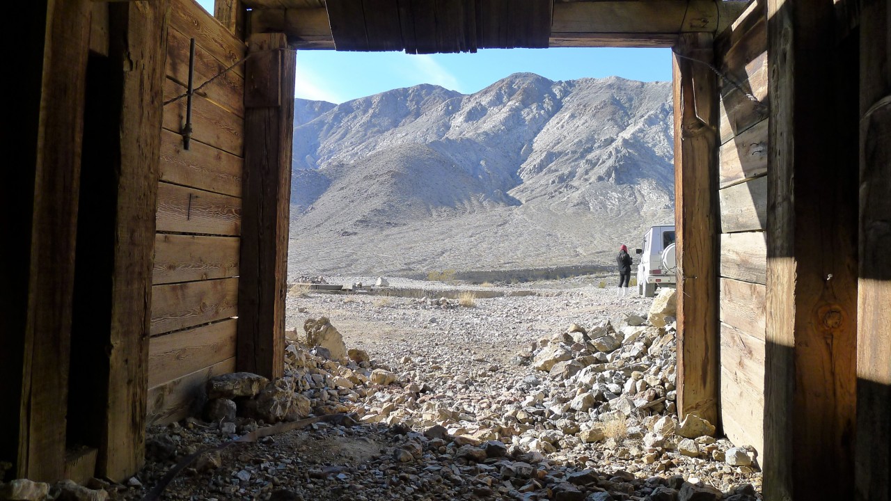
The morning sees us drinking four cups of coffee in quick succession (Italian-made percolator is a beautiful thing!); then we pack up our stuff and spend some time walking around the mine and camp site. Seeing the Rube Goldberg creations of gears and cogs and shafts and belt wheels is awesome.
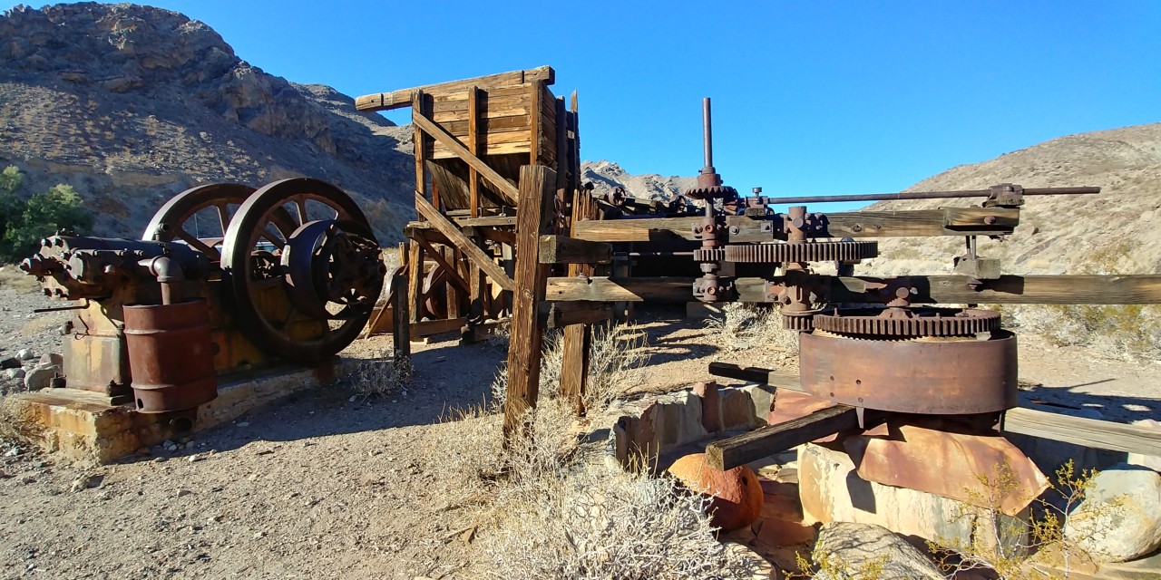

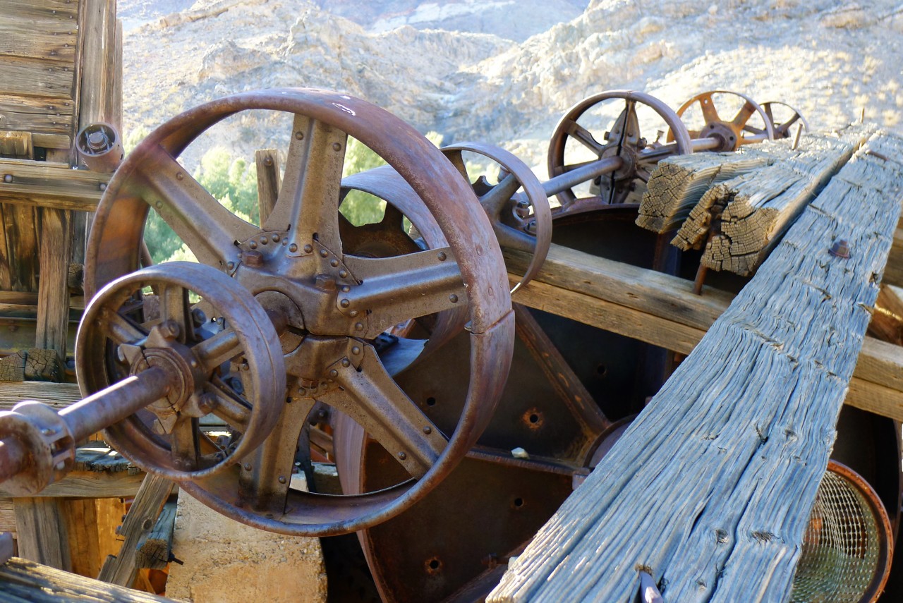
Backcountry Explorers has some good read about Warm Springs Camp.
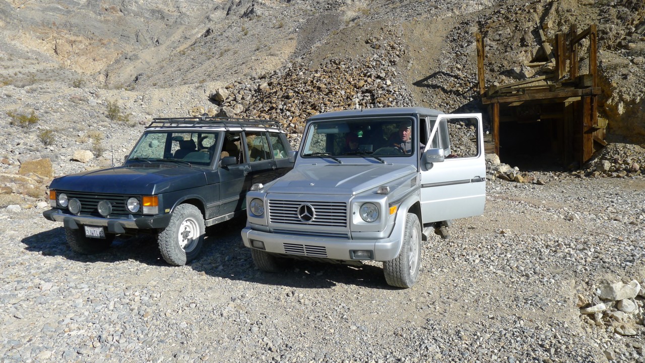
Once we have our fill of mine equipment photos, we're on our way West towards Barker Ranch.
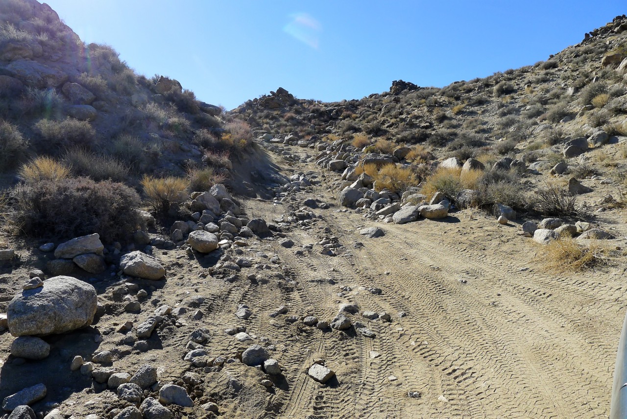
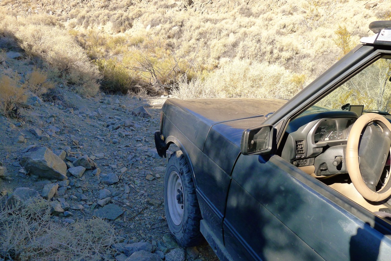
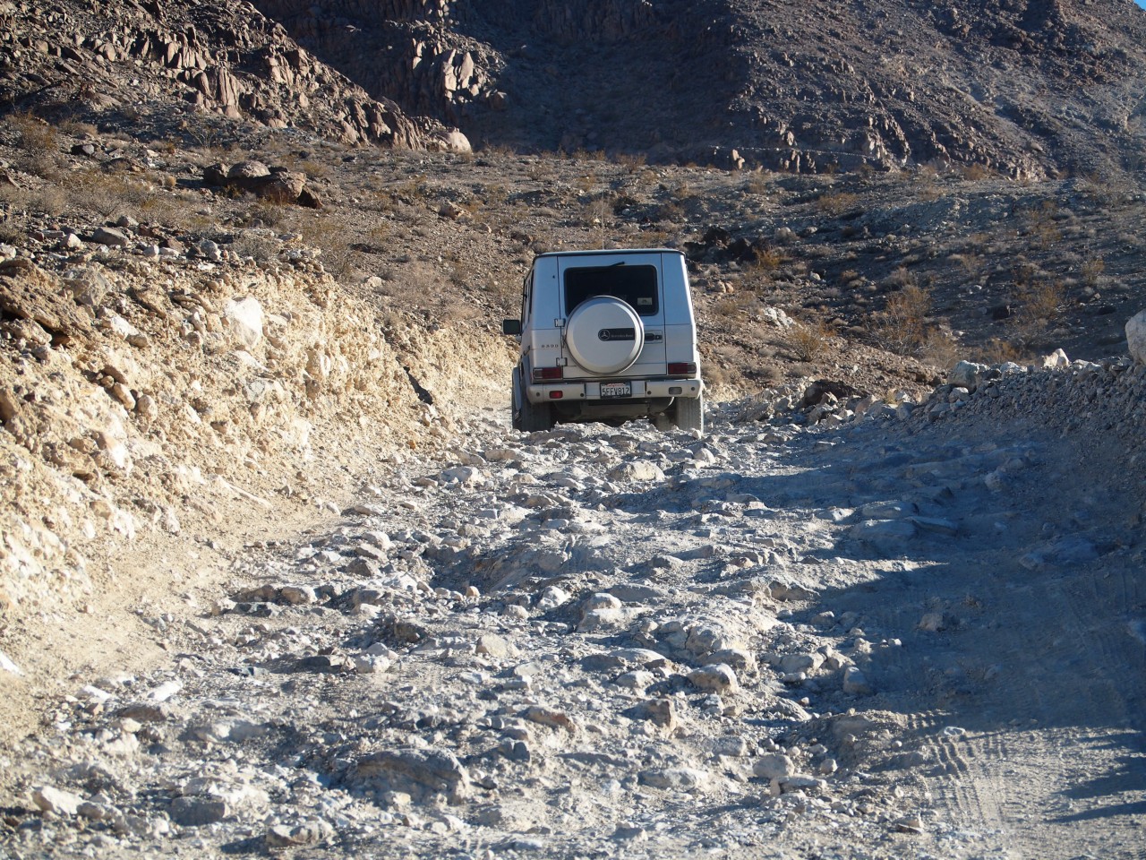
The road is a mix of bad washboard, or lava field with sharp rocks sticking out from roadbed. I am glad Matt is not aired down - the lower sidewalls of his tires can lead to bent or dented rims.
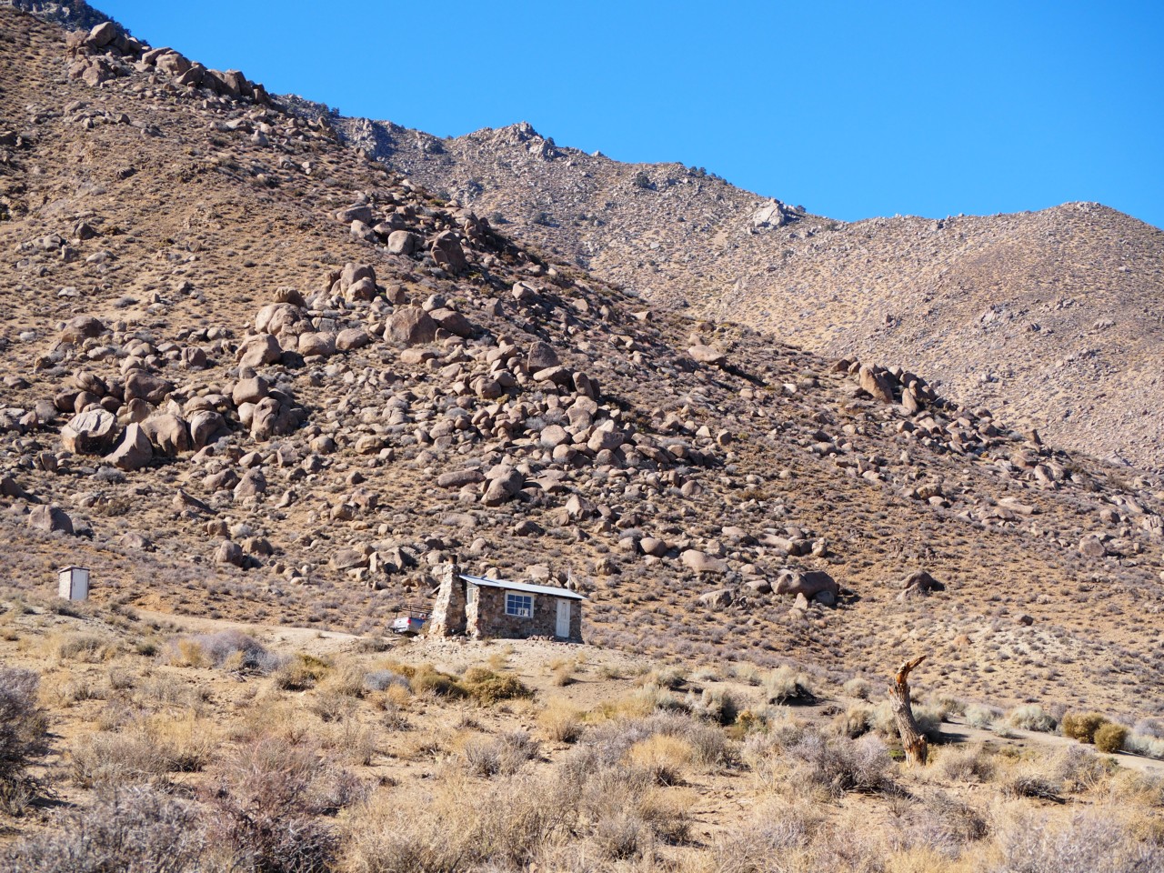
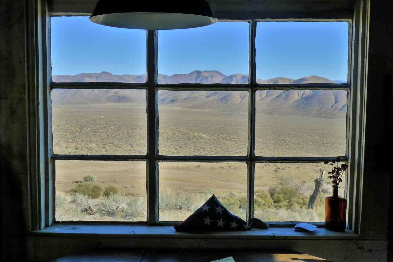
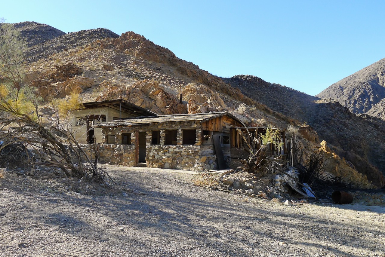
About an hour later, we see a little cabin perched about a third of the way up the Northern slope of Butte Valley. We just have to roll up close and investigate.
Backcountry Explorers has some good read about Warm Springs Camp.
Once we have our fill of mine equipment photos, we're on our way West towards Barker Ranch.
The road is a mix of bad washboard, or lava field with sharp rocks sticking out from roadbed. I am glad Matt is not aired down - the lower sidewalls of his tires can lead to bent or dented rims.
About an hour later, we see a little cabin perched about a third of the way up the Northern slope of Butte Valley. We just have to roll up close and investigate.
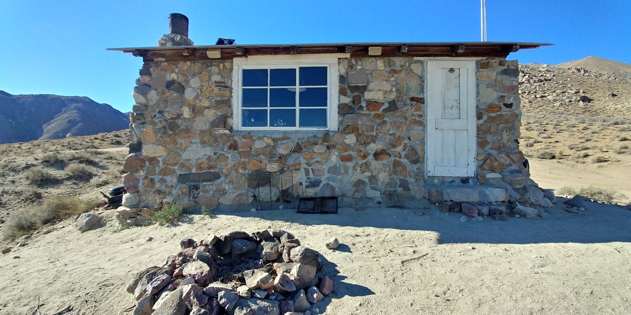
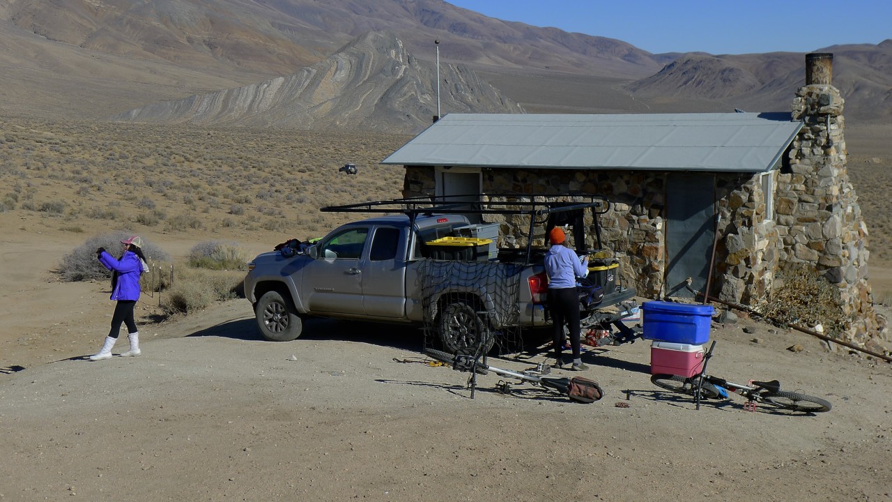
Geologist's Cabin
As we get close, we see a couple who have spent a night in the cabin. They are busy packing their things into the back of a Tacoma pickup, including their bicycles; we take our time for a couple of beers.
This cabin (and a couple of others) was built by a geologist/prospector A.M.Russell known as "Panamint Russ," sometime between 1930 and 1950s. He published his story in April, 1955, issue of Desert Magazine (published on Digital Desert website) - a fascinating insight into what life in Death Valley looked like nearly 70 years ago (and it really hasn't changed that much).
Now, the cabin belongs to "the people" - either an occasional prospector or simply tourists passing by. The visitors keep the cabin clean, whatever little equipment is in it - functioning, and plenty of supplies - just like Saline Warm Springs (that the Fed wants to put its paws on). From what we know, it is on first come -first serve basis, so it may be difficult to plan a trip with an overnight stay in this or the other cabin.
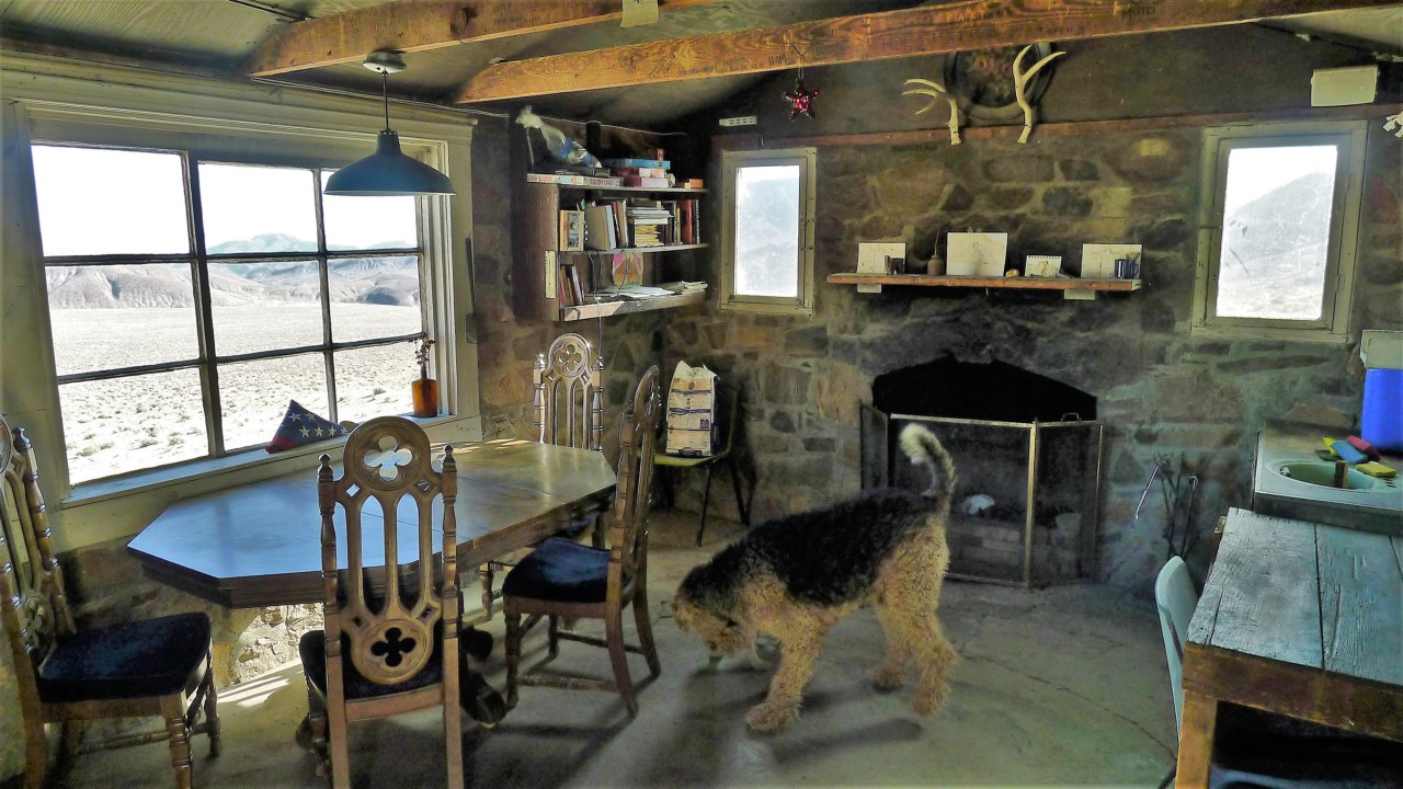
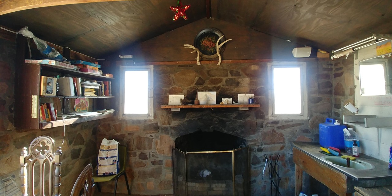
We find ourselves short of superlatives to describe the views from the cabin - when the air is clean (no wind or sandstorm), you can see nearly 90 miles away.
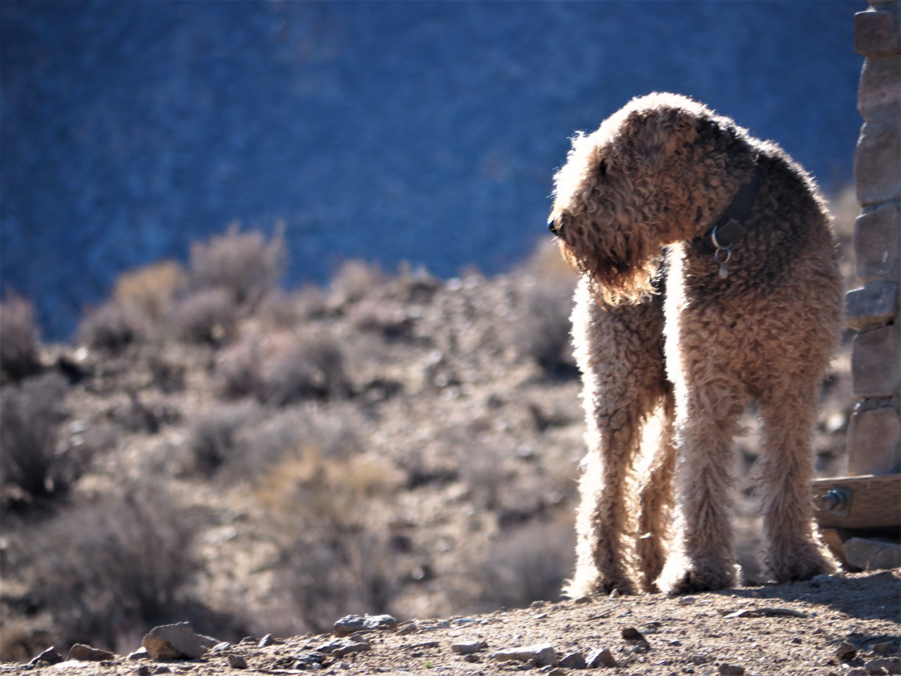
Jules The Airedale is happy to mull around and mike himself a mild nuisance for departing couple.
It's about time for us to head on towards Barker Ranch. We skip the visit to the other cabin, and keep on trucking.
As we get close, we see a couple who have spent a night in the cabin. They are busy packing their things into the back of a Tacoma pickup, including their bicycles; we take our time for a couple of beers.
This cabin (and a couple of others) was built by a geologist/prospector A.M.Russell known as "Panamint Russ," sometime between 1930 and 1950s. He published his story in April, 1955, issue of Desert Magazine (published on Digital Desert website) - a fascinating insight into what life in Death Valley looked like nearly 70 years ago (and it really hasn't changed that much).
Now, the cabin belongs to "the people" - either an occasional prospector or simply tourists passing by. The visitors keep the cabin clean, whatever little equipment is in it - functioning, and plenty of supplies - just like Saline Warm Springs (that the Fed wants to put its paws on). From what we know, it is on first come -first serve basis, so it may be difficult to plan a trip with an overnight stay in this or the other cabin.
We find ourselves short of superlatives to describe the views from the cabin - when the air is clean (no wind or sandstorm), you can see nearly 90 miles away.
Jules The Airedale is happy to mull around and mike himself a mild nuisance for departing couple.
It's about time for us to head on towards Barker Ranch. We skip the visit to the other cabin, and keep on trucking.
Geologist's Cabin to Barker Ranch
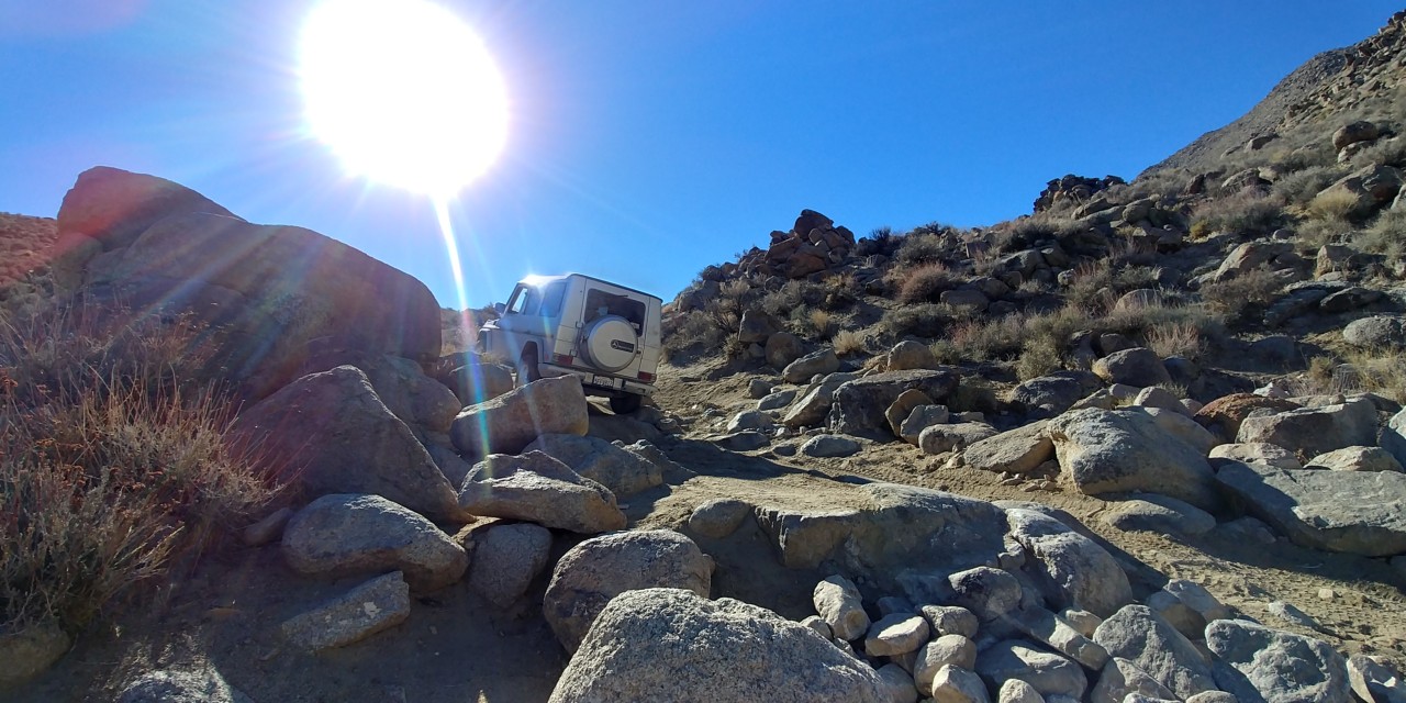
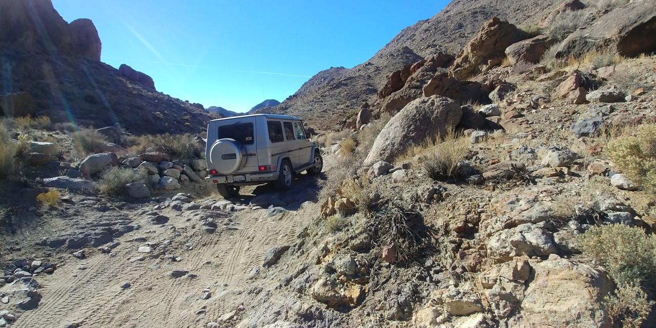
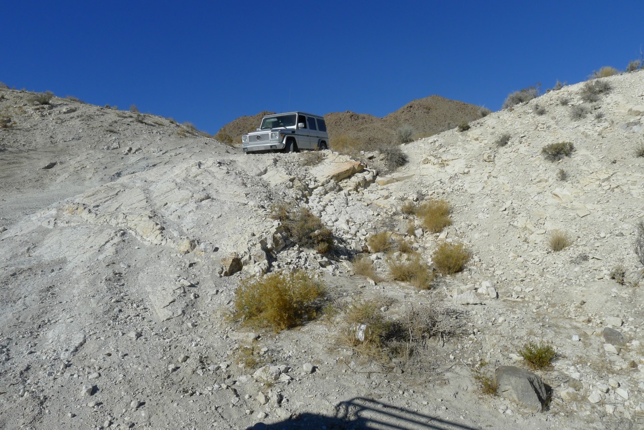
The going all of a sudden gets slow yet pretty busy.
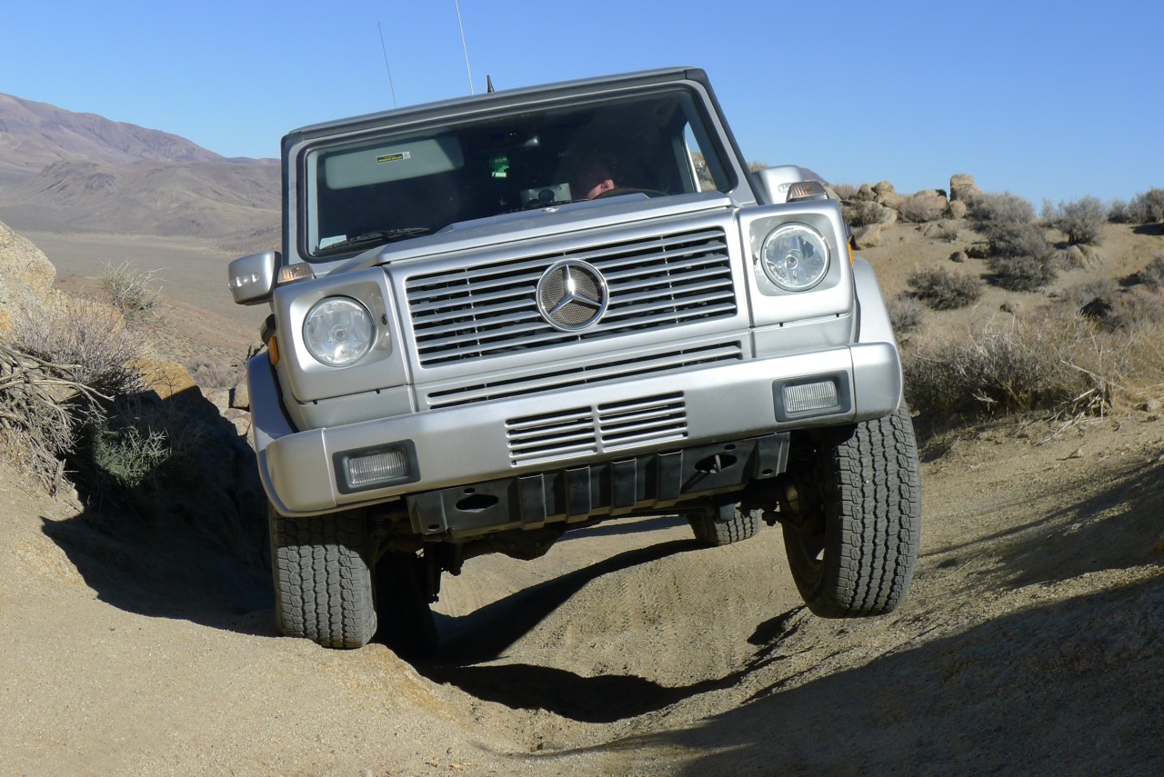
I give up high range pretty quickly and have to find my way around or over rocks. The road gets steep - up or down - and frequently off camber a decent amount. Many times I climb up the grade without a single clue what's behind - and slow down near the crest anticipating some surprise. More than once the trail changes direction behind the crest. Matt has to use one to three of his locking differentials from time to time.
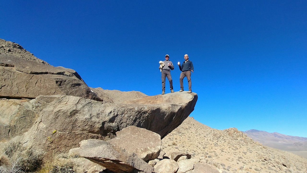
Soon, we find our trucks perched on the crest of Mengel Pass - a pass between Butte Valley and Goler Wash, named after an early 20-th century prospector Carl Mengel, who lived and was buried here in 1944 along with his prosthetic leg.
Everything calls for another short break.
We climb up to pose for photos at an overhanging rock, and come across a plaque picturing a jeep, a hangun, the U.S.Navy seal, and saying "Death Valley Beach Club."
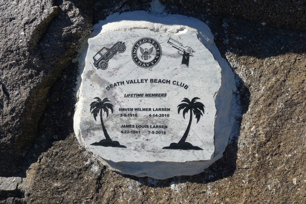
The plaque also lists one Haven Wilmer Larsen and James Louis Larsen as lifetime members; there must be a story, since Larsen the Senior has never been in the U.S.Navy according to his obituary available online. James Louis Larsen was more difficult to track down - he passed away on July 5, 2016 in Paso Robles, and his obituary page shows a neat camper and himself with a close-crop haircut.
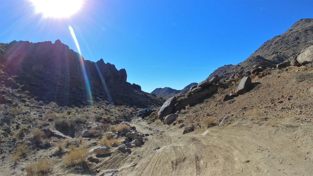
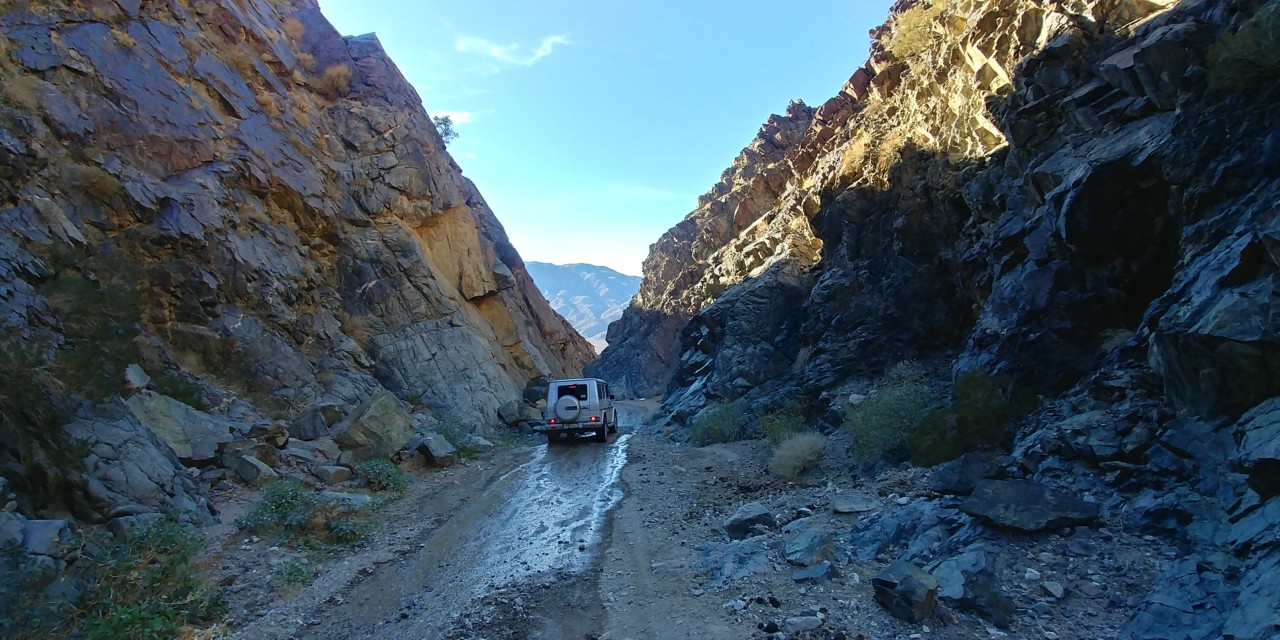
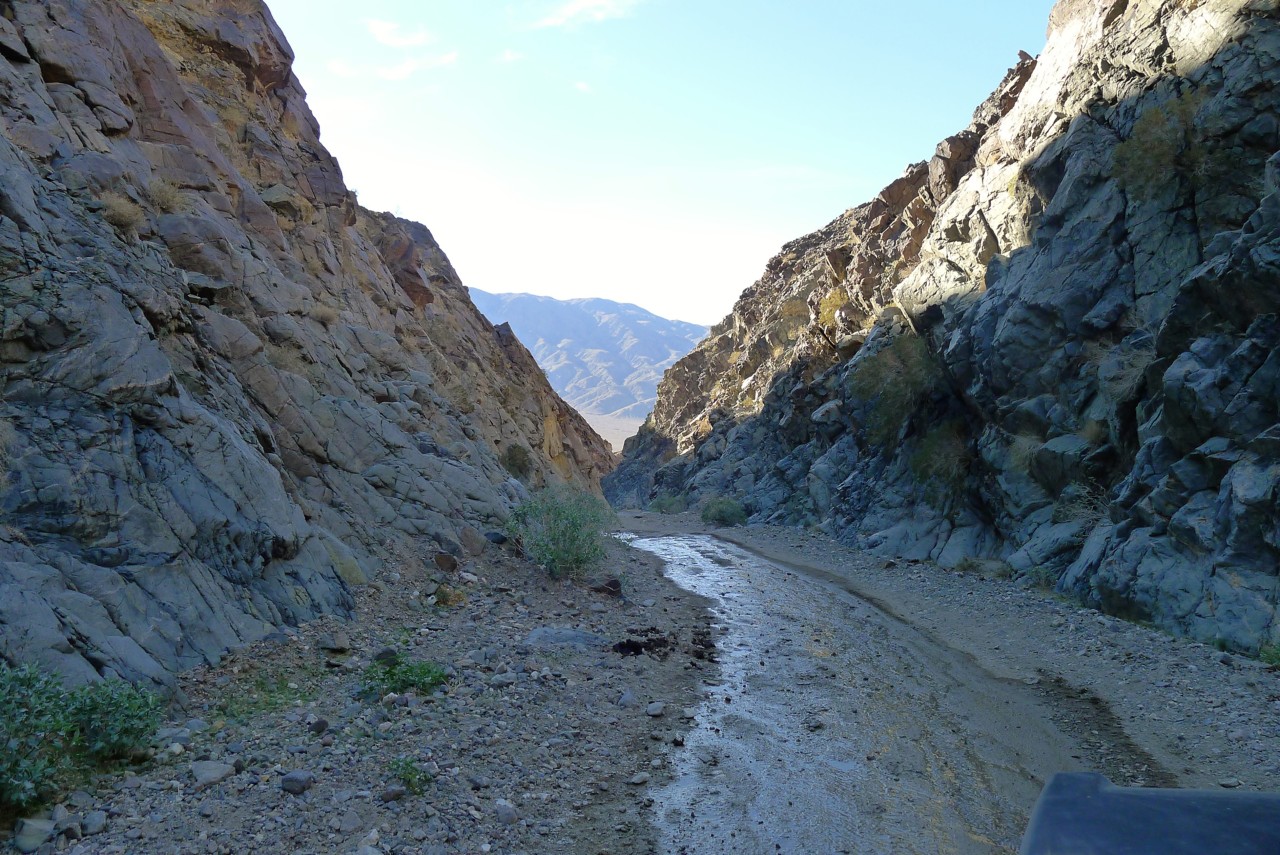
After we're done with beers and photos, we plow on down Goler Wash. The road is still moderately menacing, requiring constant attention. Six miles to Barker Ranch take a good part of half an hour.
The going all of a sudden gets slow yet pretty busy.
I give up high range pretty quickly and have to find my way around or over rocks. The road gets steep - up or down - and frequently off camber a decent amount. Many times I climb up the grade without a single clue what's behind - and slow down near the crest anticipating some surprise. More than once the trail changes direction behind the crest. Matt has to use one to three of his locking differentials from time to time.
Soon, we find our trucks perched on the crest of Mengel Pass - a pass between Butte Valley and Goler Wash, named after an early 20-th century prospector Carl Mengel, who lived and was buried here in 1944 along with his prosthetic leg.
Everything calls for another short break.
We climb up to pose for photos at an overhanging rock, and come across a plaque picturing a jeep, a hangun, the U.S.Navy seal, and saying "Death Valley Beach Club."
The plaque also lists one Haven Wilmer Larsen and James Louis Larsen as lifetime members; there must be a story, since Larsen the Senior has never been in the U.S.Navy according to his obituary available online. James Louis Larsen was more difficult to track down - he passed away on July 5, 2016 in Paso Robles, and his obituary page shows a neat camper and himself with a close-crop haircut.
After we're done with beers and photos, we plow on down Goler Wash. The road is still moderately menacing, requiring constant attention. Six miles to Barker Ranch take a good part of half an hour.
Barker Ranch
We arrive to a large party of four-wheelers at the entrance to Barker Ranch. I spend some time on pleasantries complimenting other guys' trucks and attempt to appear proficient in technical details of other makes, models, and years. The guys reciprocate. After a few minutes of chitchat we stroll around the ranch itself.
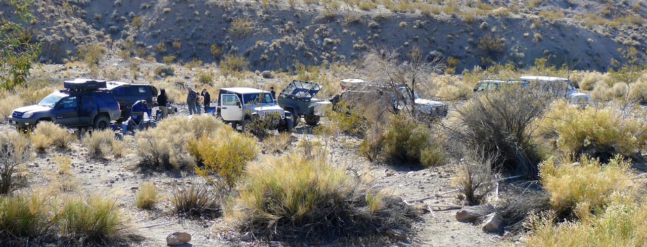
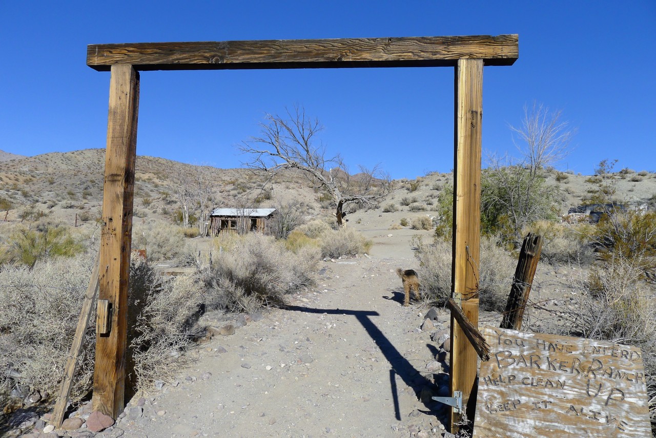
The ranch deserves some comments. I have never heard of this place before planning this trip - and only paid attention to it when it was shown and discussed in Darwin documentary (later on that); of the other places we've been to, this one has a Wikipedia page .
Please pardon me for a lenghty quote on the history of the place.
Bluch and Helen Thomason began construction of Barker Ranch around 1940. It was originally used as a storage and shop facility to support their mining activity in the area. They constructed a small cabin and out building, with electricity provided by a windmill and generator, and drinking water from a nearby spring. In 1950, Bluch Thomason died and the ranch became a seasonal vacation property.
The ranch was sold to James and Arlene Barker of Oklahoma in 1956. The Barkers engaged in gold and uranium mining in the area through the rest of the 1950s and the 1960s. To accommodate their family gatherings, the Barkers enlarged the house and constructed more out buildings.
The closest habitation to Barker Ranch is Myers Ranch. The ranch was built in 1932 by Bill and Barbara Myers. The Myers family resided on the property until 1960 when they relocated to Fresno. Myers Ranch is currently a 40-acre private inholding within Death Valley National Park owned by the Myers family.
In 1968, Charles Manson learned about the Myers Ranch from Catherine Gillies, the granddaughter of Barbara Myers. Starting in November 1968, Manson and others began staying at the ranch and discovered the nearby Barker Ranch. The buildings at Barker Ranch being in better condition, the family relocated there and later obtained Arlene Barker's permission to use the property on a temporary basis. At times, the family was using both properties.
The Inyo County sheriff department, California Highway Patrol, and National Park Service law enforcement captured the group in raids on October 10 and October 12, 1969. Manson was caught hiding under the bathroom vanity.[citation needed] At the time of his arrest they were unaware of the magnitude of their find. They wanted to prosecute the persons responsible for vandalism within Death Valley National Monument further north, unaware that they had a mass-murder suspect and his followers.
In early 1970, members of the Manson Family were filmed by Robert Hendrickson at Barker Ranch, sorting through, and taking evidence left behind by detectives, for the making of the Oscar-nominated documentary "Manson."
In 1971, Arlene Barker ceased to file reports with the Bureau of Land Management (BLM) on the family's mining activity. The land (and improvements) then reverted to government control. In 1976, the ranch became part of the California Desert Conservation Area. In 1994, it was incorporated into Death Valley National Park.
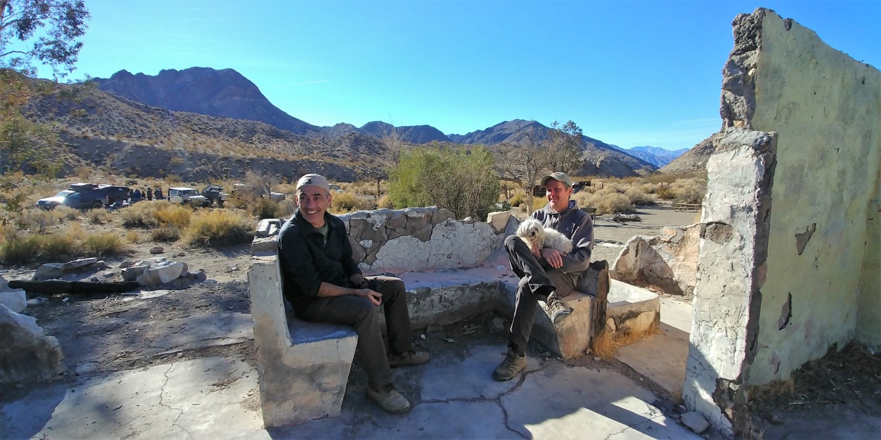
Today the remnants of the ranch belong to National Park Service.
Due to a fire in May 2009, most of the main structure has been destroyed with only the concrete and rock portion of the cabin still standing.
Impressive.
The downside of Death Valley trips is a complete lack of cell phone coverage - you can only guess what was what, when things were built, what happened here, from what you see and bits and pieces of information you heard or saw someplace else. We will be reminded again of this next day.
Here's my 2019 Year Resolution: don't go to Death Valley before reading up on the places I am going to see.
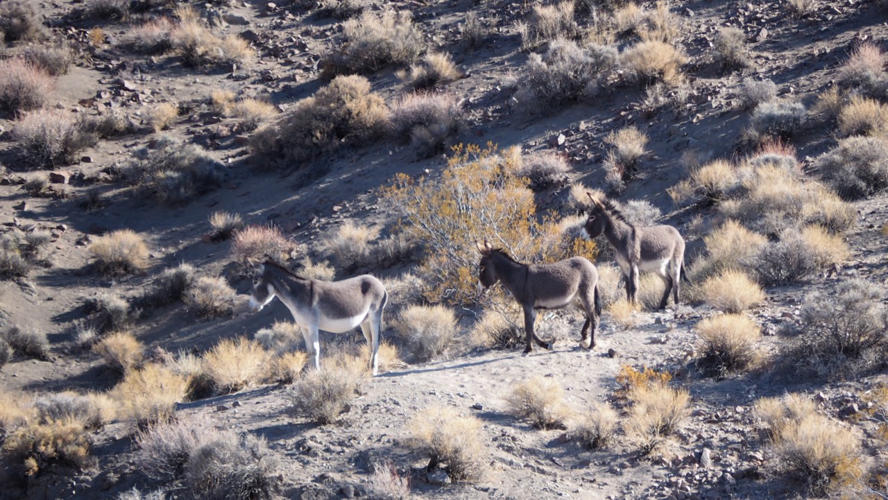
After nearly-stepping in burro crap for a whole day, we are finally treated to a sighting of a group of burros. These guys are unafraid of people (after all, strictly-speaking they are not wildlife, having been brought in and abandoned by people), and curious. They came in when people arrived, and left in disappointment when we left.

We arrive to a large party of four-wheelers at the entrance to Barker Ranch. I spend some time on pleasantries complimenting other guys' trucks and attempt to appear proficient in technical details of other makes, models, and years. The guys reciprocate. After a few minutes of chitchat we stroll around the ranch itself.
The ranch deserves some comments. I have never heard of this place before planning this trip - and only paid attention to it when it was shown and discussed in Darwin documentary (later on that); of the other places we've been to, this one has a Wikipedia page .
Please pardon me for a lenghty quote on the history of the place.
Bluch and Helen Thomason began construction of Barker Ranch around 1940. It was originally used as a storage and shop facility to support their mining activity in the area. They constructed a small cabin and out building, with electricity provided by a windmill and generator, and drinking water from a nearby spring. In 1950, Bluch Thomason died and the ranch became a seasonal vacation property.
The ranch was sold to James and Arlene Barker of Oklahoma in 1956. The Barkers engaged in gold and uranium mining in the area through the rest of the 1950s and the 1960s. To accommodate their family gatherings, the Barkers enlarged the house and constructed more out buildings.
The closest habitation to Barker Ranch is Myers Ranch. The ranch was built in 1932 by Bill and Barbara Myers. The Myers family resided on the property until 1960 when they relocated to Fresno. Myers Ranch is currently a 40-acre private inholding within Death Valley National Park owned by the Myers family.
In 1968, Charles Manson learned about the Myers Ranch from Catherine Gillies, the granddaughter of Barbara Myers. Starting in November 1968, Manson and others began staying at the ranch and discovered the nearby Barker Ranch. The buildings at Barker Ranch being in better condition, the family relocated there and later obtained Arlene Barker's permission to use the property on a temporary basis. At times, the family was using both properties.
The Inyo County sheriff department, California Highway Patrol, and National Park Service law enforcement captured the group in raids on October 10 and October 12, 1969. Manson was caught hiding under the bathroom vanity.[citation needed] At the time of his arrest they were unaware of the magnitude of their find. They wanted to prosecute the persons responsible for vandalism within Death Valley National Monument further north, unaware that they had a mass-murder suspect and his followers.
In early 1970, members of the Manson Family were filmed by Robert Hendrickson at Barker Ranch, sorting through, and taking evidence left behind by detectives, for the making of the Oscar-nominated documentary "Manson."
In 1971, Arlene Barker ceased to file reports with the Bureau of Land Management (BLM) on the family's mining activity. The land (and improvements) then reverted to government control. In 1976, the ranch became part of the California Desert Conservation Area. In 1994, it was incorporated into Death Valley National Park.
Today the remnants of the ranch belong to National Park Service.
Due to a fire in May 2009, most of the main structure has been destroyed with only the concrete and rock portion of the cabin still standing.
Impressive.
The downside of Death Valley trips is a complete lack of cell phone coverage - you can only guess what was what, when things were built, what happened here, from what you see and bits and pieces of information you heard or saw someplace else. We will be reminded again of this next day.
Here's my 2019 Year Resolution: don't go to Death Valley before reading up on the places I am going to see.
After nearly-stepping in burro crap for a whole day, we are finally treated to a sighting of a group of burros. These guys are unafraid of people (after all, strictly-speaking they are not wildlife, having been brought in and abandoned by people), and curious. They came in when people arrived, and left in disappointment when we left.
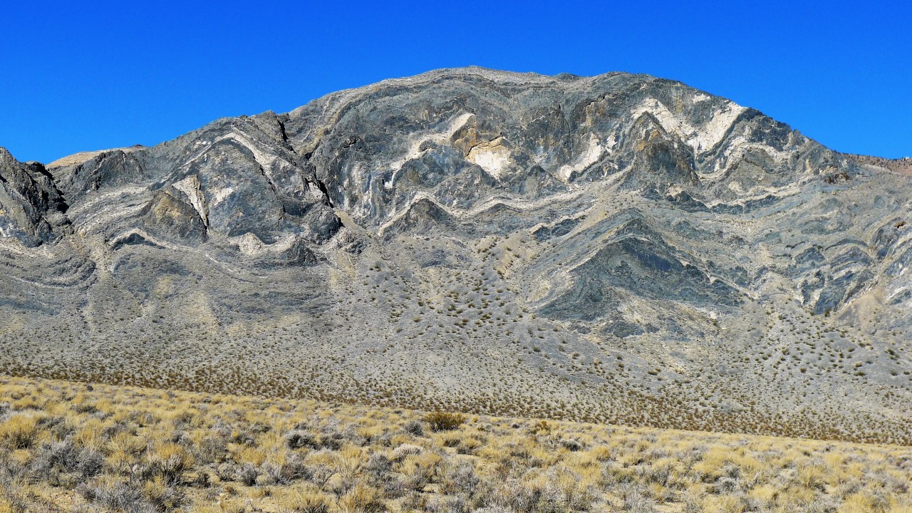
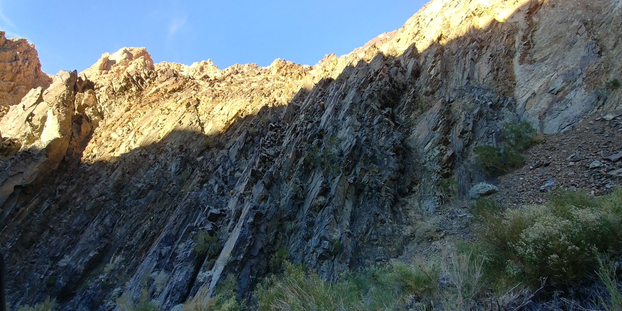
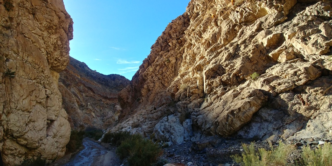
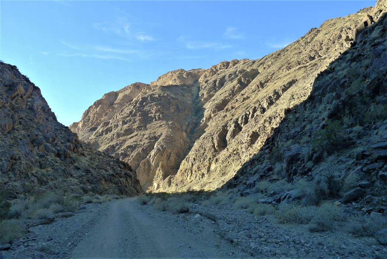
We leave Barker Ranch and head downhill into Goler Wash. The scenery here rivals the best parts of Titus Canyon; the canyon walls close in, allowing us the view of the web of geological patterns in the rocks around. This is spectacular.

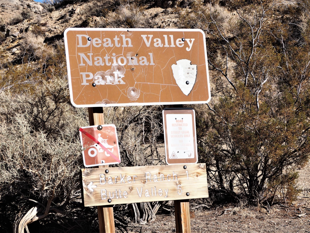
We pass a less-than-glamorous "Death Valley National Park" sign, meaning we're in BLM lands.
Some distance later, we see a turn-off to what appeared to be a site of a large former mining operation and a few abandoned yet almost-inhabitable buildings to our left. Once again, we have to learn of what it is much later, in comfort of our homes and endless Wi-Fi coverage.
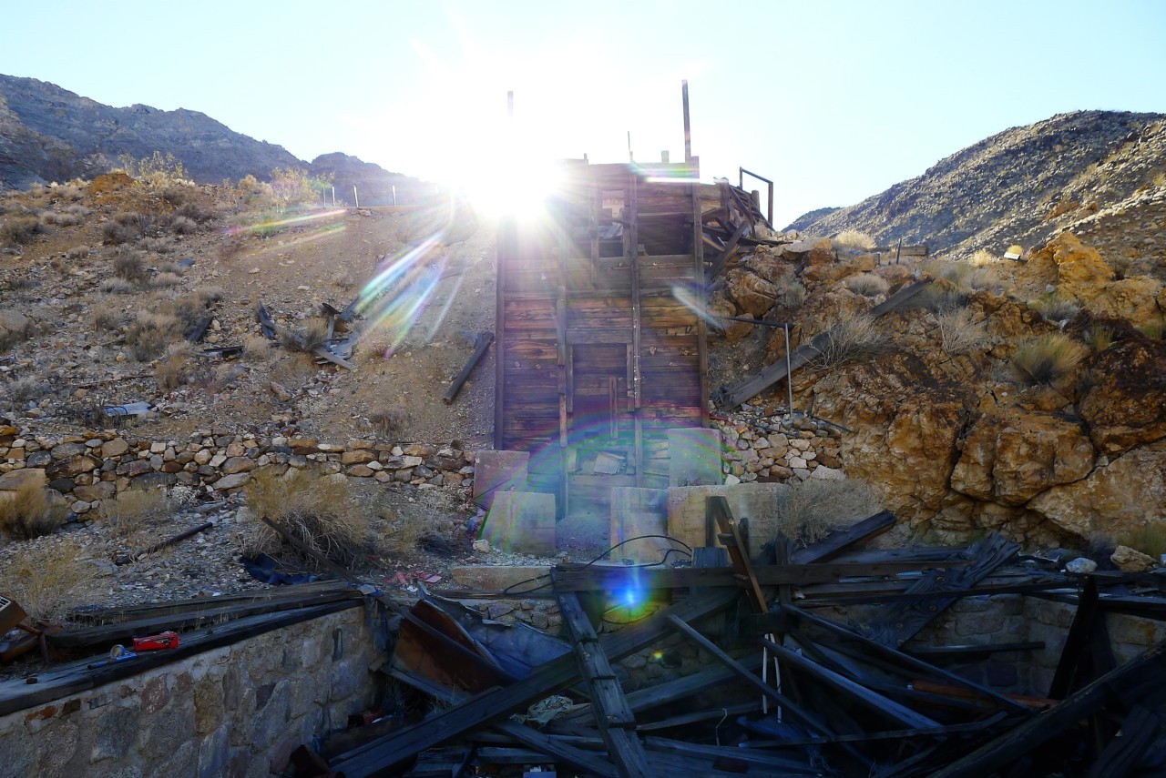
This is Keystone mine - according to National Park Service website, "Keystone Mine is an underground gold mine that has been intermittently worked since 1940. Bush Mining Company (BMC) acquired the mine in 2015, and BMC desires to do exploratory drilling. " Wow... we have seen an operating gold mine - rather, we could have seen it had we read ahead, and drove up the narrow winding dirt road from Goler Wash.
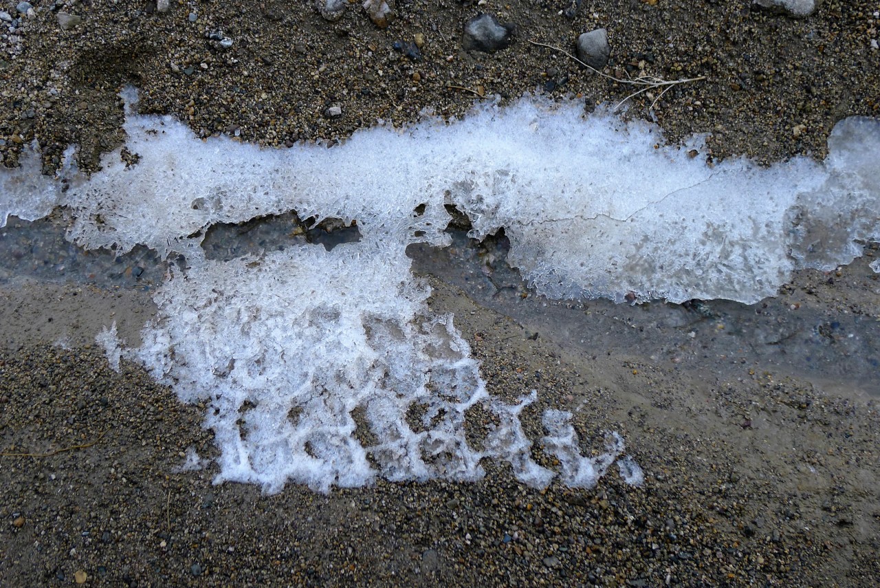
There's still a fair stretch of steep and winding canyon road to get down to Panamint Valley floor. The road is iced over in places - winters are cold and harsh in Death Valley.
Finally, we are out, and greeted by the warm sun - getting close to the mountain peaks in the West.
We turn North (right) on Wingate Road, and drive towards the ghost town of Ballarat. My attention is drawn to a hige open-pit mine site. It is Briggs Gold Mine; it is surrounded by barbed-wire fence, and appears to mean business. The owners butted heads with National Park Service during Clinton, Bush, and Obama administrations, trying to squeeze out more gold and develop new mine sites.
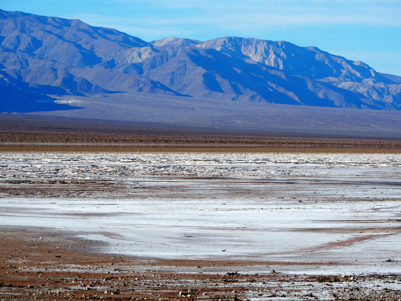
On our left, there's a nearly-dry salt lake, with telltale signs of attempts of owners of burly four-wheel-drives to brave salt mud. Don't do it, kids, you'll be regretting every second spent in that soup. Believe me, I know.
Fifteen easy and super-smooth miles down Wingate Road there is a ghost town of Ballarat.
We pass a less-than-glamorous "Death Valley National Park" sign, meaning we're in BLM lands.
Some distance later, we see a turn-off to what appeared to be a site of a large former mining operation and a few abandoned yet almost-inhabitable buildings to our left. Once again, we have to learn of what it is much later, in comfort of our homes and endless Wi-Fi coverage.
This is Keystone mine - according to National Park Service website, "Keystone Mine is an underground gold mine that has been intermittently worked since 1940. Bush Mining Company (BMC) acquired the mine in 2015, and BMC desires to do exploratory drilling. " Wow... we have seen an operating gold mine - rather, we could have seen it had we read ahead, and drove up the narrow winding dirt road from Goler Wash.
There's still a fair stretch of steep and winding canyon road to get down to Panamint Valley floor. The road is iced over in places - winters are cold and harsh in Death Valley.
Finally, we are out, and greeted by the warm sun - getting close to the mountain peaks in the West.
We turn North (right) on Wingate Road, and drive towards the ghost town of Ballarat. My attention is drawn to a hige open-pit mine site. It is Briggs Gold Mine; it is surrounded by barbed-wire fence, and appears to mean business. The owners butted heads with National Park Service during Clinton, Bush, and Obama administrations, trying to squeeze out more gold and develop new mine sites.
On our left, there's a nearly-dry salt lake, with telltale signs of attempts of owners of burly four-wheel-drives to brave salt mud. Don't do it, kids, you'll be regretting every second spent in that soup. Believe me, I know.
Fifteen easy and super-smooth miles down Wingate Road there is a ghost town of Ballarat.
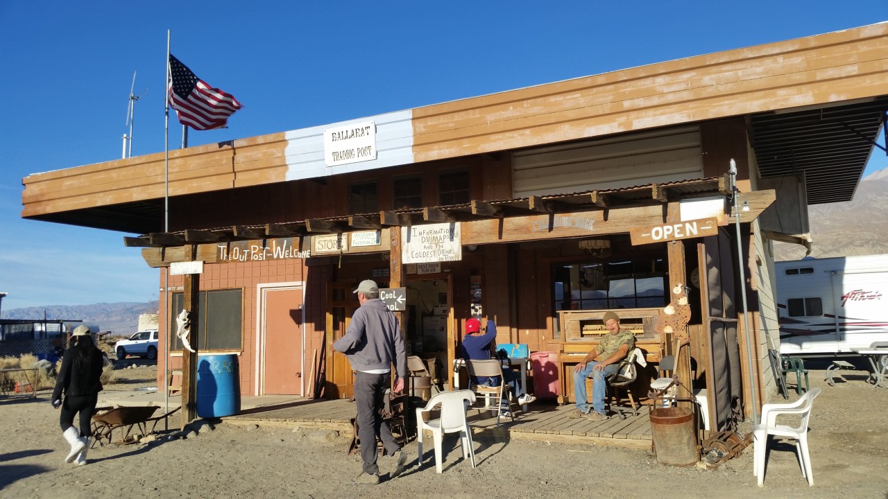
Ballarat
We have to summon Wikipedia again:
The town was founded in 1897. In its heyday—from 1897 to 1905—Ballarat had 400 to 500 residents. It hosted seven saloons, three hotels, a Wells Fargo station, post office (that opened in 1897), school, a jail and morgue, but no churches. Ballarat was a place for miners and prospectors to resupply and relax.
The town began to decline when the Ratcliff Mine, in Pleasant Canyon east of town, suspended operations. Other mines nearby also began to play out, and in 1917 the post office closed[2] and all that remained were a few diehard prospectors and desert rats.
In the 1960s, Charles Manson and the "Manson Family" of killers moved into a ranch south of Ballarat, and left graffiti in the town. The 1969 movie Easy Rider has a scene filmed in Ballarat. After arriving in the town, Peter Fonda's character, Wyatt, removes his Rolex watch and throws it away before he and Dennis Hopper's character, Billy, head east on their motorcycles towards New Orleans.
On Easter weekend, 1971, about two thousand people attended a "hippy" celebration at Ballarat. About two hundred contracted hepatitis (A) from contaminated drinking water.
Today, Ballarat has one full-time resident. As of June 2013 Rocky Novak and his dogs, Potlicker and Brownie, live in the town. Rocky runs the general store on afternoons and weekends to supply tourists, and is working on repairing the water pipes that supply the town, for which he is paid by the government. Rocky was featured in the 2018 film vignette "The Mayor of Ballarat" by Mickey Todiwala and Monika Delgado. The five-minute character piece features a montage of various Ballarat locations with a voiceover of Rocky describing his life in town and musings on human nature. Every summer, a woman named June and her son move into the former jailhouse/morgue.
Ballarat is used as a meeting point for four-wheel-drive expeditions into the Panamint Range and Death Valley, and in winter up to 300 people camp in the grounds of the town.
Mr. Novak (the guy in brown cap, camo T-shirt and jeans in the next two photos) is kind enough to supply us with a large bundle of firewood ($5) and much-needed evening fare. He also suggests places to stay ("wherever the hell you want, it's a free country") multiple exciting ways to spend the evening.
Ballarat to Nadeau Trail
We say our thanks and goodbyes to Rock and decide on the place to spend the night. Matt reasonably suggests that it made little sense to go to Panamint Springs if we plan to get to Defense Mine the next day, and we should seek a place somewhat closer.
Point taken, and we take Trona Road North, and a few miles short of junction with California 190 turn West on a graded dirt road leading to the foothills.
We end up camping a hundred feet off Nadeau Trail, named after one Remy Nadeau, owner of a freight company that moved ten thousand silver-lead bars worth about $4 Million in 1876 .
Looking for Nadeau in Wikipedia yields a treasure trove of other things, including Lookout City that is in our plans for the next day. Death Valley is Disneyland!
In 1875 rich deposits of silver-lead ore were discovered in the Argus Range on top of Lookout mountain. The discovery was named the Modoc, and was sold to a group of investors which included George Hearst, the famed mining engineer, U.S. Senator, and father of William Randolph Hearst. (He was also the great-great grandfather of Patty Hearst.)
The Modoc Consolidated Mining Company was formed with the Modoc mine as the principal mine. Together with the discovery of other nearby mines, which included the Minnietta Belle below Lookout Mountain, these mines formed the basis for the Modoc District with the townsite of Lookout located on top of Lookout Mountain.
The town of Lookout consisted of 2 general stores, 3 saloons, company offices, and as many as 30 other wood and stone structures. By 1876 two 60 ton furnaces and a 10-stamp mill were running and production was quoted as running 160 silver-lead bars per day. The bars averaged 90 lbs. each and assayed around $400.00. By the end of 1876 Remi Nadeau's Cerro Gordo Freighting Company had hauled 10,000 bars worth some $4,000,000 over the Bullion Trail which was originally built for the ore of the Cerro Gordo Mines. Remi Nadeau needed a faster route for his teams, so he constructed the Nadeau "Shotgun" road across the Panamint Valley and over the Slate Range to meet the Bullion Trail south of China Lake.
One has to visit and associate oneself with Lookout City, Cerro Gordo, and China Lake, in order to understand the scale and ambitions of this enterprize.
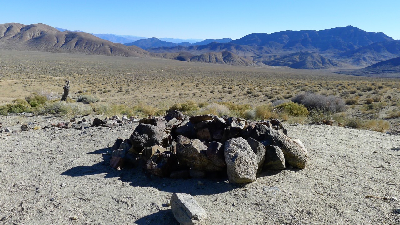
Not equipped with this fascinating information, we simply set up camp - there is plenty of richly-built fire rings. Soon, the fire is roaring, stoves are hissing, warming up beef stew and frying leftover duck magret. Dogs are roaming free and enjoying life in general.
Lacking whiskey, we work on our evening beers - but it gets cold in a hurry. I expire around 8 in the evening - but warm up the engine and the cab of Range Rover before I turn in. Jules gets covered by my old stinky jacket - he may think he's got some fur, but it is going to be seriously cold at night.
Jules is restless all night long. He gets up, looks around, and growls at something. In the morning, Matt tells me he must have seen a desert fox roaming around our campsite. Every time Jules gets up I have to wait until he lies down and throw my jacket over him again.
We have to summon Wikipedia again:
The town was founded in 1897. In its heyday—from 1897 to 1905—Ballarat had 400 to 500 residents. It hosted seven saloons, three hotels, a Wells Fargo station, post office (that opened in 1897), school, a jail and morgue, but no churches. Ballarat was a place for miners and prospectors to resupply and relax.
The town began to decline when the Ratcliff Mine, in Pleasant Canyon east of town, suspended operations. Other mines nearby also began to play out, and in 1917 the post office closed[2] and all that remained were a few diehard prospectors and desert rats.
In the 1960s, Charles Manson and the "Manson Family" of killers moved into a ranch south of Ballarat, and left graffiti in the town. The 1969 movie Easy Rider has a scene filmed in Ballarat. After arriving in the town, Peter Fonda's character, Wyatt, removes his Rolex watch and throws it away before he and Dennis Hopper's character, Billy, head east on their motorcycles towards New Orleans.
On Easter weekend, 1971, about two thousand people attended a "hippy" celebration at Ballarat. About two hundred contracted hepatitis (A) from contaminated drinking water.
Today, Ballarat has one full-time resident. As of June 2013 Rocky Novak and his dogs, Potlicker and Brownie, live in the town. Rocky runs the general store on afternoons and weekends to supply tourists, and is working on repairing the water pipes that supply the town, for which he is paid by the government. Rocky was featured in the 2018 film vignette "The Mayor of Ballarat" by Mickey Todiwala and Monika Delgado. The five-minute character piece features a montage of various Ballarat locations with a voiceover of Rocky describing his life in town and musings on human nature. Every summer, a woman named June and her son move into the former jailhouse/morgue.
Ballarat is used as a meeting point for four-wheel-drive expeditions into the Panamint Range and Death Valley, and in winter up to 300 people camp in the grounds of the town.
Mr. Novak (the guy in brown cap, camo T-shirt and jeans in the next two photos) is kind enough to supply us with a large bundle of firewood ($5) and much-needed evening fare. He also suggests places to stay ("wherever the hell you want, it's a free country") multiple exciting ways to spend the evening.
Ballarat to Nadeau Trail
We say our thanks and goodbyes to Rock and decide on the place to spend the night. Matt reasonably suggests that it made little sense to go to Panamint Springs if we plan to get to Defense Mine the next day, and we should seek a place somewhat closer.
Point taken, and we take Trona Road North, and a few miles short of junction with California 190 turn West on a graded dirt road leading to the foothills.
We end up camping a hundred feet off Nadeau Trail, named after one Remy Nadeau, owner of a freight company that moved ten thousand silver-lead bars worth about $4 Million in 1876 .
Looking for Nadeau in Wikipedia yields a treasure trove of other things, including Lookout City that is in our plans for the next day. Death Valley is Disneyland!
In 1875 rich deposits of silver-lead ore were discovered in the Argus Range on top of Lookout mountain. The discovery was named the Modoc, and was sold to a group of investors which included George Hearst, the famed mining engineer, U.S. Senator, and father of William Randolph Hearst. (He was also the great-great grandfather of Patty Hearst.)
The Modoc Consolidated Mining Company was formed with the Modoc mine as the principal mine. Together with the discovery of other nearby mines, which included the Minnietta Belle below Lookout Mountain, these mines formed the basis for the Modoc District with the townsite of Lookout located on top of Lookout Mountain.
The town of Lookout consisted of 2 general stores, 3 saloons, company offices, and as many as 30 other wood and stone structures. By 1876 two 60 ton furnaces and a 10-stamp mill were running and production was quoted as running 160 silver-lead bars per day. The bars averaged 90 lbs. each and assayed around $400.00. By the end of 1876 Remi Nadeau's Cerro Gordo Freighting Company had hauled 10,000 bars worth some $4,000,000 over the Bullion Trail which was originally built for the ore of the Cerro Gordo Mines. Remi Nadeau needed a faster route for his teams, so he constructed the Nadeau "Shotgun" road across the Panamint Valley and over the Slate Range to meet the Bullion Trail south of China Lake.
One has to visit and associate oneself with Lookout City, Cerro Gordo, and China Lake, in order to understand the scale and ambitions of this enterprize.
Not equipped with this fascinating information, we simply set up camp - there is plenty of richly-built fire rings. Soon, the fire is roaring, stoves are hissing, warming up beef stew and frying leftover duck magret. Dogs are roaming free and enjoying life in general.
Lacking whiskey, we work on our evening beers - but it gets cold in a hurry. I expire around 8 in the evening - but warm up the engine and the cab of Range Rover before I turn in. Jules gets covered by my old stinky jacket - he may think he's got some fur, but it is going to be seriously cold at night.
Jules is restless all night long. He gets up, looks around, and growls at something. In the morning, Matt tells me he must have seen a desert fox roaming around our campsite. Every time Jules gets up I have to wait until he lies down and throw my jacket over him again.
We both don't get any decent sleep. Jules makes me leave the truck at 6:30 in the morning; I pour him two bowlfuls of water which he gulps in a hurry - he must have been really thirsty. The third bowl is only emptied half-way - and the water freezes in it in ten minutes while I am trying to make coffee. I wonder how cold it is - must have been about 20 degrees outside.
A few times through the night I wished Jules slept, and close to me. I remembered the story - however probable - about the origins of the name of the rock group "Three-Dog Night." This night wasn't quite that cold, but it would have been definitely a two-dog night had I slept in a tent - hence the title for the report.
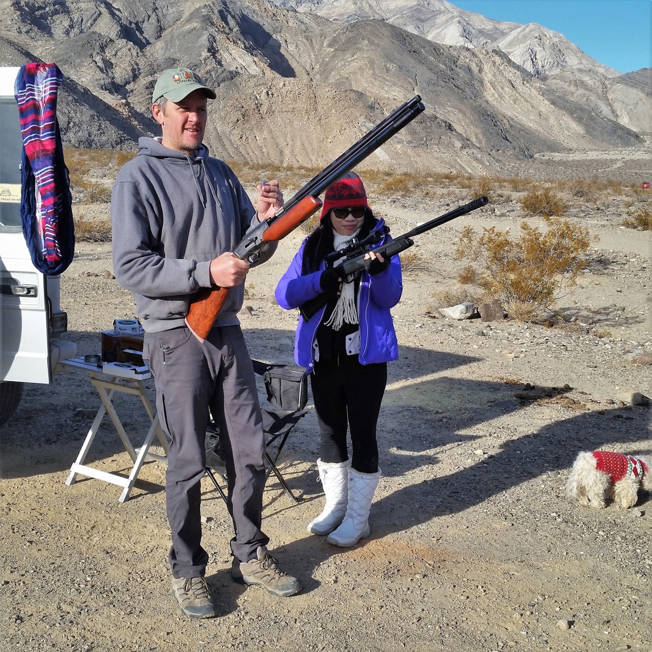
Matt and Thao also get up early. It takes us a while to "thaw out" and make breakfast, after which toys come out of their hiding. Neither of them is a firearm, but the entertainment value is very close.
The plan for the day starts with a visit to Defense Mine.
There, however, lies a problem. It has been 10 years since I've been to Defense Mine during one of the Rover Rendezvous events, and I sure don't remember which canyon is which. Garmin GPS is utterly useless, but Google Maps on the cell phone shows us a trail leading toward, yet not reaching, Defense Mine.
Around 10 in the morning we're on our way.
Nadeau Trail to Minnietta Mine
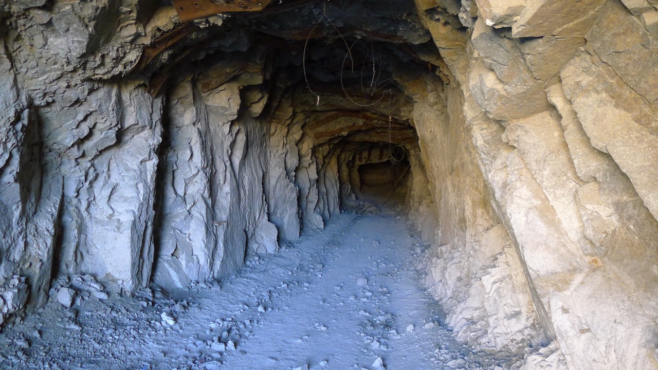
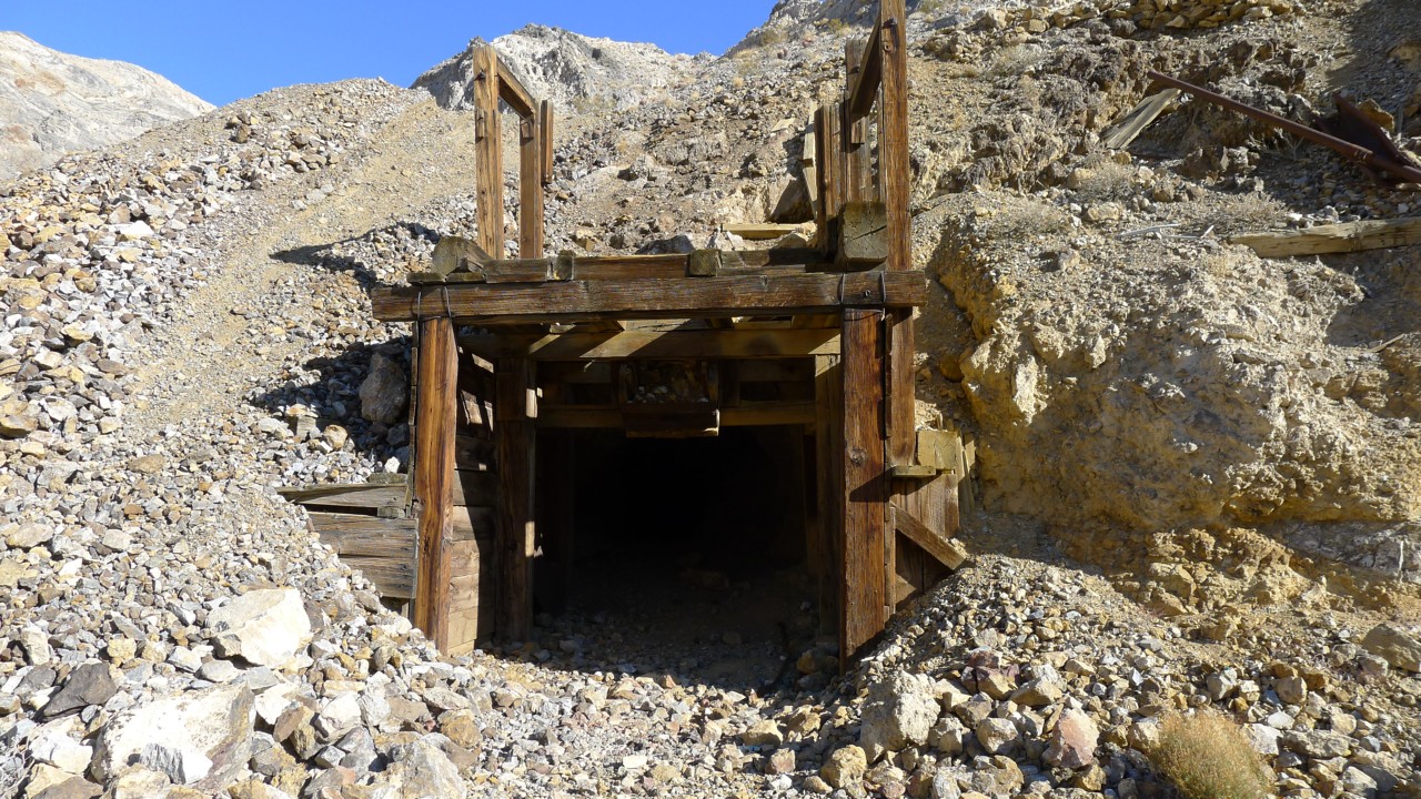
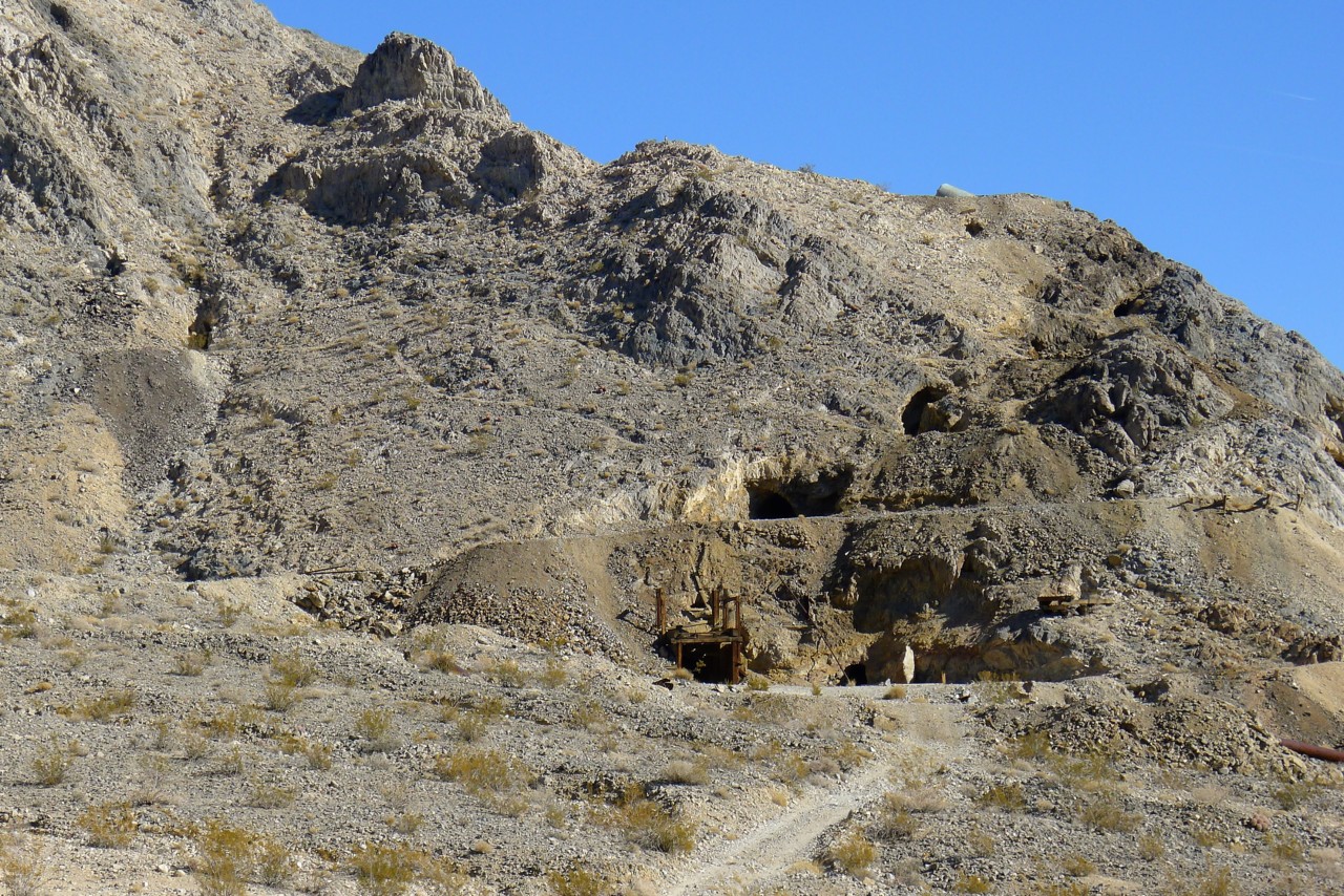
Somehow, I see the first open mineshaft far sooner than I anticipated. Hmmm.... We disembark, and venture inside for the first five forks in the mineshaft, after which I find that I should have concentrated harder at remembering them.
We find our way back, and drive on - for all of 20 minutes or so. The road is very rocky, with some sharp outcroppings threatening sidewalls and wheel rims.

An abandoned cabin appears, and next to it - a Subaru Forester. I am in awe of the owner's driving abilities and ambitions; fifty feet further the road disappears in the dense bushes.
Hmmm... Is it really true that Defense Mine is no longer accessible? The jeep guys at the Barker Ranch seemed to know a lot about Defense Mine - have they really been there?
Nothing to do here, however, so we back out of the dead end, turn around, and head downhill.
On the way down we pass the mineshaft we've peeked into, and come across a large and well-built cabin.
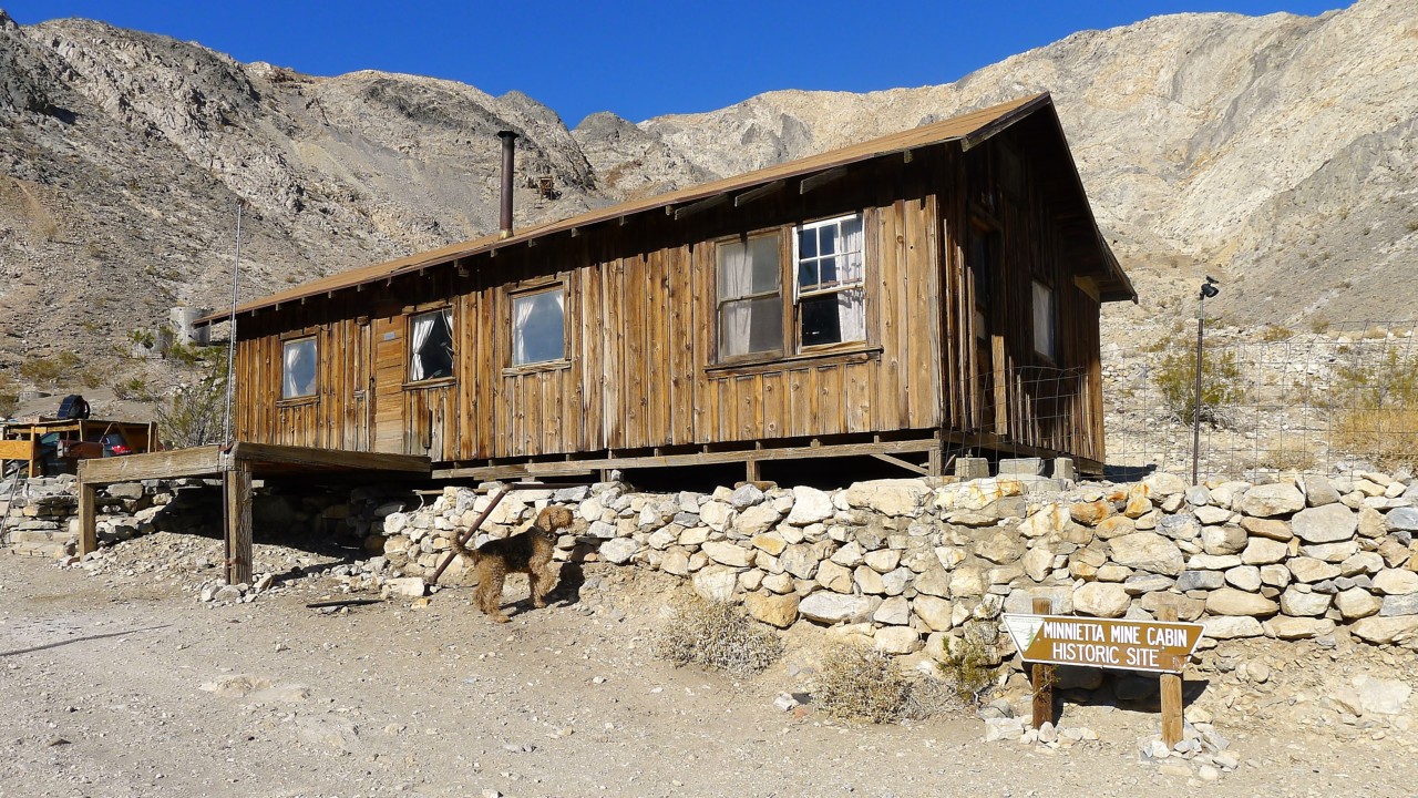
Next to it there's a sign: "Minnietta Mine Cabin."
We must be in a wrong canyon.
We peek inside the cabin - it is even larger, and better-equipped and stocked than the Geologist's Cabin. A Grand Cherokee is parked nearby, suggesting someone's exploring the mine works on foot.
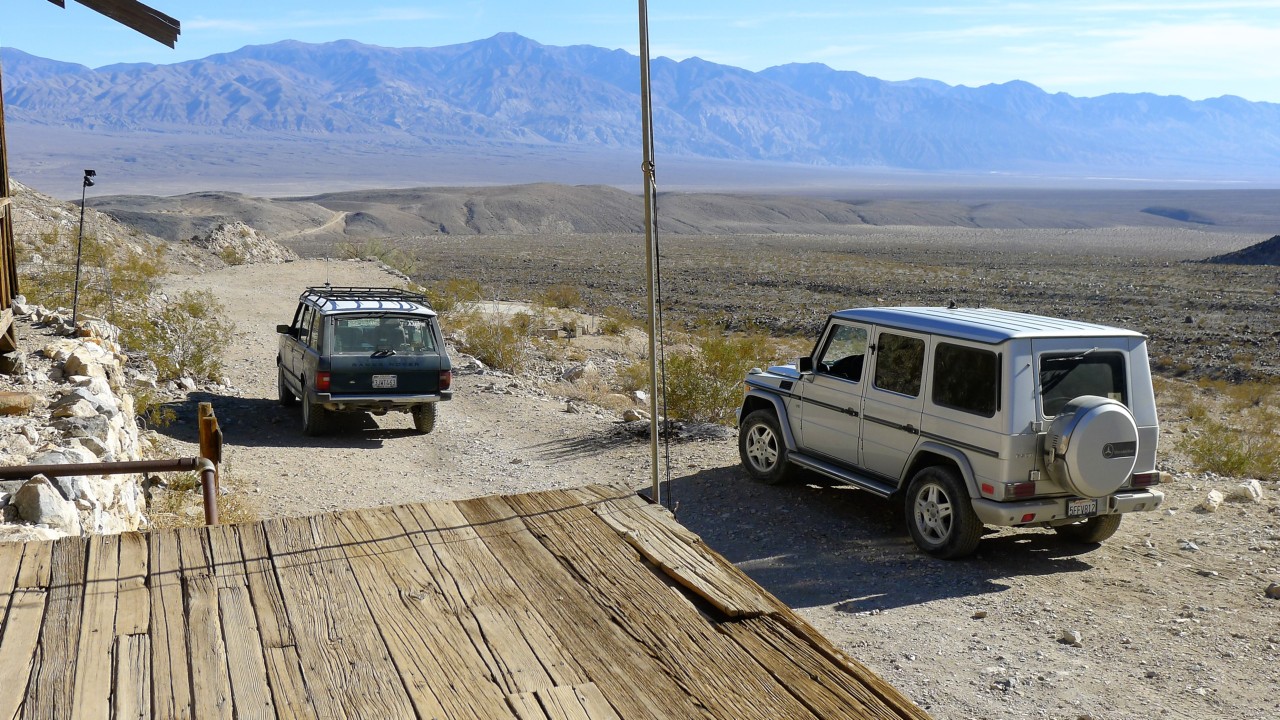
The Subaru catches up with us; its owner, a sunny kid in his mid-20s, graduated from USC and moved to Bishop. I can't put these two facts together in any reasonable manner, but that's okay.
We discuss the local places, and the conversation veers off to Lookout City; he waves his hand in the opposite side of the canyon.
We are in a wrong canyon.
The kid shows us a couple of great books on Death Valley and its environs, we take pictures and leave.
Defense Mine will have to wait for the next trip - from the valley floor, it is easily a 3-4 hour trip by itself.
Somewhat defeated, we drive off back to pavement, to hit Trona Road to Highway 190, past Panamint Springs, and towards Old Toll Road to Darwin Falls and the town of Darwin.
Oh the falls...
A few times through the night I wished Jules slept, and close to me. I remembered the story - however probable - about the origins of the name of the rock group "Three-Dog Night." This night wasn't quite that cold, but it would have been definitely a two-dog night had I slept in a tent - hence the title for the report.
Matt and Thao also get up early. It takes us a while to "thaw out" and make breakfast, after which toys come out of their hiding. Neither of them is a firearm, but the entertainment value is very close.
The plan for the day starts with a visit to Defense Mine.
There, however, lies a problem. It has been 10 years since I've been to Defense Mine during one of the Rover Rendezvous events, and I sure don't remember which canyon is which. Garmin GPS is utterly useless, but Google Maps on the cell phone shows us a trail leading toward, yet not reaching, Defense Mine.
Around 10 in the morning we're on our way.
Nadeau Trail to Minnietta Mine
Somehow, I see the first open mineshaft far sooner than I anticipated. Hmmm.... We disembark, and venture inside for the first five forks in the mineshaft, after which I find that I should have concentrated harder at remembering them.
We find our way back, and drive on - for all of 20 minutes or so. The road is very rocky, with some sharp outcroppings threatening sidewalls and wheel rims.
An abandoned cabin appears, and next to it - a Subaru Forester. I am in awe of the owner's driving abilities and ambitions; fifty feet further the road disappears in the dense bushes.
Hmmm... Is it really true that Defense Mine is no longer accessible? The jeep guys at the Barker Ranch seemed to know a lot about Defense Mine - have they really been there?
Nothing to do here, however, so we back out of the dead end, turn around, and head downhill.
On the way down we pass the mineshaft we've peeked into, and come across a large and well-built cabin.
Next to it there's a sign: "Minnietta Mine Cabin."
We must be in a wrong canyon.
We peek inside the cabin - it is even larger, and better-equipped and stocked than the Geologist's Cabin. A Grand Cherokee is parked nearby, suggesting someone's exploring the mine works on foot.
The Subaru catches up with us; its owner, a sunny kid in his mid-20s, graduated from USC and moved to Bishop. I can't put these two facts together in any reasonable manner, but that's okay.
We discuss the local places, and the conversation veers off to Lookout City; he waves his hand in the opposite side of the canyon.
We are in a wrong canyon.
The kid shows us a couple of great books on Death Valley and its environs, we take pictures and leave.
Defense Mine will have to wait for the next trip - from the valley floor, it is easily a 3-4 hour trip by itself.
Somewhat defeated, we drive off back to pavement, to hit Trona Road to Highway 190, past Panamint Springs, and towards Old Toll Road to Darwin Falls and the town of Darwin.
Oh the falls...
Darwin Falls
Here's some strong opinion expressed by a reviewer on Hikespeak.com:
Darwin Falls should not be part of Death Valley National Park. In fact, the year-round waterfall does not belong in the California desert at all. The hike starts as innocently as so many nearby trails, at the mouth of a gravel-bottom canyon, but after 0.7 miles the canyon closes and the trail enters a lush oasis of cottonwoods and willows. The next 0.3 miles involve multiple creek crossings en route to a 20-foot waterfalls. That’s right, creek crossings … in the desert! Then there’s the waterfall, which looks like it was transported from the tropics. This 2-mile round trip hike simply has no place in Death Valley.
That's good that we don't read reviews prior to seeing places.
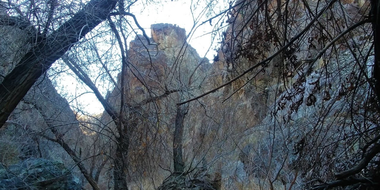
We arrive to a small and busy parking lot off Old Toll Road, park, and set out for the hike. It matches the description to a tee. The creek crossings start fairly benign, but turn somewhat gnarly with narrow, off-camber, and wet, granite ledges - always with a bypass option, which is more often than not worse than the main route.

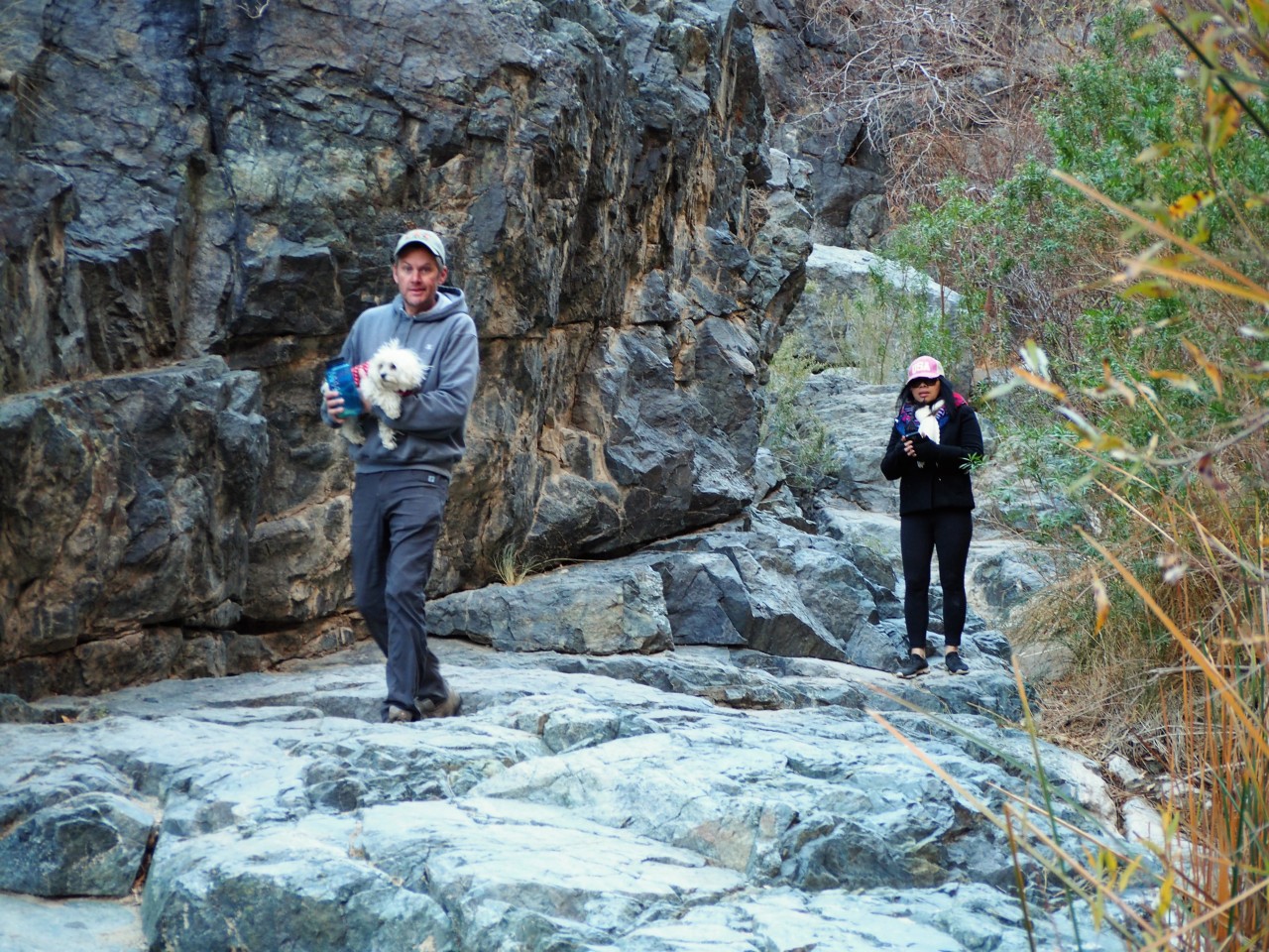
After the short scramble (dogs don't always have an advantage of four-paw-drive here), we're at the foot of the waterfall.
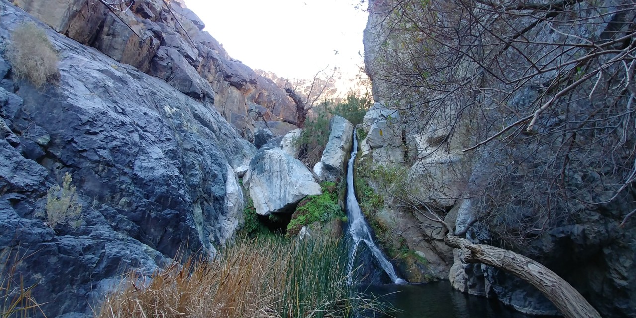
Somehow, on that very busy day - December 30 - we have the falls all to ourselves, and enjoy the view and freshness for some time.
Then, the trickle of other visitors kick up a notch, and we leave. By the time we return to our trucks, I counted 23 people on their way up the canyon. Good grief, it's like a tiny Yosemite.
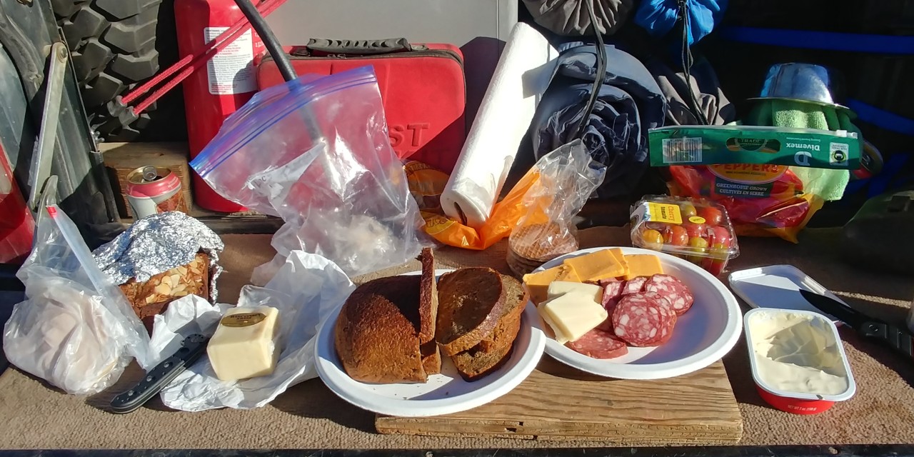
We spread out our "lunchables" on the tailgate of the Range Rover, and have a nice and unhurried lunch.
Then, it is time to see Darwin.
The Old Toll Road continues steeply uphill; we end up behind a group of jeepers headed in the same direction. Going is mostly into the sun, and at times I see exactly nothing in bright clouds of dust.
We follow the jeepers - until Matt tells me on the radio that we're off the road to Darwin. I am incredulous - Garmin insists that's the one. I suggest we continue behind until something develops.
And develop it does.
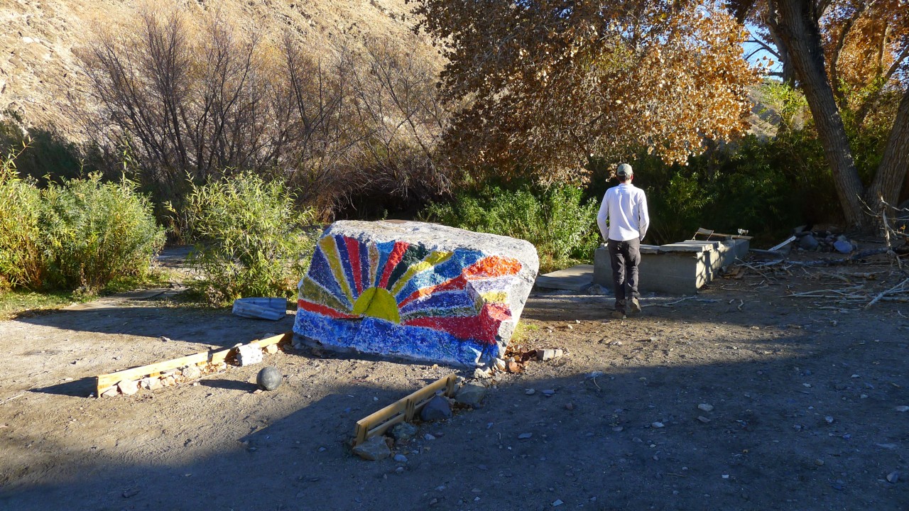
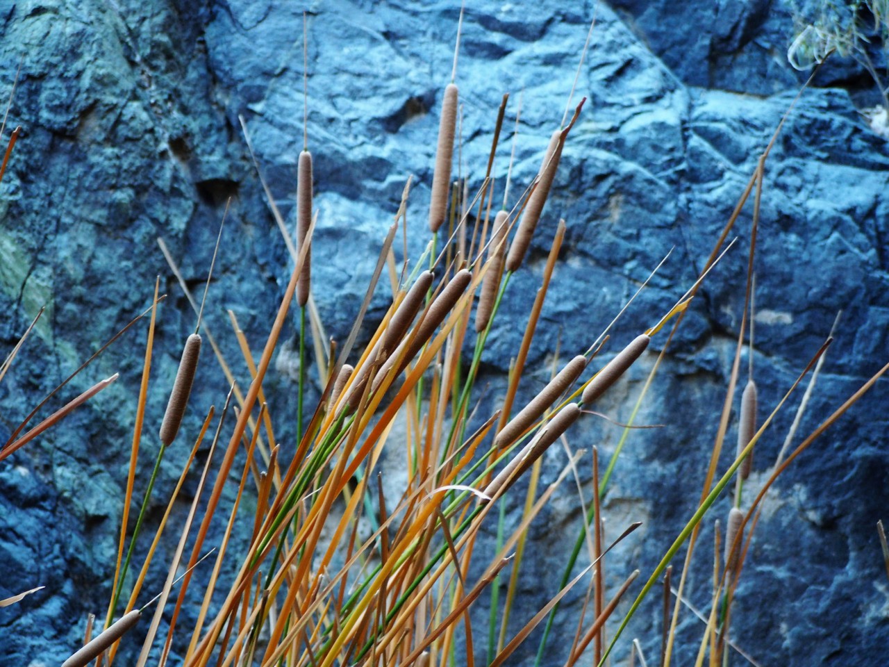
By the time we catch up with the convoy ahead, they are already parked and exploring the area on foot. There's an abandoned ranch building nearby, and what seems to be a pond with reeds.
Don't laugh, East Coast people, there are not too many reed ponds in California desert.
One of the guys from the other group tells us that this pond is at the head of the spring feeding Darwin Falls. We haven't crossed a stream on our ascent to the place - it must have taken the other path downhill.
I talk to a nice lady with two Irish wolfhounds in her vehicle; after a dose of dog talk, she asks me the question quoted at the beginning of this report -
"Have you seen the goldfish?"
What goldfish? We're in the desert!
"Well... There are goldfish in that pond - walk around the reeds, you'll see them."
Not knowing of a nice path around, I scramble over rocks and between the trees to see the pond. Yeah, here it is. Nice koi pond, in the middle of the desert. What else does this Disneyland have in store for us?
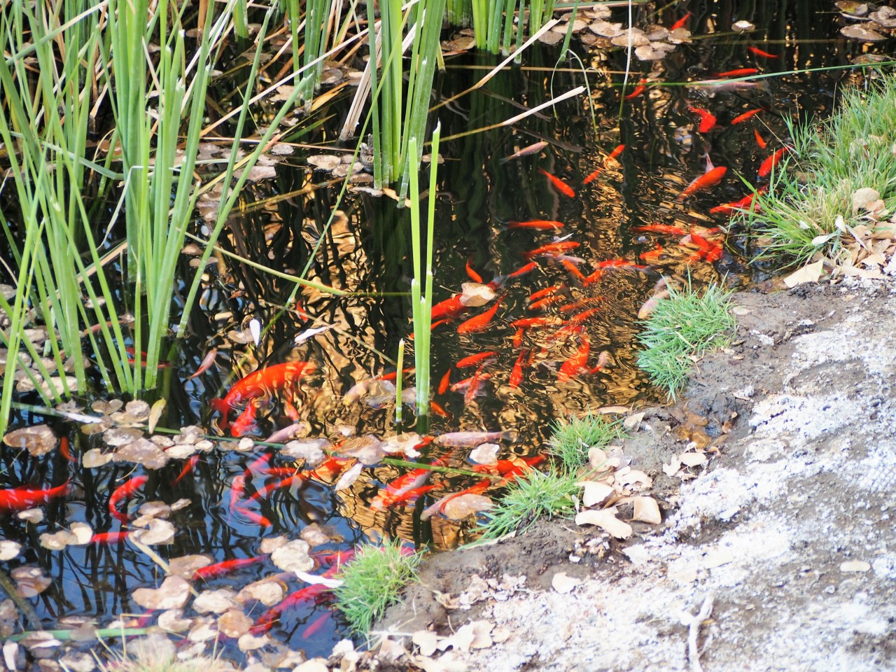
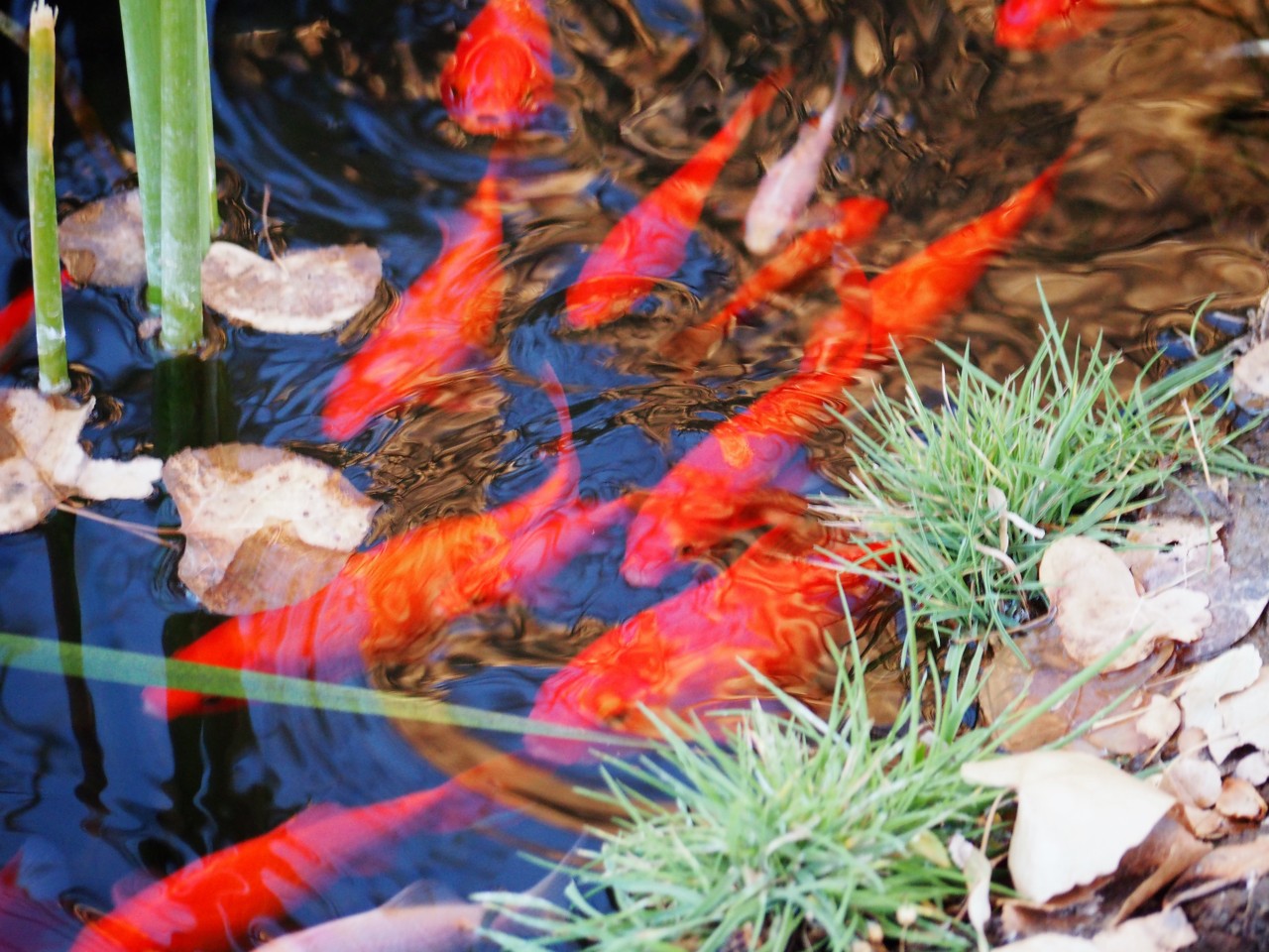
I take a bunch of blurry photos of the fish (need to remember to bring a polarizing filter!!!), and we leave for Darwin.
Here's some strong opinion expressed by a reviewer on Hikespeak.com:
Darwin Falls should not be part of Death Valley National Park. In fact, the year-round waterfall does not belong in the California desert at all. The hike starts as innocently as so many nearby trails, at the mouth of a gravel-bottom canyon, but after 0.7 miles the canyon closes and the trail enters a lush oasis of cottonwoods and willows. The next 0.3 miles involve multiple creek crossings en route to a 20-foot waterfalls. That’s right, creek crossings … in the desert! Then there’s the waterfall, which looks like it was transported from the tropics. This 2-mile round trip hike simply has no place in Death Valley.
That's good that we don't read reviews prior to seeing places.
We arrive to a small and busy parking lot off Old Toll Road, park, and set out for the hike. It matches the description to a tee. The creek crossings start fairly benign, but turn somewhat gnarly with narrow, off-camber, and wet, granite ledges - always with a bypass option, which is more often than not worse than the main route.
After the short scramble (dogs don't always have an advantage of four-paw-drive here), we're at the foot of the waterfall.
Somehow, on that very busy day - December 30 - we have the falls all to ourselves, and enjoy the view and freshness for some time.
Then, the trickle of other visitors kick up a notch, and we leave. By the time we return to our trucks, I counted 23 people on their way up the canyon. Good grief, it's like a tiny Yosemite.
We spread out our "lunchables" on the tailgate of the Range Rover, and have a nice and unhurried lunch.
Then, it is time to see Darwin.
The Old Toll Road continues steeply uphill; we end up behind a group of jeepers headed in the same direction. Going is mostly into the sun, and at times I see exactly nothing in bright clouds of dust.
We follow the jeepers - until Matt tells me on the radio that we're off the road to Darwin. I am incredulous - Garmin insists that's the one. I suggest we continue behind until something develops.
And develop it does.
By the time we catch up with the convoy ahead, they are already parked and exploring the area on foot. There's an abandoned ranch building nearby, and what seems to be a pond with reeds.
Don't laugh, East Coast people, there are not too many reed ponds in California desert.
One of the guys from the other group tells us that this pond is at the head of the spring feeding Darwin Falls. We haven't crossed a stream on our ascent to the place - it must have taken the other path downhill.
I talk to a nice lady with two Irish wolfhounds in her vehicle; after a dose of dog talk, she asks me the question quoted at the beginning of this report -
"Have you seen the goldfish?"
What goldfish? We're in the desert!
"Well... There are goldfish in that pond - walk around the reeds, you'll see them."
Not knowing of a nice path around, I scramble over rocks and between the trees to see the pond. Yeah, here it is. Nice koi pond, in the middle of the desert. What else does this Disneyland have in store for us?
I take a bunch of blurry photos of the fish (need to remember to bring a polarizing filter!!!), and we leave for Darwin.
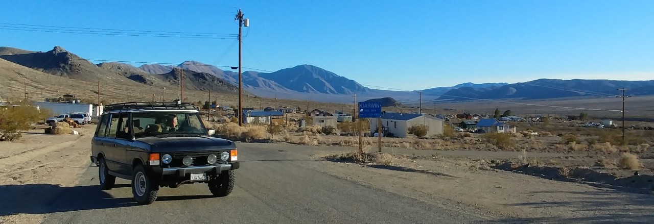
Darwin, California
Darwin... I've been curious about this place for a few years since first seeing it on the map while looking for new trails near Panamint Valley. When I shared my Death Valley travel plans with coworkers, they asked me if I have ever seen Darwin documentary; that very night, I dug it up on Amazon - and we watched it without taking our eyes off the screen. If you haven't seen it, do it - that's two hours very well spent!
Here I have to make a verbal detour. Bear with me.
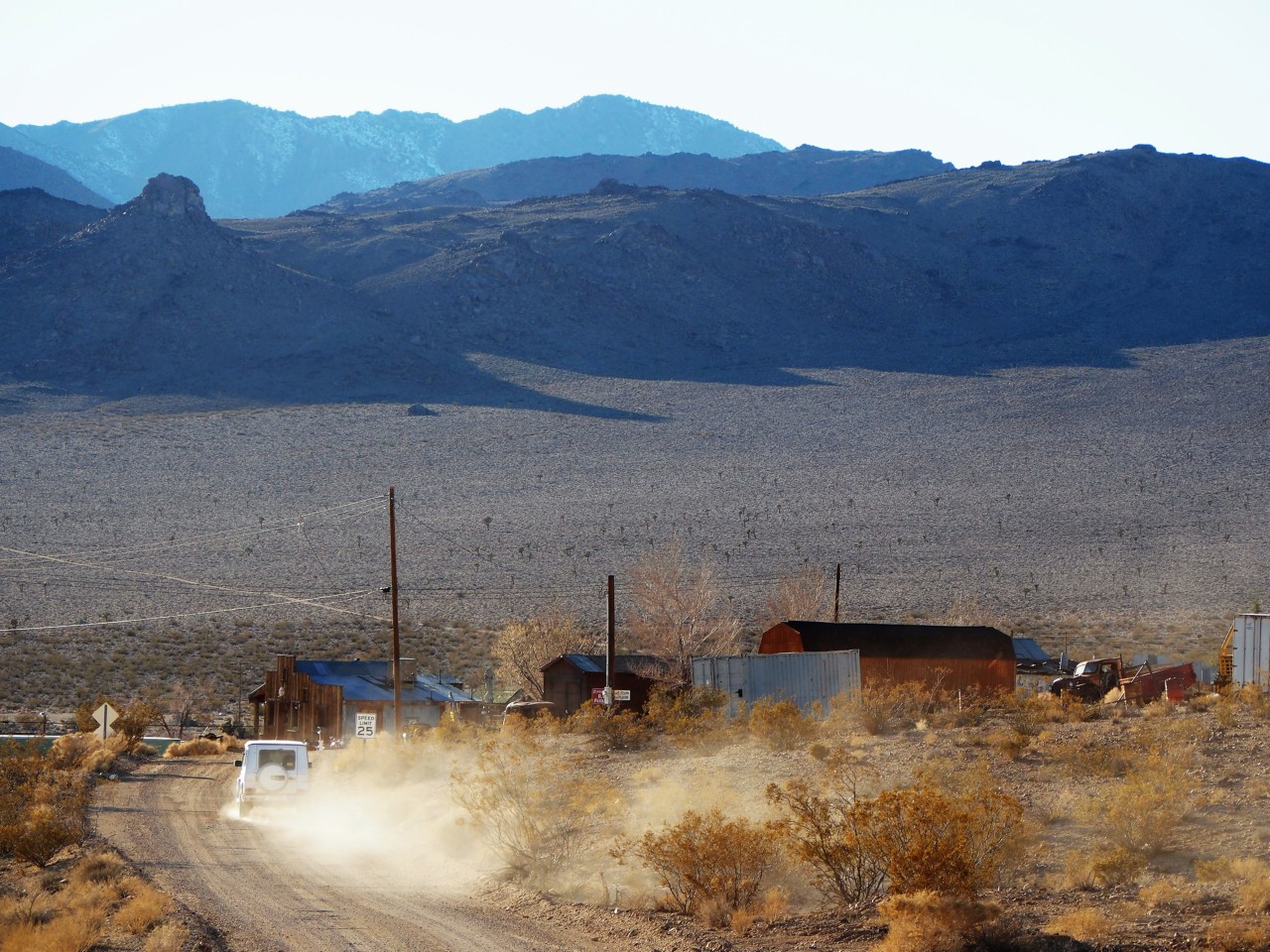
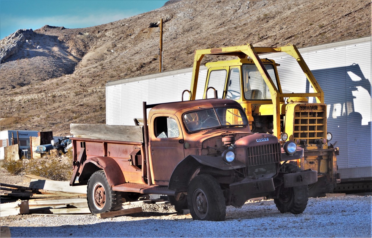
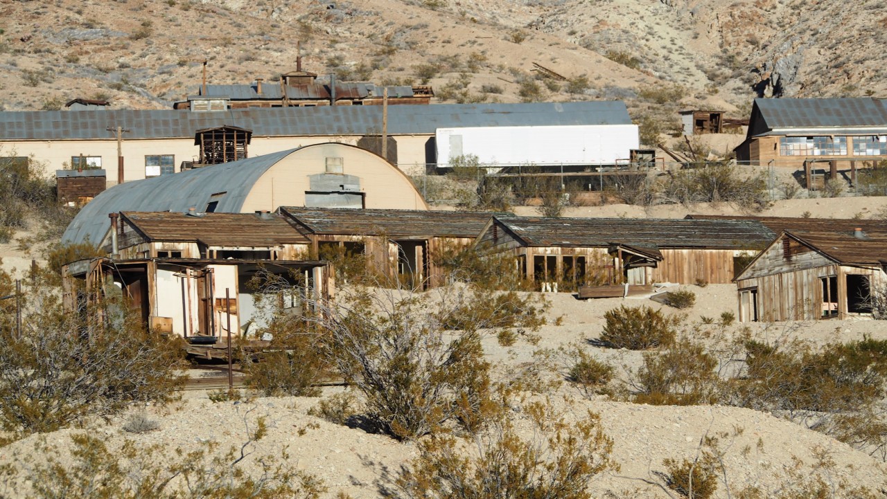
Every time we travel from Southern California to Eastern High Sierras along U.S.395, I wonder about the former mining towns the road goes through - now mostly refuges of the die-hards who either lived there all their lives, or can't live in the big cities, or have their other reasons. Most of them are littered with abandoned vehicles, appliances, and furniture; most houses are shuttered - or broken or burnt down.
Some of them are dead - like Bodie further up North.
Some are semi-alive in a suspended preserve-or-develop-or-demolish state, like Cerro Gordo.
Some still linger but are outright depressing - like Johannesburg or Red Mountain; some maintain their spirit (like Randsburg).
Some still have active mining operations and live in a state of a perpetual company town (like Trona), supplementing the income by copious meth production. I almost crashed a rental car once when my boss in the passenger seat explained the differences to another coworker - "Trona... is just like Randsburg, without the glitz."
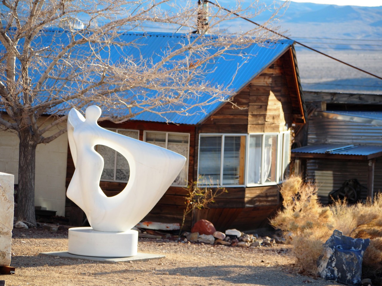
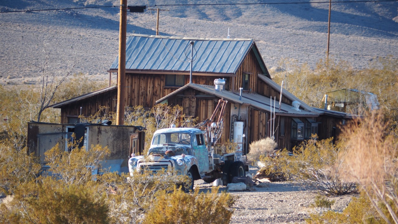
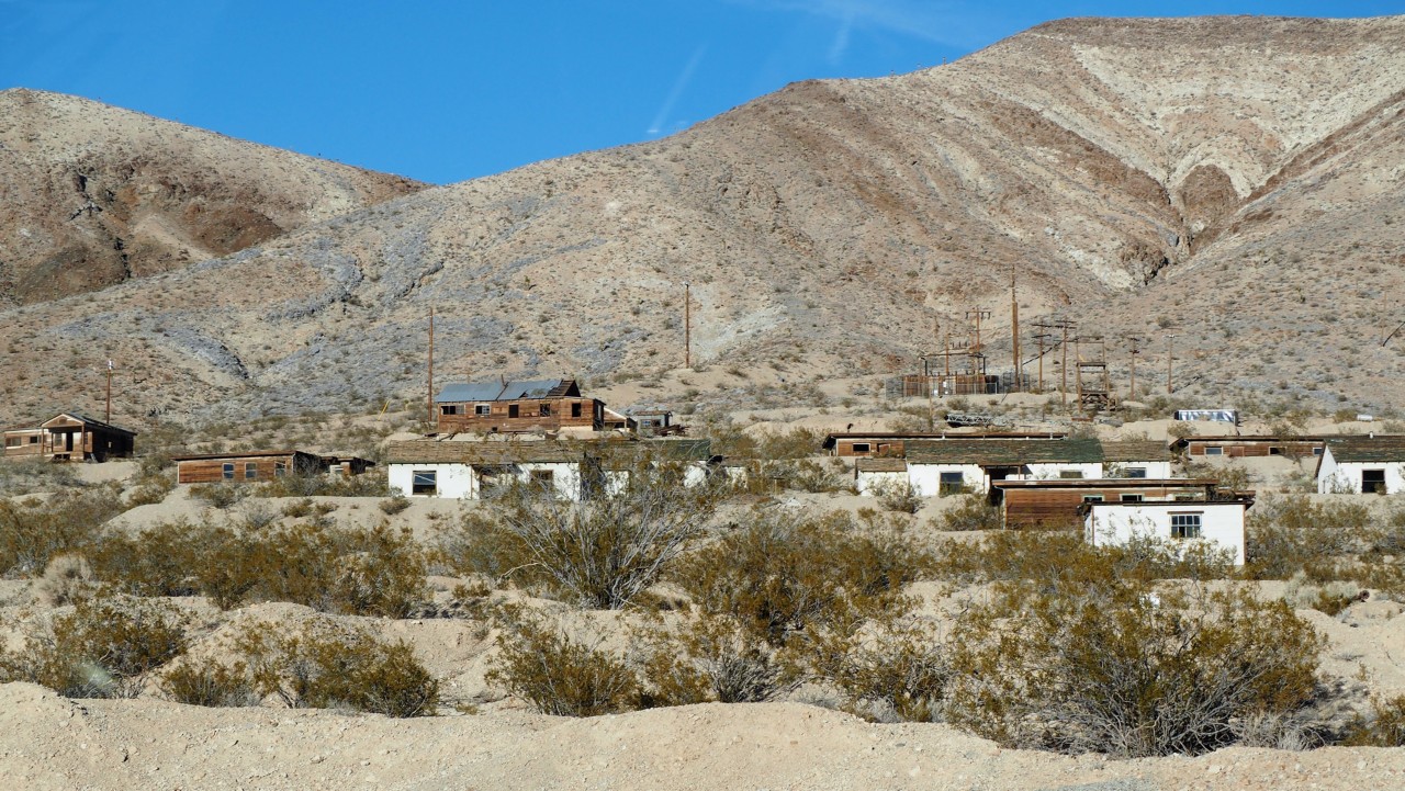
Darwin appears different. Somewhat secluded in the valley adjacent to mammoth China Lakes Naval Weapons Center (also worth mentioning - a Navy base in the middle of a largest desert in North America!), lost most of its glamour and allure. It is pretty far from today's commodities - the nearest gas station in Olancha is about 40 minutes away; one has to drive over an hour North-West to Lone Pine for groceries. The nearest bar and restaurant are in Panamint Springs - an hour on or off pavement, complete with astronomical gas prices and rather indifferent service. Yet, there's a handful of souls - not sure of the latest head count - who stay. Enough to maintain a U.S.Post Office.
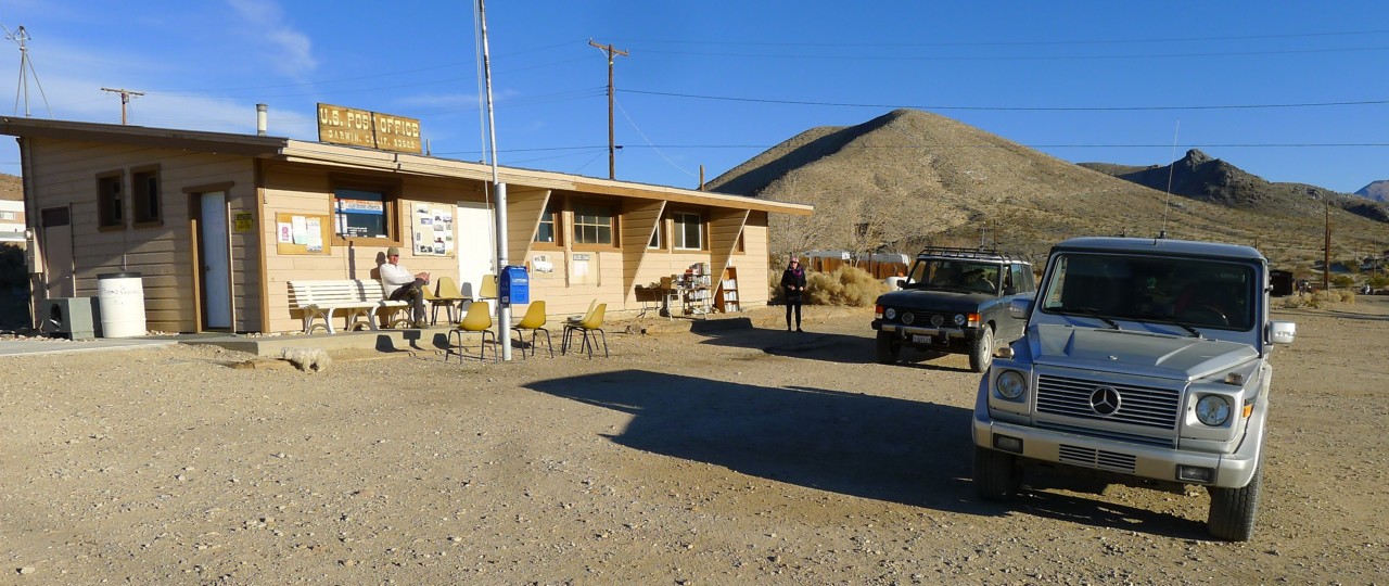
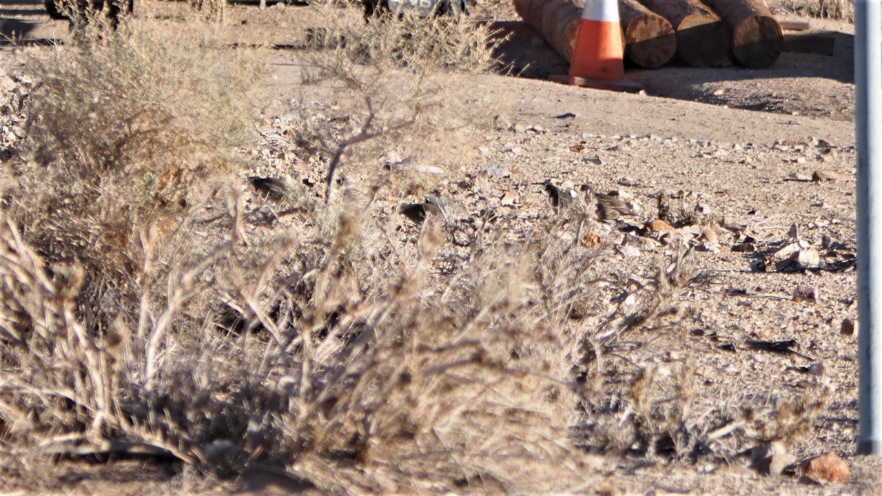
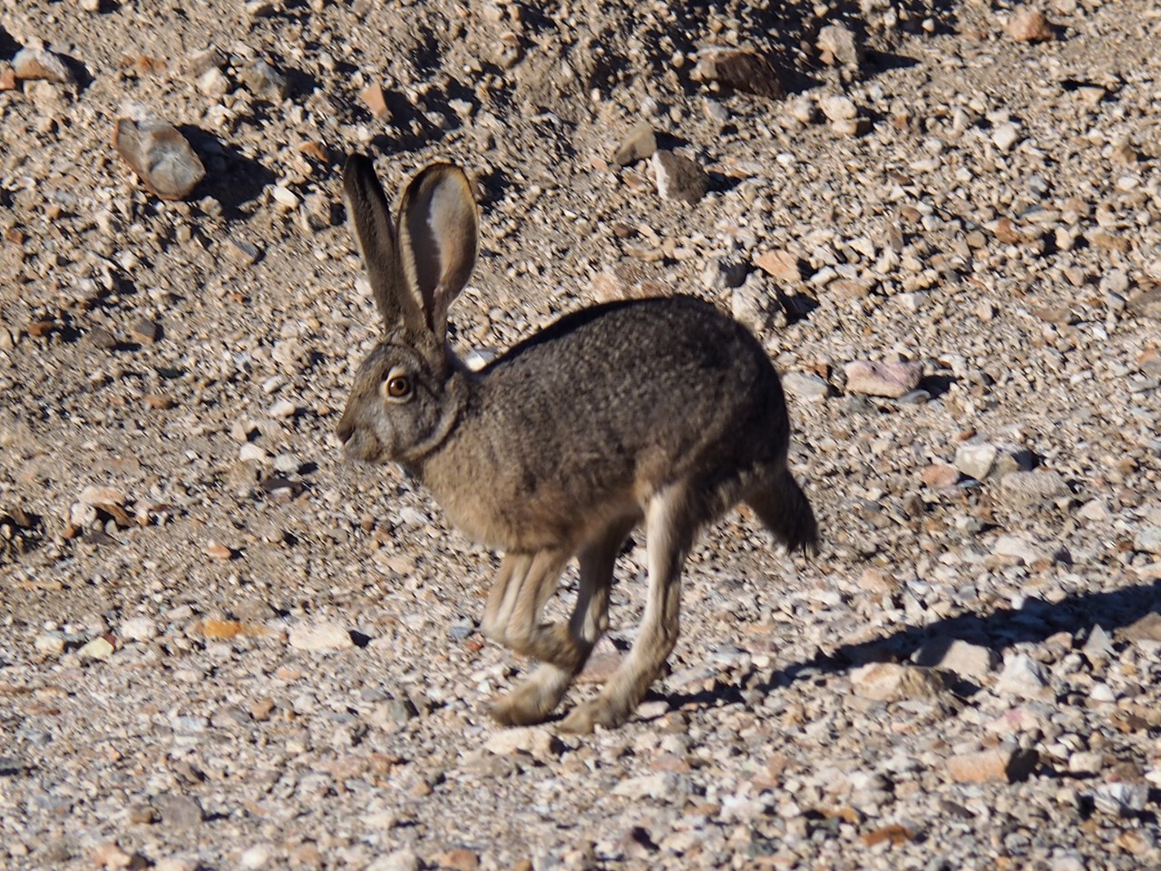
Compared to nearly decade-old itself in the documentary, today's Darwin appears much cleaner and neater (and definitely cleaner and neater than towns near Red Mountain). We haven't seen a soul in an half-hour we spent loitering near the Post Office; a family of California quail ambled by in a short distance, and a large jackrabbit made his way in the opposite direction. Neither appeared to be troubled by Jules' loud bark.

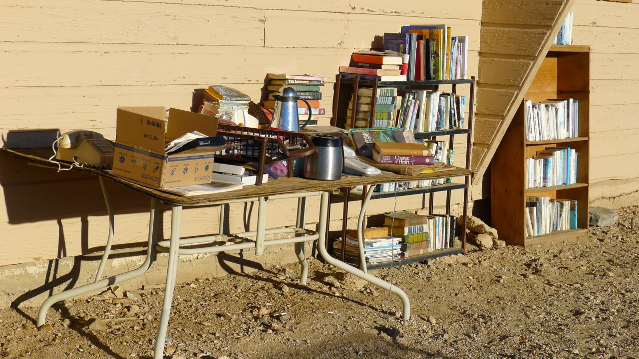
We enjoyed the solitude of Darwin's main square for a while, stopped for the last cold beer of the trip, and reluctantly left that majestic desert. New Year's eve's tomorrow, and we have to re-enter the hustle and bustle of large city traffic and activities.
So long, Death Valley.
* * *
P.S.Driving a loaded Classic on pizza-cutter tires in holiday traffic on Interstate 405 in Los Angeles was absolutely terrifying. I much prefer desert to a jungle.
Darwin... I've been curious about this place for a few years since first seeing it on the map while looking for new trails near Panamint Valley. When I shared my Death Valley travel plans with coworkers, they asked me if I have ever seen Darwin documentary; that very night, I dug it up on Amazon - and we watched it without taking our eyes off the screen. If you haven't seen it, do it - that's two hours very well spent!
Here I have to make a verbal detour. Bear with me.
Every time we travel from Southern California to Eastern High Sierras along U.S.395, I wonder about the former mining towns the road goes through - now mostly refuges of the die-hards who either lived there all their lives, or can't live in the big cities, or have their other reasons. Most of them are littered with abandoned vehicles, appliances, and furniture; most houses are shuttered - or broken or burnt down.
Some of them are dead - like Bodie further up North.
Some are semi-alive in a suspended preserve-or-develop-or-demolish state, like Cerro Gordo.
Some still linger but are outright depressing - like Johannesburg or Red Mountain; some maintain their spirit (like Randsburg).
Some still have active mining operations and live in a state of a perpetual company town (like Trona), supplementing the income by copious meth production. I almost crashed a rental car once when my boss in the passenger seat explained the differences to another coworker - "Trona... is just like Randsburg, without the glitz."
Darwin appears different. Somewhat secluded in the valley adjacent to mammoth China Lakes Naval Weapons Center (also worth mentioning - a Navy base in the middle of a largest desert in North America!), lost most of its glamour and allure. It is pretty far from today's commodities - the nearest gas station in Olancha is about 40 minutes away; one has to drive over an hour North-West to Lone Pine for groceries. The nearest bar and restaurant are in Panamint Springs - an hour on or off pavement, complete with astronomical gas prices and rather indifferent service. Yet, there's a handful of souls - not sure of the latest head count - who stay. Enough to maintain a U.S.Post Office.
Compared to nearly decade-old itself in the documentary, today's Darwin appears much cleaner and neater (and definitely cleaner and neater than towns near Red Mountain). We haven't seen a soul in an half-hour we spent loitering near the Post Office; a family of California quail ambled by in a short distance, and a large jackrabbit made his way in the opposite direction. Neither appeared to be troubled by Jules' loud bark.
We enjoyed the solitude of Darwin's main square for a while, stopped for the last cold beer of the trip, and reluctantly left that majestic desert. New Year's eve's tomorrow, and we have to re-enter the hustle and bustle of large city traffic and activities.
So long, Death Valley.
* * *
P.S.Driving a loaded Classic on pizza-cutter tires in holiday traffic on Interstate 405 in Los Angeles was absolutely terrifying. I much prefer desert to a jungle.