Overland Navigator - Free Shipping

craig

Well-known member
Oct 1, 2004
1,747
0
Edmonds, WA
overlandnavigator.com
NOTE: FREE SHIPPING IS NO LONGER AVAILABLE -- this post was originally made in June of 2009.

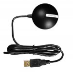
Overland Navigator turns any Windows netbook, laptop, tablet, or UMPC and a cheap GPS puck into an easy to use offroad mapping system.
  • USGS topographic maps are rich in detail.
  • Maps are seamless and automatic
  • Record GPS tracks and waypoints
  • Ideal for netbooks and UMPCs - Uses the entire screen
  • Touchscreen, mouse, and keyboard compatible

See the Video Overview of the features.
See the "Testimonials" section of our website for example installations.

To get free shipping within the continental US enter the "DISCOWEB" as the claim code when checking out.

We are in Mount Vernon, WA. Software is $39.95, Map-packs are $39.95 per region except the US wide map-pack which is $99.95 (250k/100k maps only).
 
Last edited:

squirt

Well-known member
Nov 13, 2008
824
13
Los Angeles
Curious, are you making donations to D-Web for sales solicited here? Or are you already a forum sponsor??
 
Last edited:

craig

Well-known member
Oct 1, 2004
1,747
0
Edmonds, WA
overlandnavigator.com
Yep, I'll make donations. I've been a member here for a while now.

There are no forum sponsors on dweb, though there are several businesses selling in the classifieds that I'm sure donate to dweb.
 
Last edited:

craig

Well-known member
Oct 1, 2004
1,747
0
Edmonds, WA
overlandnavigator.com
That's the basic idea, but the Nuvi doesn't have an industry standard NMEA0183 output port on it. There are two options that I'm aware of:

- This guy makes a cable, for $48, that looks like it will convert your Nuvi's output to NMEA. https://www.argentdata.com/catalog/product_info.php?products_id=114

or

- Pickup a new Globalsat BU-353 GPS ($36) which has the same SIRF III chipset inside of it as your Nuvi. This is a very high quality GPS. It plugs into a USB port and speaks NMEA0183.
 

Attachments

  • bu-353.jpg
    bu-353.jpg
    25.3 KB · Views: 8

mastercamper

Well-known member
Nov 18, 2006
952
21
Erwin TN
Ok sounds good, last question what about maps of the south east say GA, TN, NC. Didn't see on the list or are they in the bundel?

Thanks,
Eric
 

craig

Well-known member
Oct 1, 2004
1,747
0
Edmonds, WA
overlandnavigator.com
TN is in beta testing and will be out in the next week or so. GA is a few months away still (working hard).

The US wide map-pack covers both with 1:250k and 1:100k maps, but doesn't include 1:24k maps.

Craig
 

craig

Well-known member
Oct 1, 2004
1,747
0
Edmonds, WA
overlandnavigator.com
There was an error with the promotion code where only 1 item in your cart qualified for free shipping. I believe the error has been fixed, but if anyone has any trouble please feel free to contact me.
 

craig

Well-known member
Oct 1, 2004
1,747
0
Edmonds, WA
overlandnavigator.com
We've just completed topographic map-packs for:

Ohio
Minnesota
Missouri
Illinois
Alabama
Lousiana
Alabama
Georgia
Iowa
Kentucky
Indiana

These are in addition to our existing map-packs:
Washington
Oregon
California North
California Central
California South
Nevada
Arizona
Utah
Montana North
Montana South
Wyoming
Colorado
New Mexico
North Dakota
South Dakota
Nebraska
Kansas
Oklahoma
Texas
Mid-Atlantic Region (District of Columbia, Virginia, West Virginia, Maryland, and Delaware).
 

craig

Well-known member
Oct 1, 2004
1,747
0
Edmonds, WA
overlandnavigator.com
:D

The USGS maps for Wisconsin are going to take some work. Many are non-conforming, missing, in a different map-projection than described, mis-aligned, etc. I'll have eventually have them, but want to finish up the states that are less problematic first.

Craig
 

gmookher

Well-known member
Oct 30, 2004
5,201
0
Grand Canyon State
craig said:
That's the basic idea, but the Nuvi doesn't have an industry standard NMEA0183 output port on it. There are two options that I'm aware of:

- This guy makes a cable, for $48, that looks like it will convert your Nuvi's output to NMEA. https://www.argentdata.com/catalog/product_info.php?products_id=114

or

- Pickup a new Globalsat BU-353 GPS ($36) which has the same SIRF III chipset inside of it as your Nuvi. This is a very high quality GPS. It plugs into a USB port and speaks NMEA0183.


all you need is that puck and your choice of carputer/toughbook/netbook
 

xengineguy

Well-known member
Jan 18, 2009
71
1
Angola In. 46703
Craig I'm very interested in your software.Is the topo done for michigan,upper/lower? Will your software work with any street maps? If it will, which ones? Just got a touch screen cf 28 . I'm considering a bluetooth gps reciever for on top of the truck. Have you had any success with this type of setup? Does the US topo map combo have minor roads/dirt roads/two tracks on it????
 

craig

Well-known member
Oct 1, 2004
1,747
0
Edmonds, WA
overlandnavigator.com
I just finished Michigan. It will be up for sale on the website in the next day or so (just waiting on the publisher).

The software only works with Topographic maps, and does not do street network routing (e.g. driving directions). It is squarely targeted at the back-country traveler where routing software would inevitably get it wrong anyway (closed gates, not being able to tell the difference between a 4x4 trail and smoot USFS gravel road, etc).

I haven't used a bluetooth GPS, but I do use a Bluetooth OBDII reader that works great. The problem with most bluetooth GPS receivers IMHO is that they run off of batteries.

The US wide map-pack only goes down to 1:100k maps. It really isn't suitable for detailed navigation. You definately want the MI map-pack for minor roads, dirt roads, and twin track. I only recommend it being used to augment a more detailed map-pack for those "just in case I go xyz" situations. For example, I live in WA and have WA, OR, and ID detailed map-packs and the US wide map-pack in case I take a road trip and don't have time to load additional maps.

Craig
 

craig

Well-known member
Oct 1, 2004
1,747
0
Edmonds, WA
overlandnavigator.com
We've just released map-packs for NY/NJ, PA, NC/SC, WI, and MI for sale through our webstore. http://spatialminds.com

The total list of map-packs that are available now includes:

Global - Satellite Imagery - Course scale only - This is not aerial photography
United States - 1:100k and 1:250k maps for the entire US. Does not include detailed 1:24k maps.

DETAILED MAP-PACKS: Include 1:250k, 1:100k, and detailed 1:24k USGS maps.
Alabama
Arizona
Arkansas
California Central
California North
California South
Colorado
Georgia
Idaho
Illinois
Indiana
Iowa
Kansas
Kentucky
Louisiana
Michigan
Mid Atlantic Region (DC, VA, WV, MD, DE)
Minnesota
Mississippi
Missouri
Montana North
Montana South
Nebraska
Nevada
New Mexico
New York & New Jersey
North & South Carolina
North Dakota
Ohio
Oklahoma
Oregon
Pennsylvania
South Dakota
Tennessee
Texas North
Texas South
Utah
Washington
Wisconsin
Wyoming
 
Last edited:

reka12

Well-known member
Dec 27, 2007
138
0
Did not see FL in the store. Can't be that hard as we only deviate by 350' from lowest to hightest...
 

craig

Well-known member
Oct 1, 2004
1,747
0
Edmonds, WA
overlandnavigator.com
I made a mistake in my most recent list. Florida isn't in the store because it isn't finished. Florida is actually one of the hardest states. Like most states with complex coastlines it has a huge number of non-standard USGS maps that need to be manually corrected. Elevation isn't a factor in difficulty.

I'll post when it is finished.
 
Last edited: